You are currently viewing all posts tagged with wilderness.

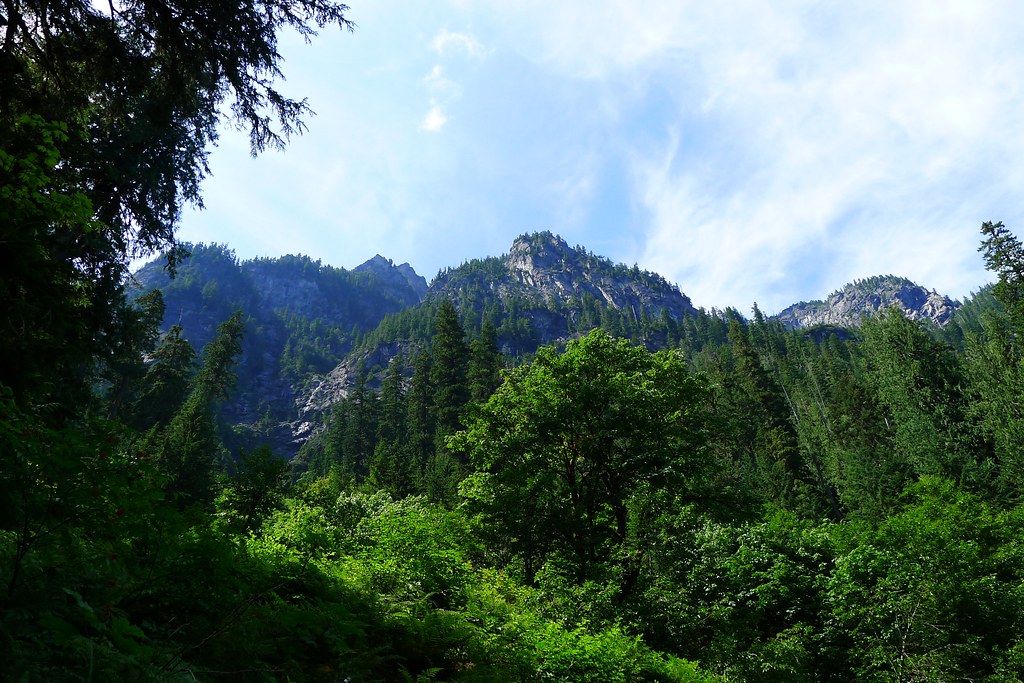
The Valleys and Ridges of Glacier Peak

The Spider Gap – Buck Creek loop is one of the most popular trips in the north Cascades. For 40 miles the trail winds through the Glacier Peak Wilderness. It takes the traveler through low, emerald valleys and atop high alpine ridges.
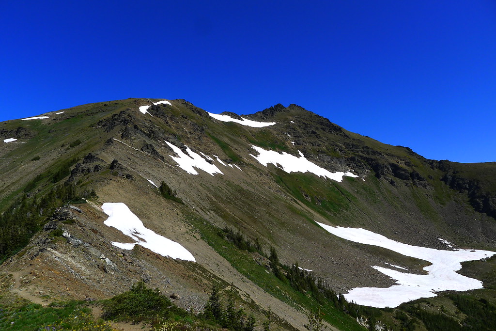
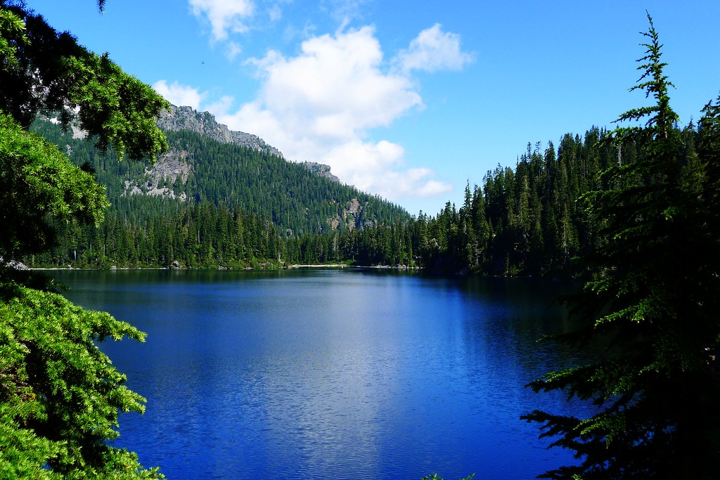
Spider Gap

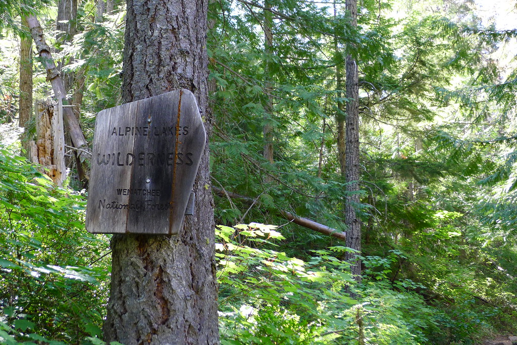
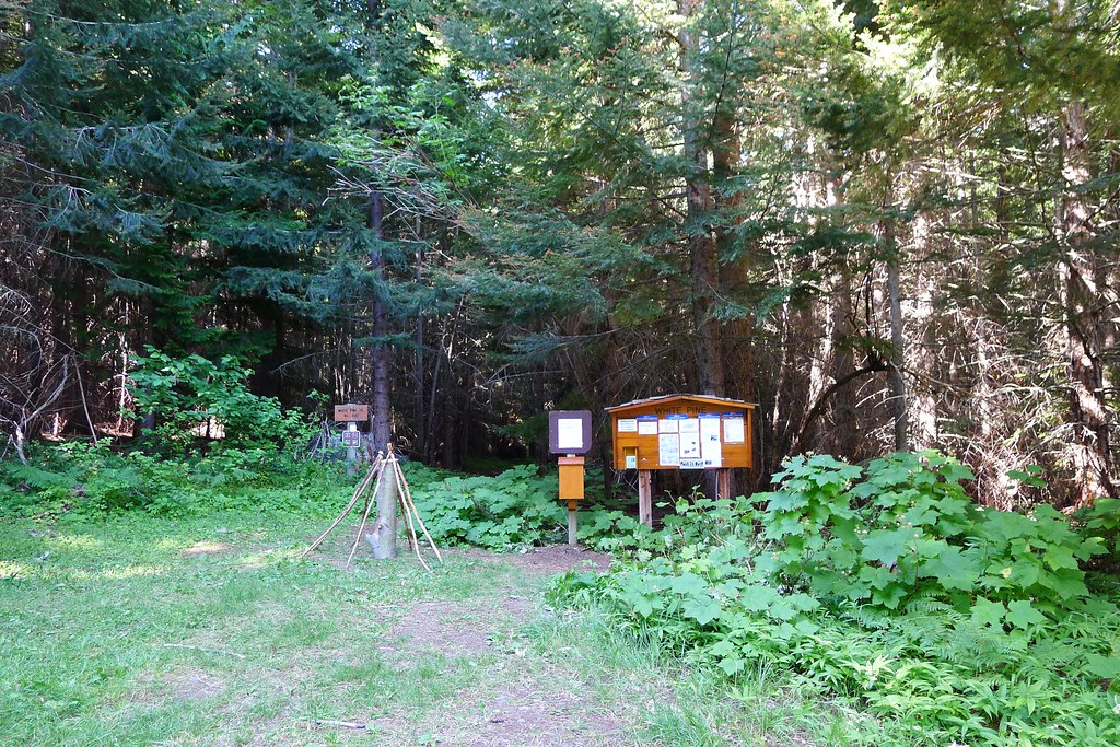
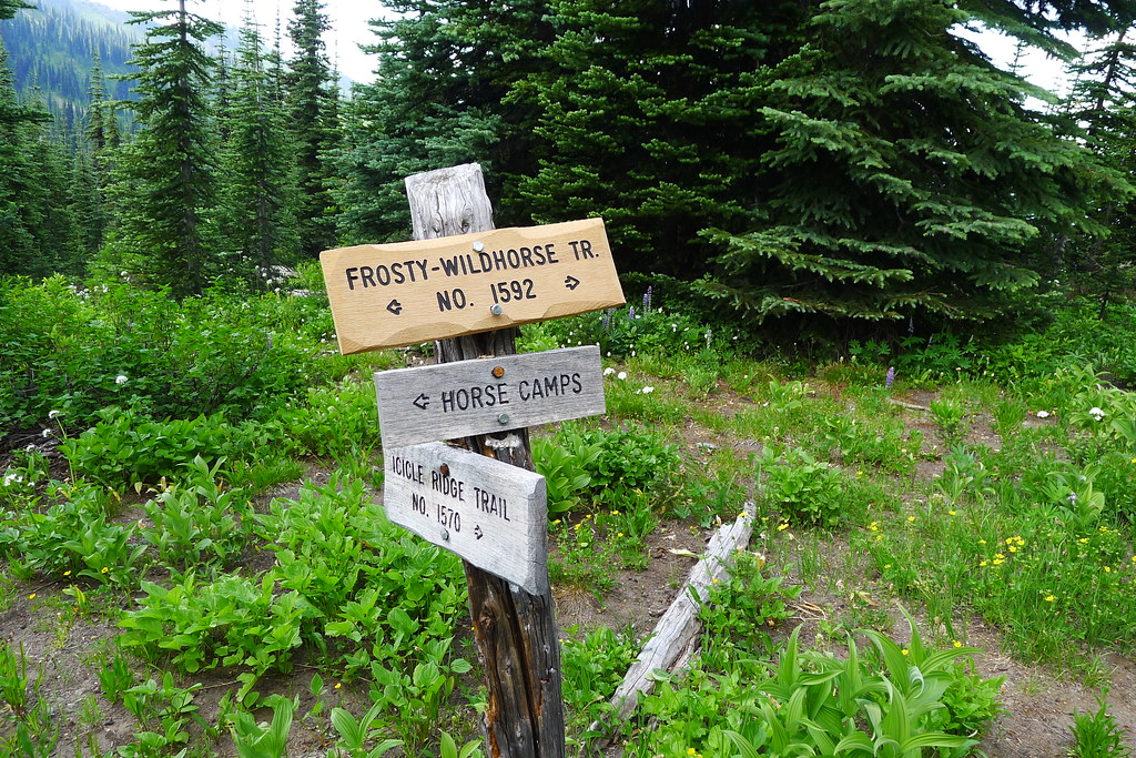
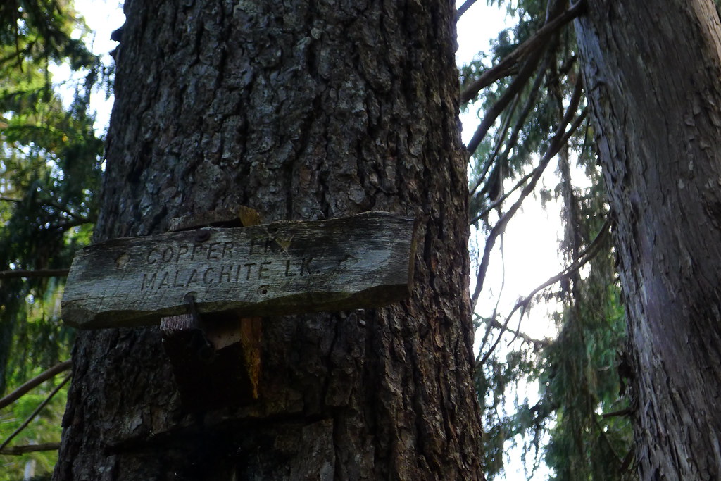
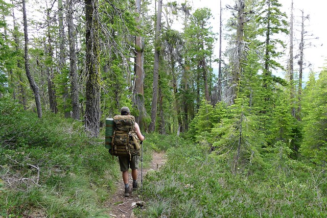
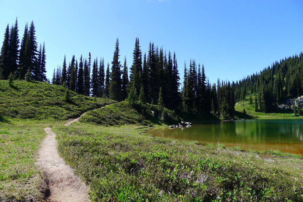
The trail along Phelps Creek is well used by hikers and hunters. It is a wide horse road, leading through thick woods. When I arrive in the middle of the week there are three different groups heading out, but no one else going in. It looks as if I have hit a lull in the summer crowds.

At the head of the valley the forest thins, giving way to wide meadows, good camps, and the remnants of avalanche slides. Two grouse hunters were tramping through the meadows, and one person hunting the opening of archery season for deer. None of them had so far had any luck.

Spider Meadow

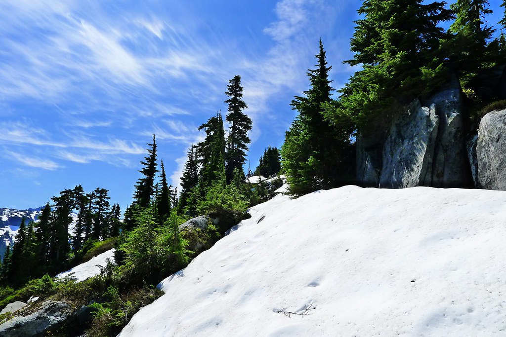
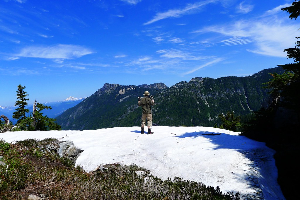
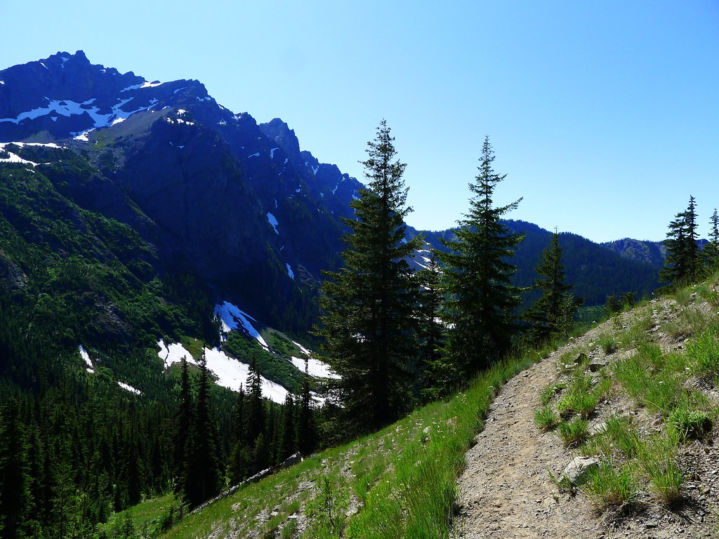
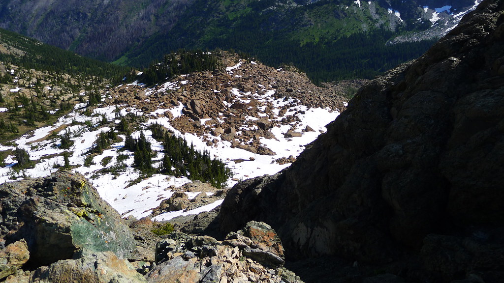
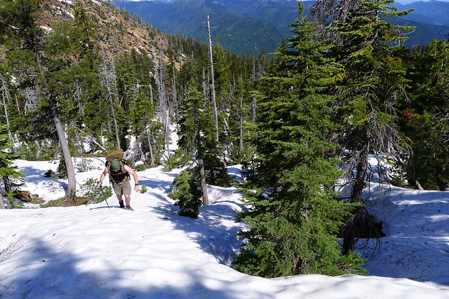
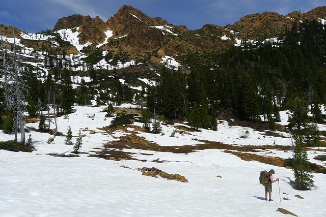
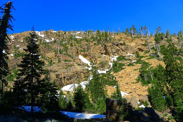
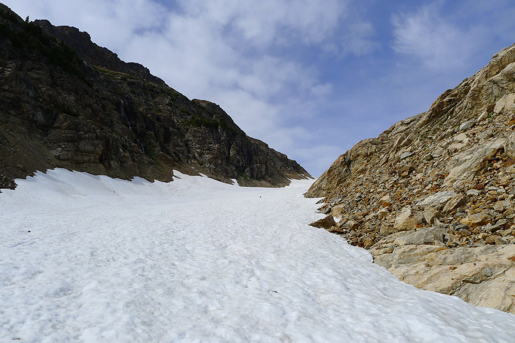
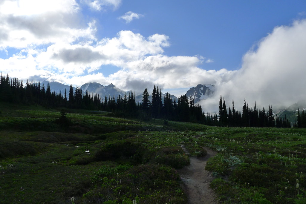
From Spider Meadows my route climbs up the first of many ridges. I was aiming for Spider Gap, a small pass between towering rock, carved by the small but powerful Spider Glacier. The trail is steep. The noontime sun strikes it hard. Trees are soon left behind in the valley bottom, and any shade left with them. An occasional cooling breeze gives reason to stop and gaze back down to the valley of Phelps Creek below.

Spider Meadow

Soon I hit talus. Soon after, the source. Spider Glacier: narrow but long, and uphill to the Gap. I put my trekking pole into the pack, trading it for an ice axe. The year’s heavy snow and late melt-off means that the glacier is still covered with a coat of snow. I progress slowly, but the snow allows for a relatively easy walk up without the traction devices that would be necessary had I been walking on the ice itself. All the way up, I think to myself that I should have done the loop in reverse, so that I could glissade down the glacier rather than walk up it. (Later, I shared my observations with others I encountered on the trail. None seemed to agree. “You have a different idea of fun that I do,” said one.)

Spider Glacier

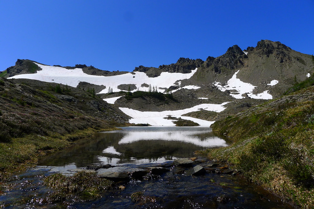
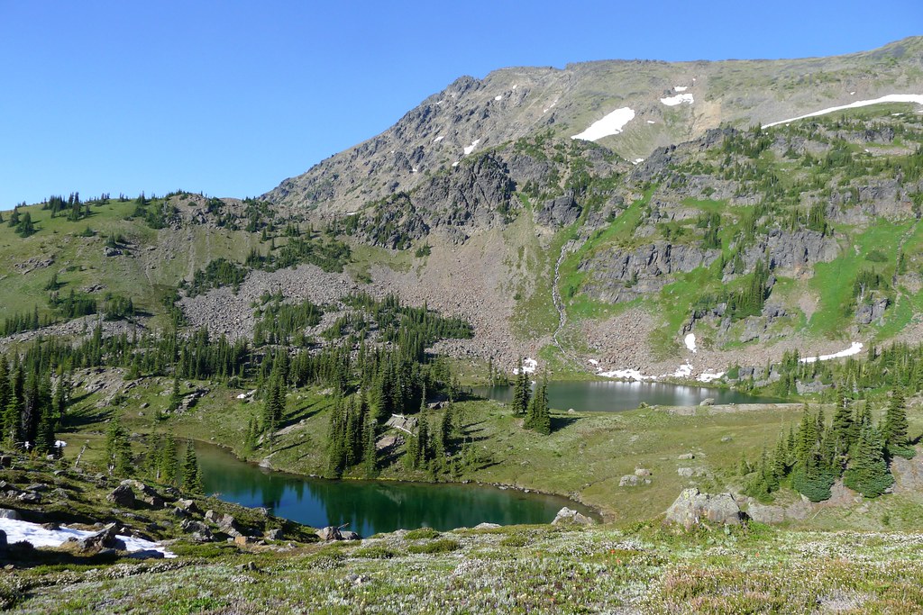
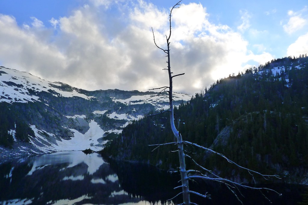
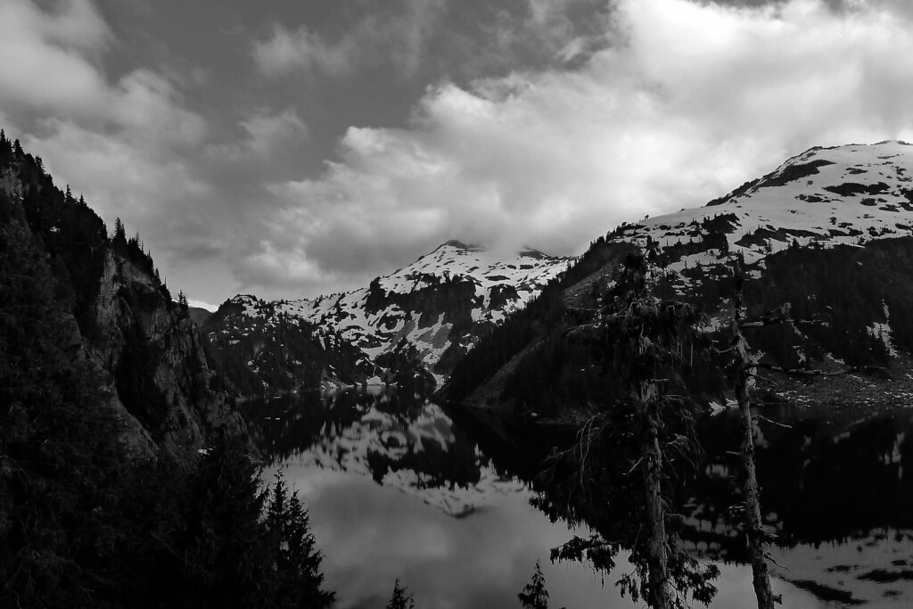
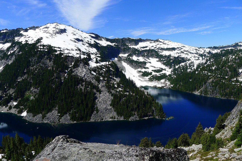
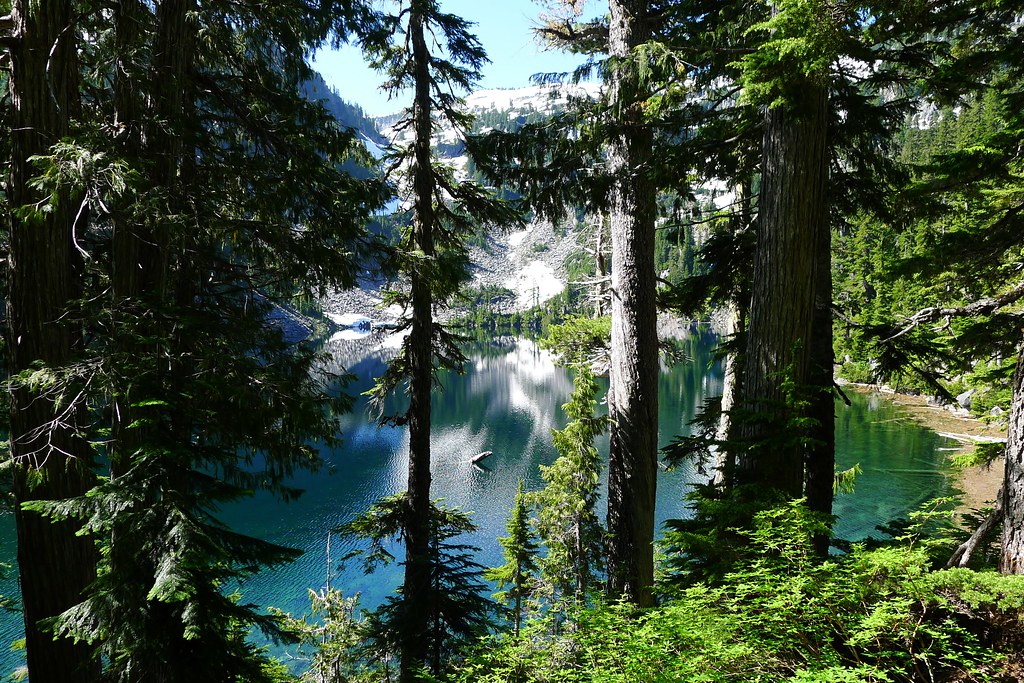
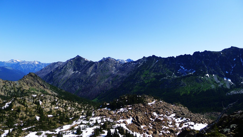
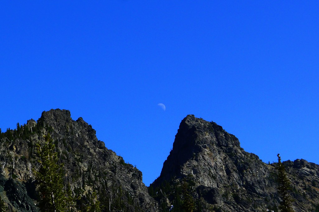
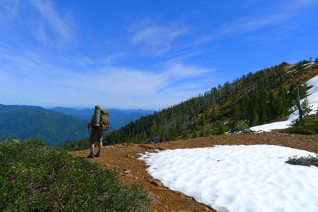
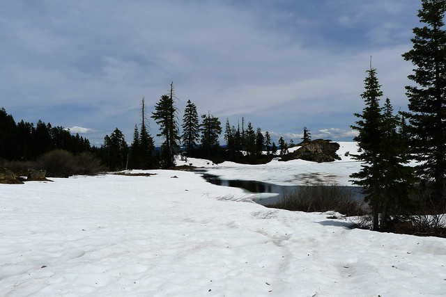
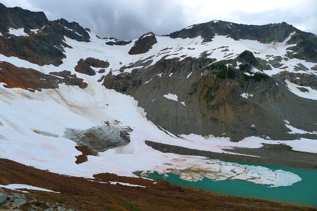
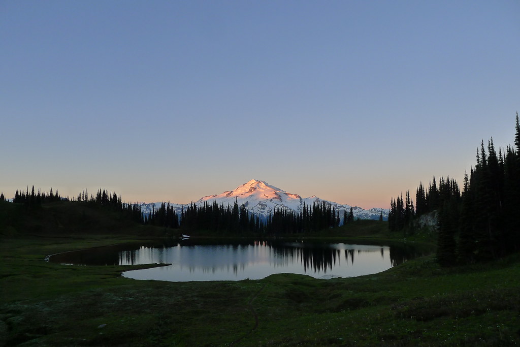
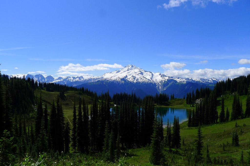
At the head of the glacier and the top of the gap I drop pack to hydrate and take in the views. This is surely mountain goat country – bare, carved rock and spiring peaks abound. Peering down the other side I spot the ever diminishing Lyman Glacier and the relatively young Upper Lyman Lakes. My goal for the day is the lower Lyman Lake, hidden in the trees beyond.

Lyman Lakes and beyond to Cloudy Peak

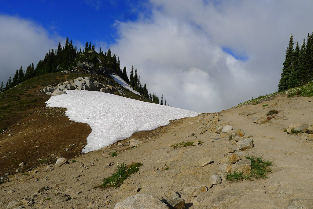
Snow fields occasionally cover the rocky north facing slopes on the other side of the Gap, but I can see faint outlines of a trail where the snow has melted, traversing the western slope of Dumbell Mountain. Ice axe still in hand, I make my way in that direction.

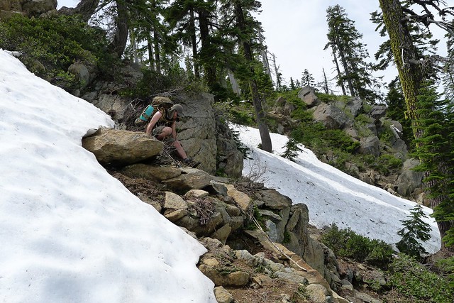
As I reach the opposite side of a field of snow, I find myself among scree and boulders. No longer can I make out the previously spotted trail. I peer ahead, but I cannot see its relief anywhere along the slope. I’m not sure what the trail was making for, anyways. When I did see it, it looked to keep the slope of the mountain, heading off perhaps to Rubin Creek on the other side. It is definitely not the obvious route given the topography. A few hundred feet below me I can see Upper Lyman Lakes, and the bare fields surrounding. It looks easy enough to just walk along the edge of the lakes, following the drainage down to lower Lyman Lake itself. Simpler than fooling around on the side of the mountain.

Lyman Glacier

So I begin the descent, lowering myself down large boulders, occasionally loosing my footing as I kick loose small rocks that go tumbling down. After some time I reach another snow field, steep and perhaps forty or fifty feet down to the other side. I could go around it, but it has been slow going, making my way among the rocks. “Ballsy,” I think, but what’s the point of packing an ice axe if you aren’t going to really use it? I carefully step onto the snow, sit down, and push off.

The late season snow is hard packed and crusty, more like ice, which makes for a faster acceleration than I had planned. I cannot dig in with my heels or the spike of the axe enough to slow the descent. Nearing the bottom, I’m forced to roll over and arrest with the pick of the axe to avoid flying into the talus below. That done, and feeling quite pleased with myself, I merrily make my way down the remaining hundred feet to the lakes below. Reaching the bottom, I spot good tread, and even a few cairns here and there. I don’t know what route the path took down from the Gap – it certainly wasn’t the same as mine – but there it is.

Cairn at Upper Lyman Lakes

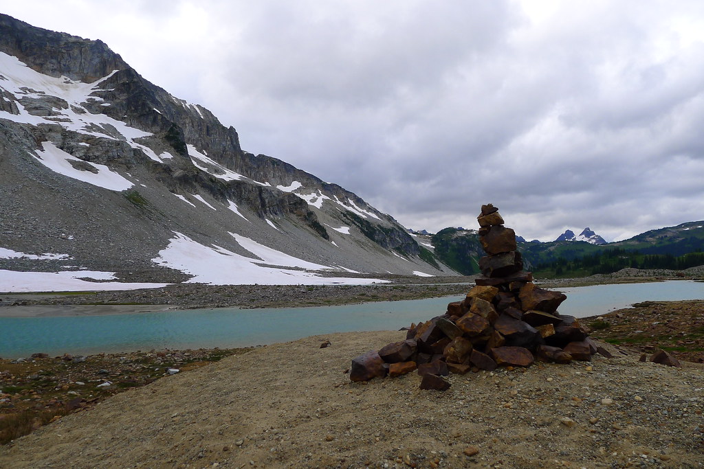
The tread soon turns to trail. Clouds begin to move in and, as I make my way to the lower lake, I feel drops of rain on my face. The trail descends into trees, reaching Lyman Lake itself soon thereafter.

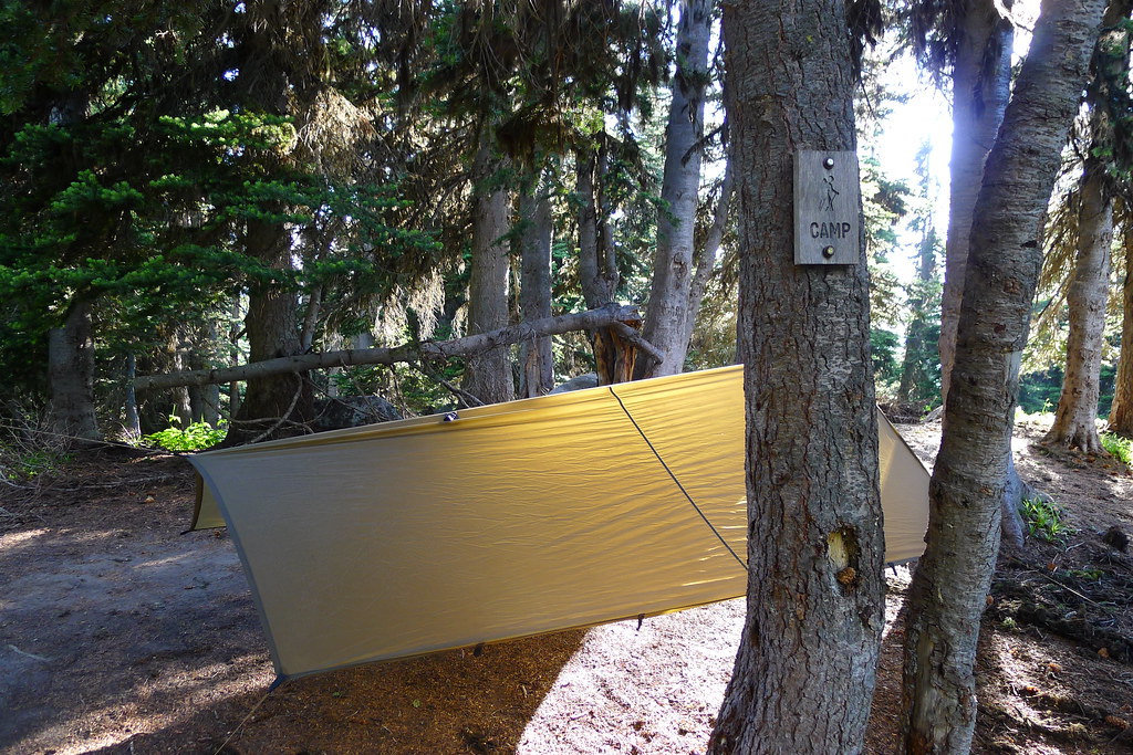
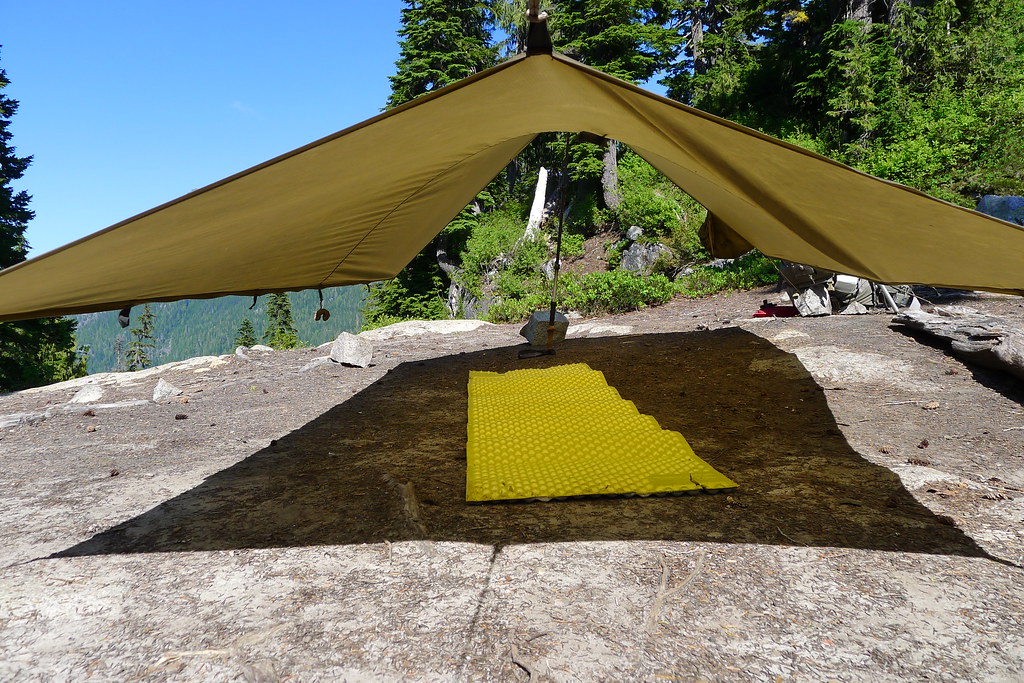
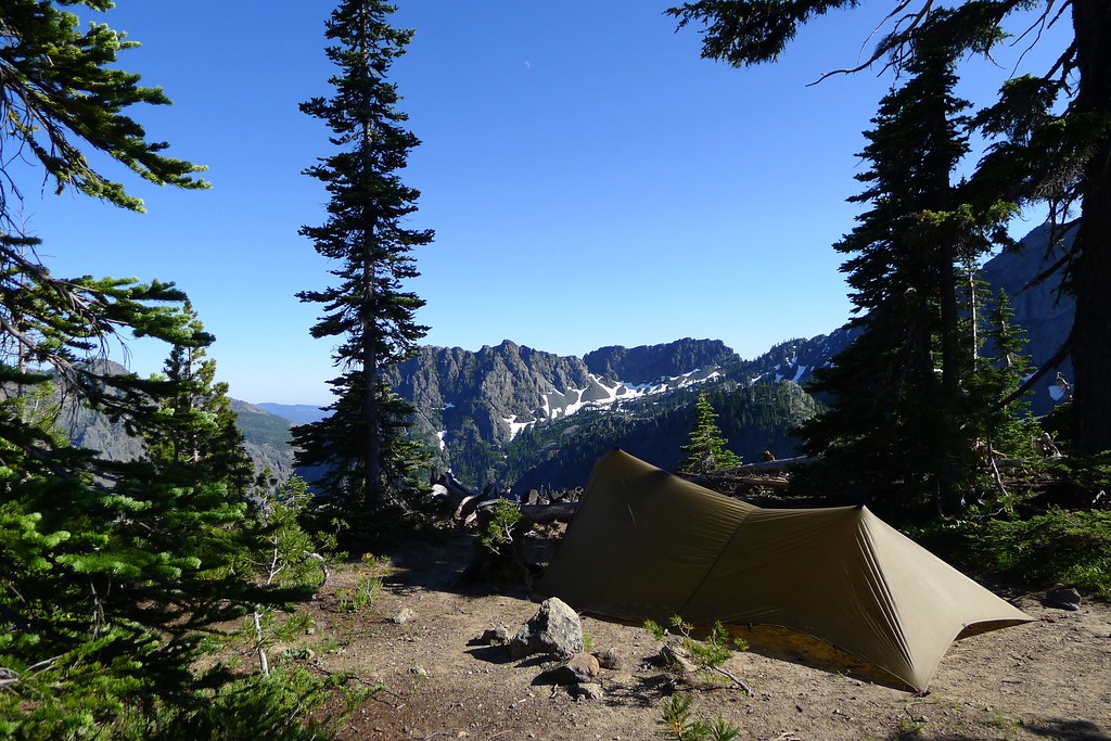
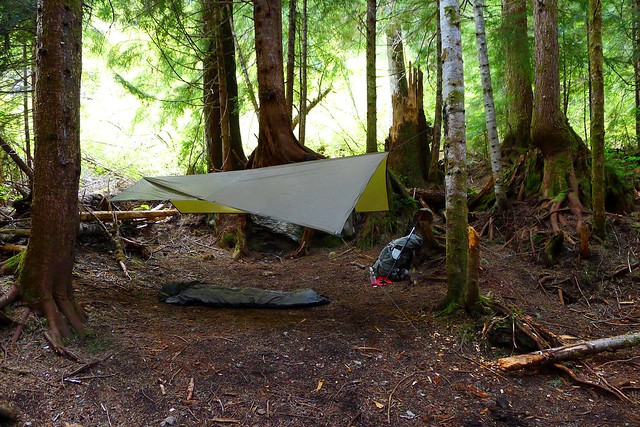
At the lake there are a few other people already camped. I find a likely looking spot and pitch the tarp before the rain increases. It does not last long, soon diminishing to only occasional sprinkles. That and the accompanying breeze are enough to keep down any bugs.

Lyman Lake

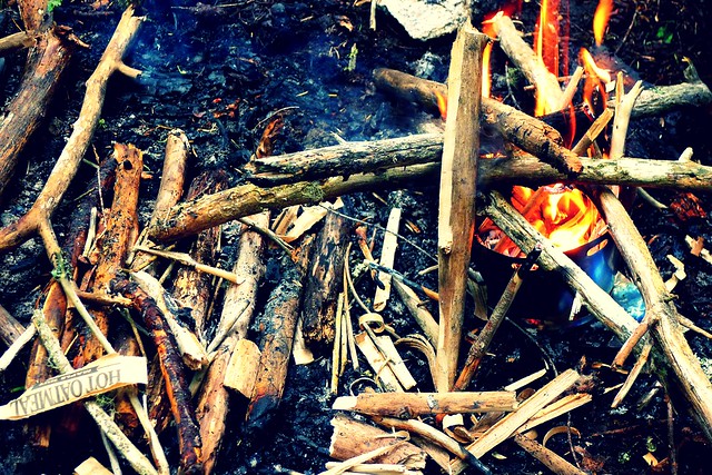
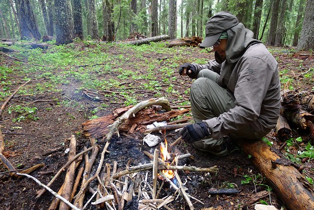
A downed Hemlock tree next to my camp provides plenty of slightly-damp wood. I break off a few branches and after three minutes of processing have enough to fire up the Inferno. After dinner I have plenty of fuel left over, so I boil some water for hot chocolate. The fire is still going as I finish the drink, allowing me to heat a bit of water for cleaning and then dry the pot before putting it away. Then to bed.

Image Lake

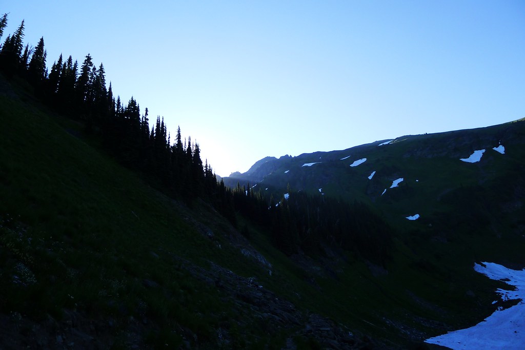
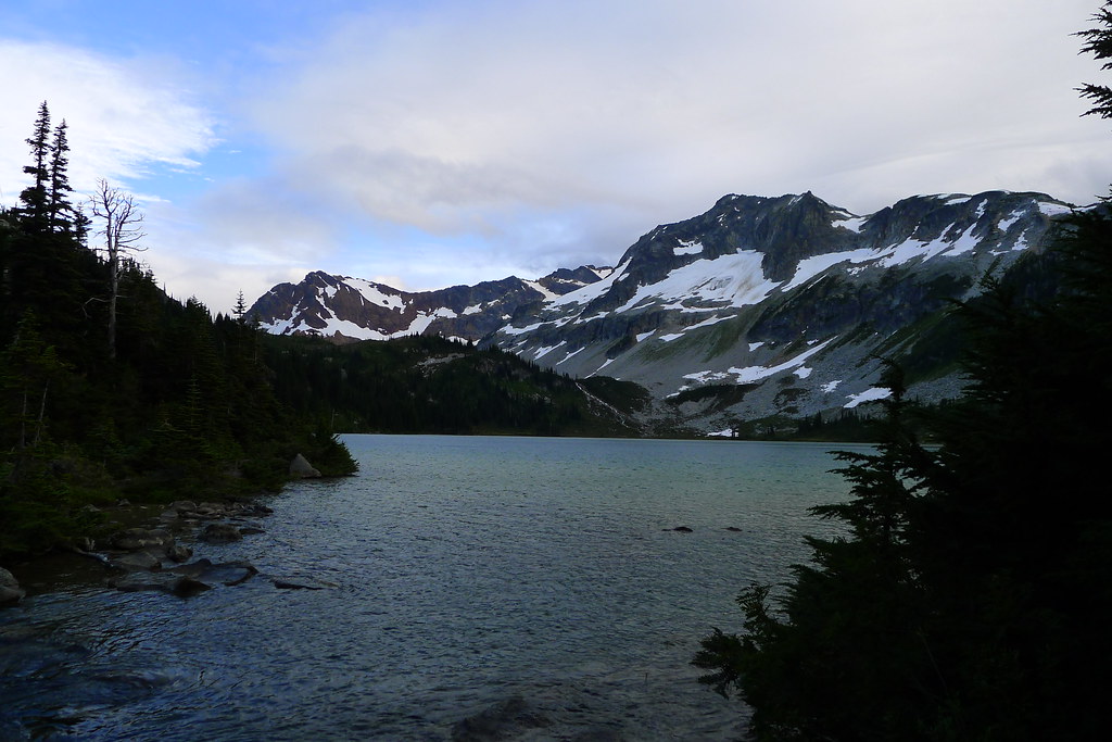
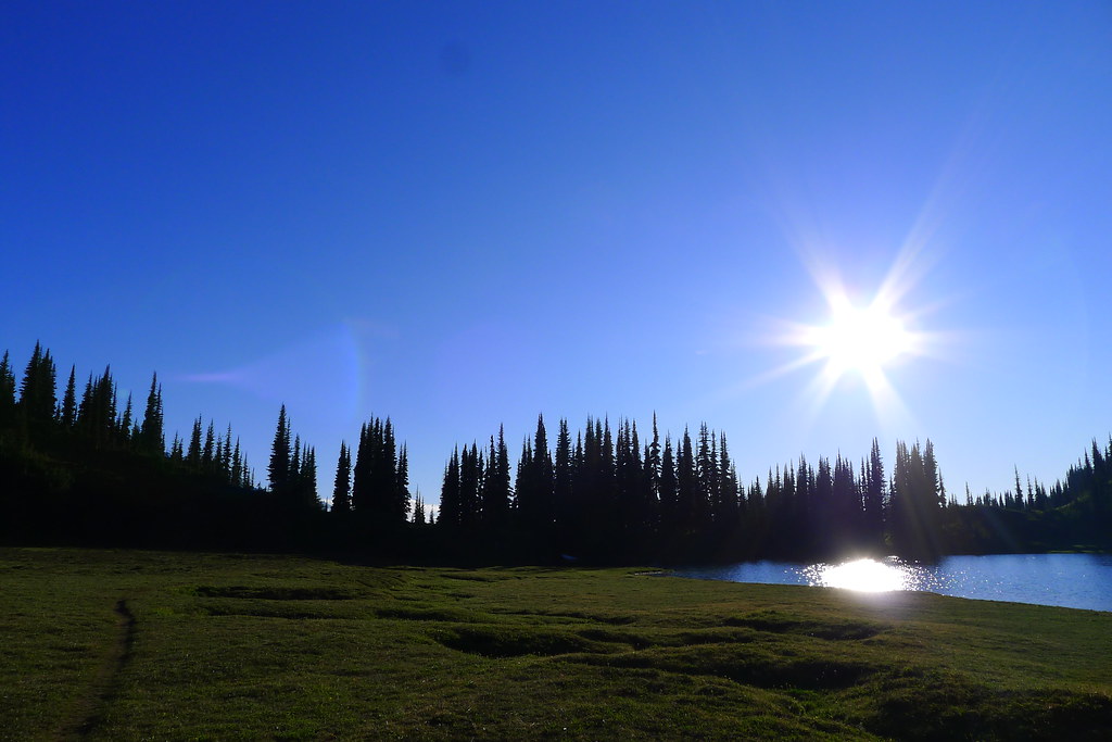
I rise early, break camp, and walk a couple hundred feet through the woods to the shore of the lake. Breakfast, and water, and then I’m gone. I want to get on the trail ahead of the others, whom I assume are doing the same loop as I. The trail winds along the shore of the lake for a short while before breaking off to head north and west. It climbs out of forest, into the meadow below Cloudy Pass. Here I spook deer and marmot, the latter collecting grass for their winter holes. (Already, the temperature dropped to freezing last night.) I spotted blue sky as I woke, but now Cloudy Pass is living up to its name. Looking back, I see clouds moving in to veil Lyman Lakes and the Gap.

Clouds over Spider Gap and Chiwawa Mountains

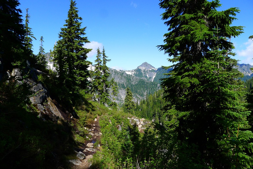
Low clouds obscure the country by the time I reach Cloudy Pass. Descending to the other side I catch tantalizing glimpses of massive walls of rock all around me. I rather enjoy this hiking, walking through the mists in country that is new to me. It is fitting for the second day of September, being in stark contrast to the sweaty hikes under strong sun that defined much of August.

Cloudy Pass

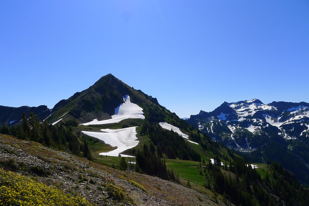
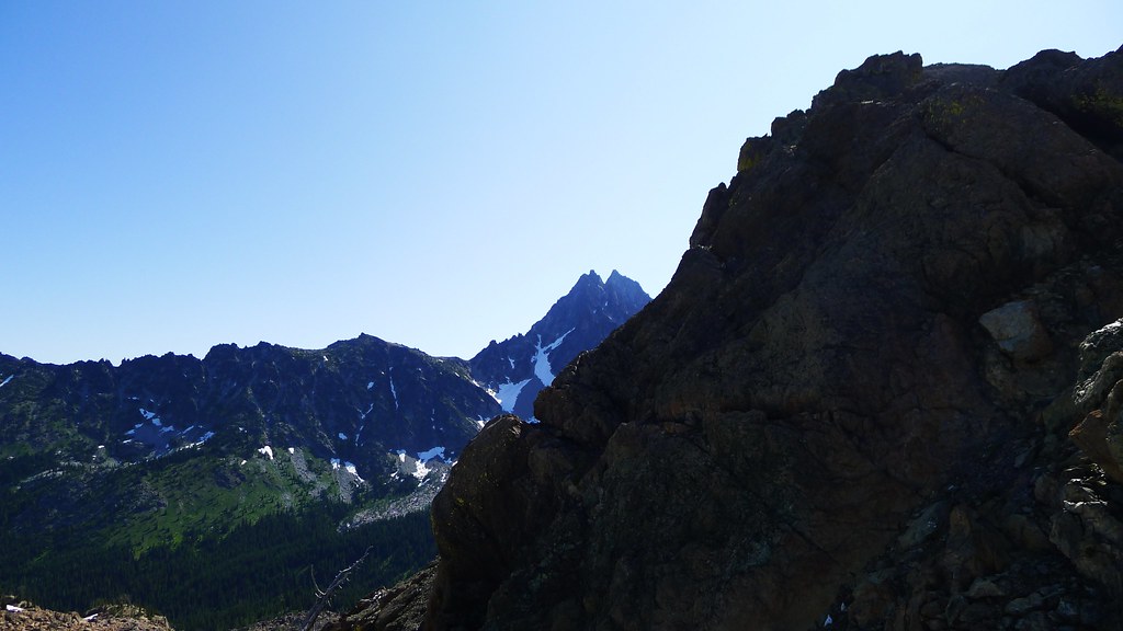
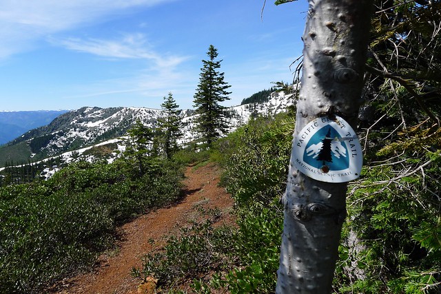
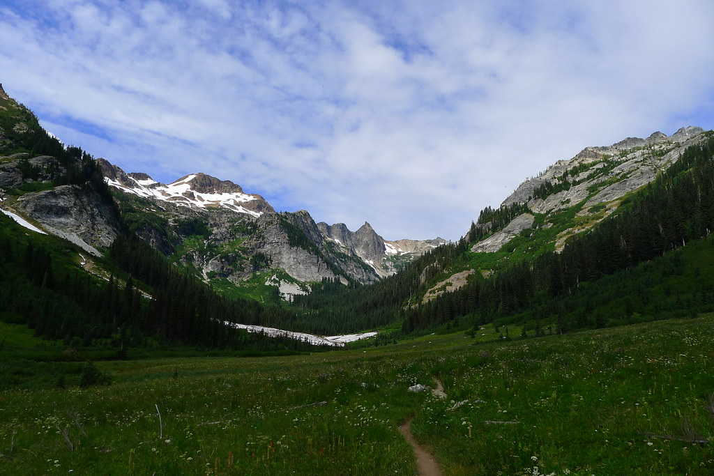
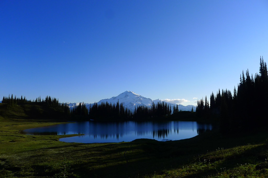
After Cloudy Pass, I avoid the descent all the way into the valley bottom just to rise again by taking a shortcut along the side of a steep ridge to Suiattle Pass. At the top of the pass I look forward and can see mammoth slopes of snow obscured by trees and clouds. Glacier Peak is in front of me, but still only allowing glimpses of its noble flanks. I step onto the Pacific Crest Trail and descend lower into thick trees, reaching the junction with the trail to Miners Ridge. Here the classic loop continues south along the PCT, but I intend to make the detour to Miners Ridge and spend a night at the famed Image Lake. There, the summit of Glacier towers over the lake and is reflected in the still waters, giving the lake its name.

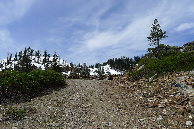
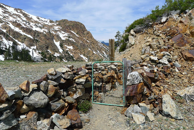
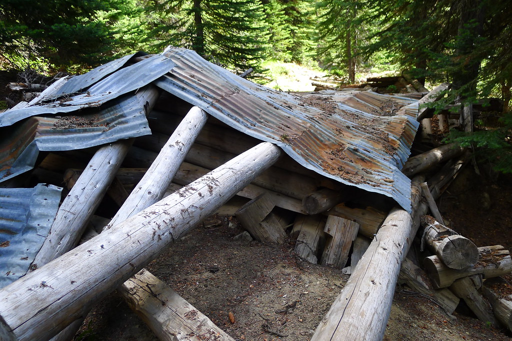
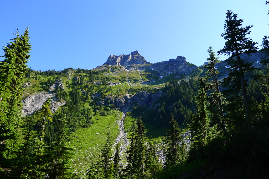
It is late morning now. The sun has begun to burn off the clouds as I start the climb to the top of the ridge. Mining artifacts from the sixties liter the trail, making for interesting archaeological pauses. (The ridge was largely saved from being destroyed by copper mining thanks to William O. Douglas.)

Artifacts on Miners Ridge

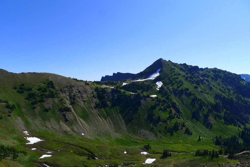
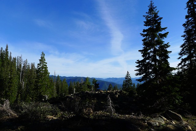
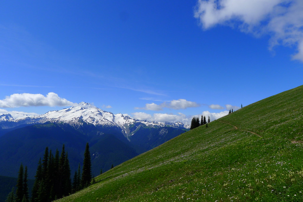
As the trail climbs, the day warms, and the trees are once again left behind, revealing meadows which carpet the upper slopes of the ridge. The clouds are all but gone now. Under a blue sky, green fields roll out before me and, to the south, Glacier Peak, the Wilderness Sentinel, stands in all its glory, surrounded by its court of lesser peaks.

Glacier Peak and Miners Ridge

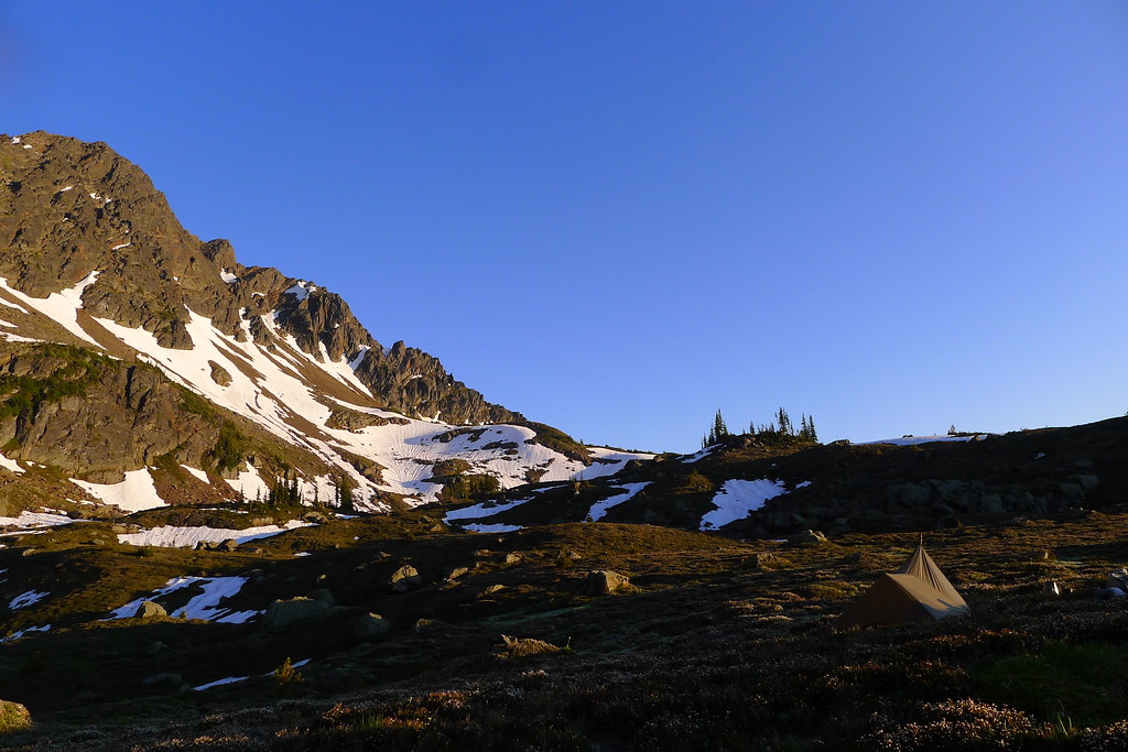
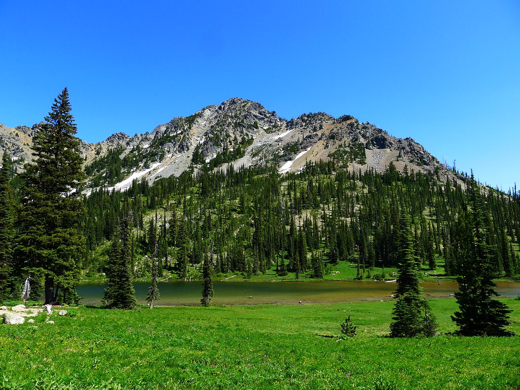
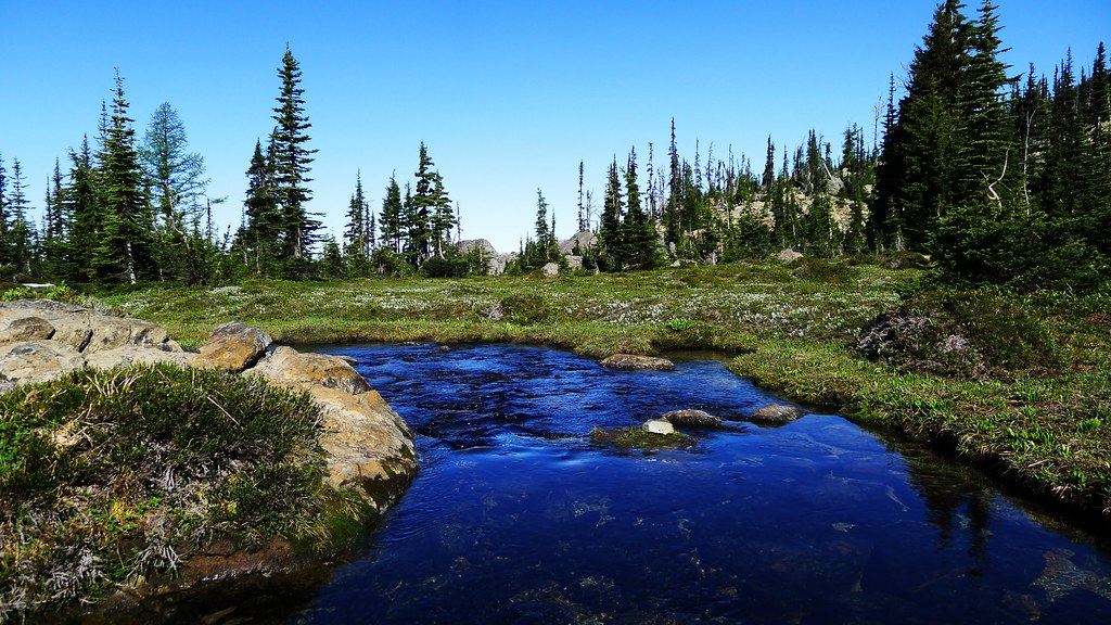
The trail leads along the southern face of the ridge and descends to the small basin that holds Image Lake. There are good camps just south of the lake, where I drop my pack. It is just shortly after noon now, but I plan to spend the night here so that I may catch the sunrise over the lake the following morn. The rest of the day is spent exploring the basin and taking in the views.
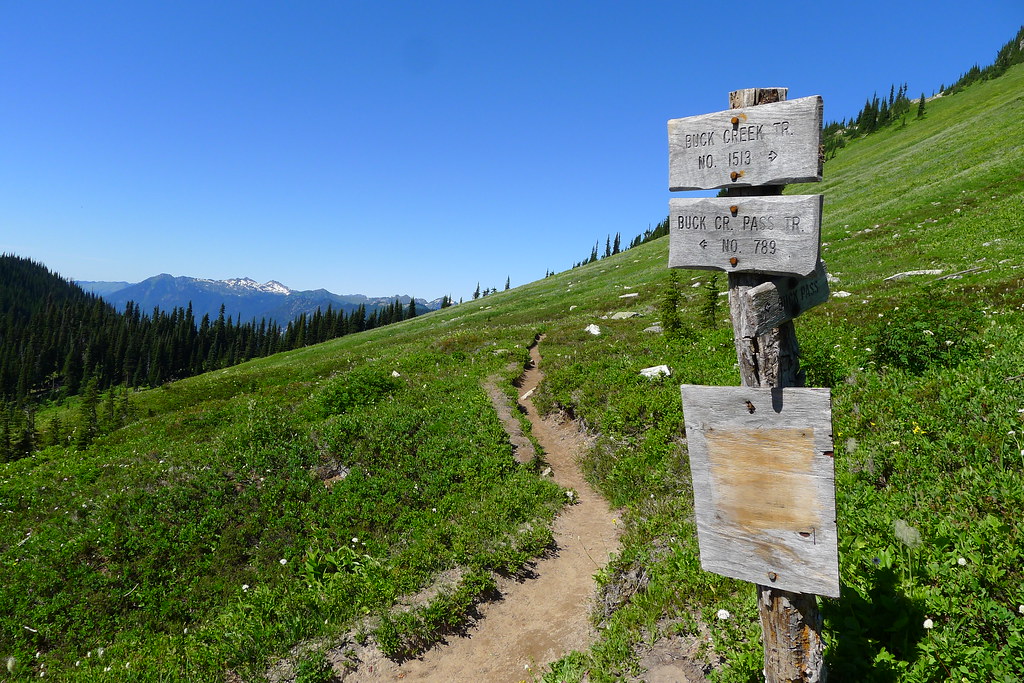
Image Lake

Evening at Image Lake

Glacier Peak over Image Lake

Crescent above Glacier Peak

Buck Creek Pass

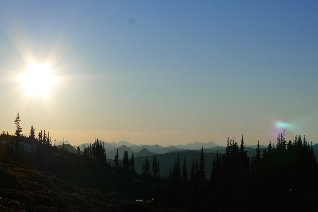
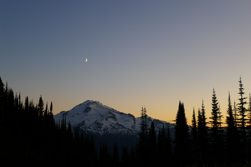
I rise at half past five to a clear dawn. Down comes the tarp, and I throw my things into the pack and walk slightly up the ridge on the north shore of the lake. As the sun rises, it sets fire to the summit and upper glaciers of the peak. I eat breakfast as the show progresses, and soon the whole of Glacier is red with the dawn. That’s my cue to leave. I pack up again, and retrace my steps east along the southern slope of Miners Ridge. There are plenty of deer out browsing, or perhaps they are just watching the sun rise.

Dawn on Glacier Peak

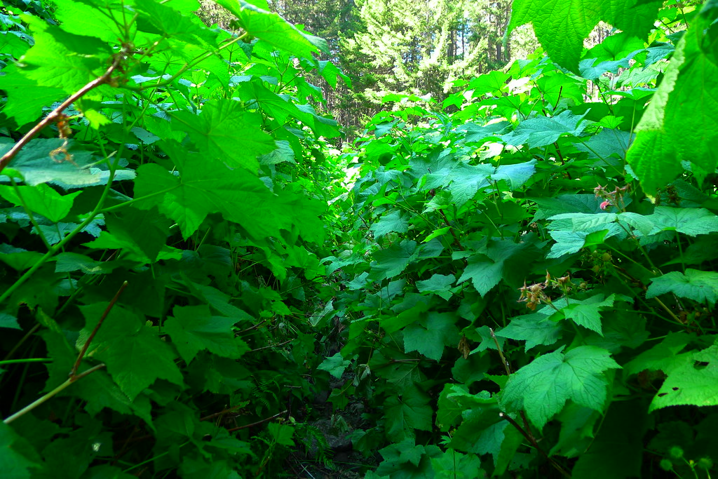
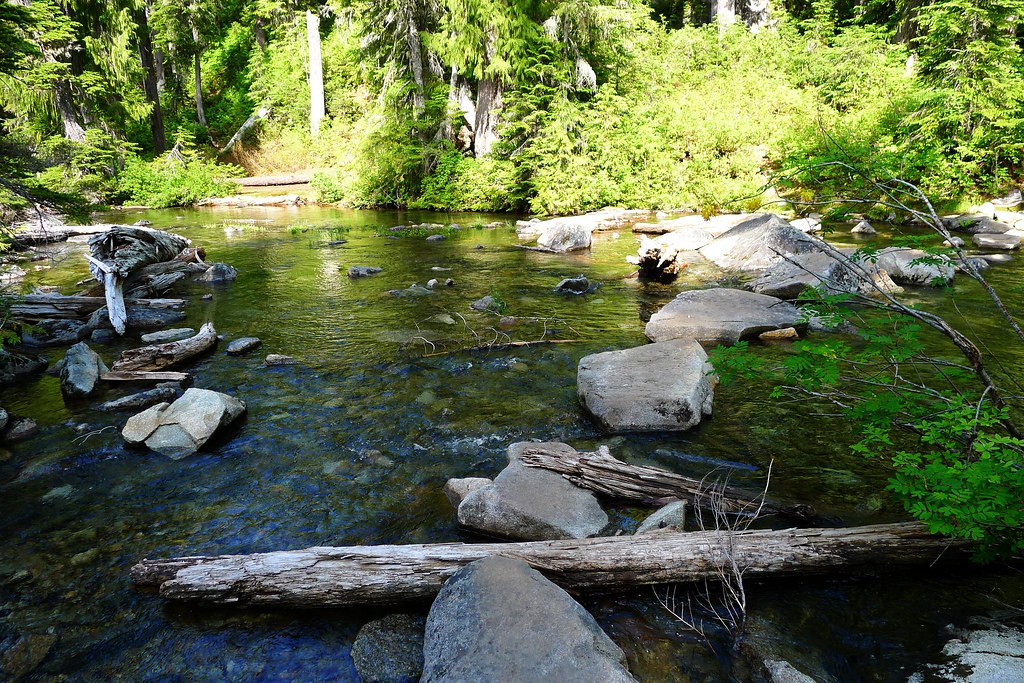
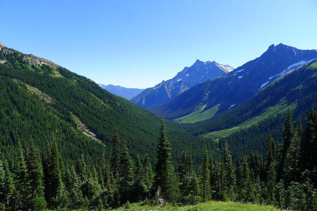
At the bottom of the ridge I come to the end of my detour and once again gain the Pacific Crest Trail. There, the trail descends further to Miners Creek, re-entering thick old growth where the morning light has barely yet penetrated. After the creek is crossed, I leave the PCT and head south, aiming for Middle Ridge and Buck Creek Pass.

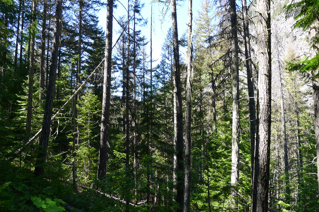
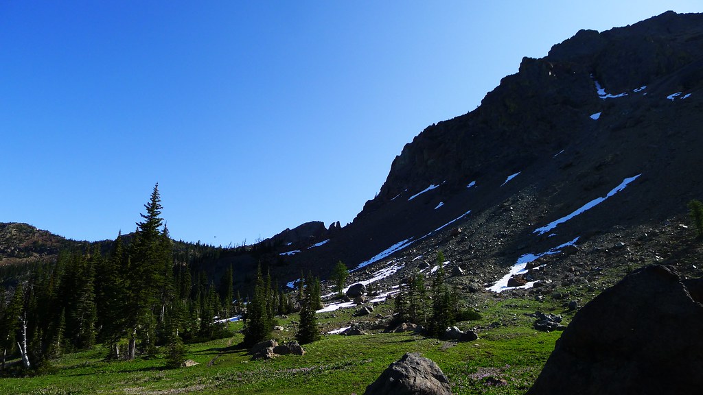
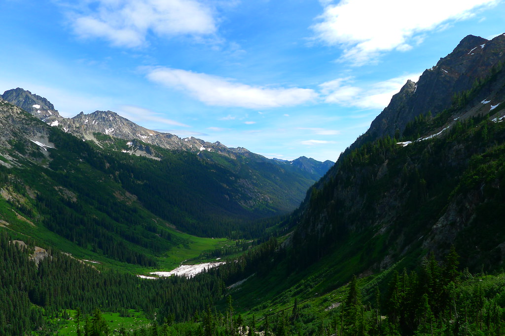
I spend the rest of the morning in the old growth forest. The trail begins to climb, soon opening up to expose the avalanche-scoured slopes of Middle Ridge. The shady trees are left behind just as the sun reaches its peak. Views of the aptly named Fortress Mountain dominate the route.

Fortress Mountain

I stop for lunch at the top of Middle Ridge. The bugs, which have hitherto not been bothersome on this trip, encourage me to cut the break short. I descend once more, this time steeply into the valley of (not so) Small Creek. There is shade down here in the forest. I drop my pack again, this time for a more relaxing break.

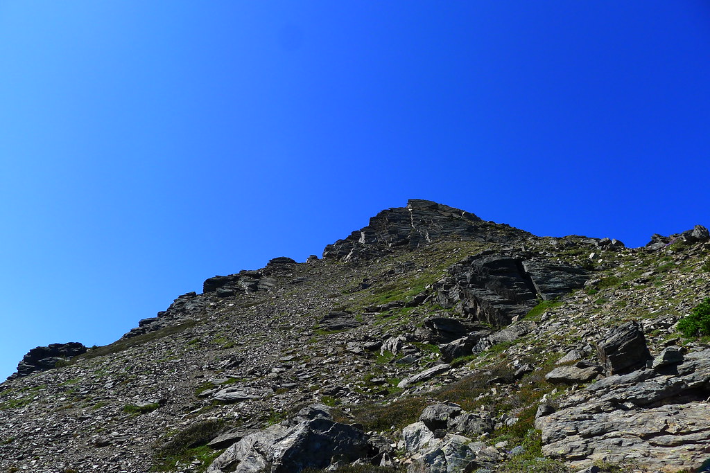
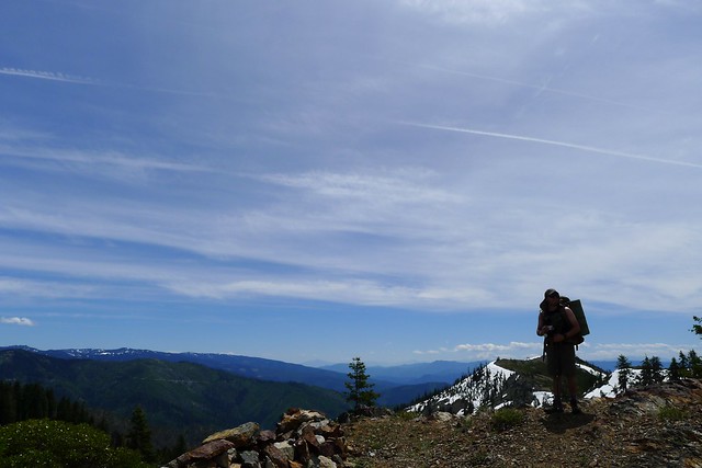
There is one more climb ahead of me: up steep, dusty slopes to Buck Creek Pass, the last high point of the loop. It’s a slog to get up there under the early afternoon sun, but, once gained, the pass offers close-up views of the eastern slopes of Glacier, rising steeply up from the deep Suaittle valley. Flower Dome, Helmet Butte and Liberty Cap surround the meadows here at the pass.

Sign at Buck Creek Pass

I see two groups camped at the pass, but it is early yet, and after yesterday’s short day I want a longer hike today. The trail leads down to Buck Creek. I follow, into the last valley.

The trail chooses a long and gradual way down to the valley bottom. It is the weekend now. I pass many people on the way up, likely looking to sleep at the pass. I think that it will get a bit crowded up there tonight, and I’m glad that I chose to come down to the cool and largely empty valley.

Chiwawa Mountains and Buck Creek Valley

It’s late afternoon and I figure that I’ve come seventeen miles or so from Image Lake. Another four or five miles and I’ll be at the Buck Creek trailhead, which I don’t want to reach until tomorrow. Branching off the trail, I head close to Buck Creek and soon find a clearing large enough for my tarp. I decide on an early dinner, followed down with the last of the trail mix. Afterwards I entertain myself with a fire built up around the stove.

Trinity

The night is not as cold down in the valley as it was in the high country around Lyman and Image lakes, but it still gets down close to freezing. I wake early, shivering. The sun won’t reach down here for a few hours yet. Quickly, I complete the morning routine and regain the trail, looking to generate some heat with movement.

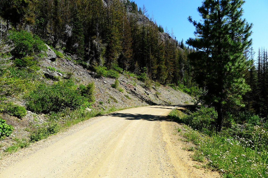
I’ve only been a couple hours on the trail when I reach the trailhead outside of the small town of Trinity (which looks to consist of three buildings). I’m not yet done with the loop – three miles remain, on dirt road, until I reach the Phelps Creek trailhead. I shed a few layers at the Buck Creek trailhead, which the sun has begun to warm, and meet a man preparing to take a mule train up to the pass. Then, it is the dusty road. An hour later I am back where I entered the Wilderness, satisfied in my experience of these mountains.

The secret of the mountains is that the mountains simply exist, as I do myself: the mountains exist simply, which I do not. The mountains have no “meaning,” they are meaning; the mountains are. The sun is round. I ring with life, and the mountains ring, and when I can hear it, there is a ringing that we share. I understand all this, not in my mind but in my heart, knowing how meaningless it is to try to capture what cannot be expressed, knowing that mere words will remain when I read it all again, another day.

Peter Matthiessen, The Snow Leopard

Glacier Peak over Image Lake

As always, there are more photos on Flickr.

High Summer Rambling in the Chiwaukum Mountains

Continuing with my recent theme of short, low-mileage trips I ventured back into the Alpine Lakes Wilderness last weekend. After hitting snow at low elevations at the Foss Lakes the previous week, I decided this time to head east of the crest.

Entering the Alpine Lakes

Whitepine Creek runs just west of Leavenworth and provides a lesser known and lesser used route onto Icicle Ridge and the surrounding area, compared to the popular Icicle Creek Road. I reached the nearest trailhead at midmorning on Friday. As I pulled my pack out of the car, I realized something was missing. Whoops, no trekking pole! I only ever carry one pole anymore, and don’t find it to be required gear for walking. Its import lies in the fact that I use it to set up my tarp. The pole isn’t needed when I string up the tarp between two trees – which I prefer to do whenever two conveniently placed trees present themselves at my intended camp – but I would be getting high on this trip and thought it likely that I would be spending a night or two above tree line.

Near the trailhead’s bulletin board I spotted a few walking sticks leaning against a stump. Throwing the pack on my back, I walked over to the sticks and inspected the lot for one that would suit me. I found one that was light and skinny, but still strong enough to serve for any swift stream crossings that may lay ahead. It was a good height for walking, which meant it was too tall for the front beak of the tarp. I could cut it down to size later.

Whitepine Trailhead

With stick in hand, I headed out. The trail leads into the Whitepine valley, filled with thick pine woods which provide shade from the morning sun. Occasionally, I caught a glimpse of the valley ridge above. At two and a half miles, I reached a junction with Wildhorse creek, which drains into Whitepine on its way out of the mountains. I took a left and began the climb up the Wildhorse valley, to its head at Frosty Pass and the high country beyond.

Whitepine Valley

The Whitepine and the Wildhorse sit in the Chiwaukum Mountains, which in Wenatchee means many-little-creeks-leading-together. True to form, dozens of small creeks flow down the otherwise dry eastern ridge of the Wildhorse, turning it into a wet hike. In places the trail was a creek. In others, the small amount of use and large amount of moisture had created thick patches of salmon berry and devil’s club that obscured the trail. I push through it, hoping that I’m the only one walking through this berry feast at the moment.

A Thick Trail

As the trail lead higher, the trees began to thin and the views along the opposite ridge reveal high peaks and green fields.

With wet, muddy feet I reached Frosty Pass sometime in mid-afternoon., around 10 miles and a few thousand feet of elevation from the trail head. The sun is strong. The weather forecast called for 90°F down below. It doesn’t feel much cooler up here.

Frosty Pass

From Frosty Pass, my route headed directly east and climbed up to Icicle Ridge. Shortly, I reached the first of the ridge’s lakes, Lake Mary, which was my destination for the day.

Above Lake Mary

In the time that it took to set my pack down and take a drink of water, I had dozens of mosquitos biting my skin. I was ready for them this time, after having a similar experience last week. Rain pants, rain jacket, hat, headnet and gloves all came out of my pack. I soon was protected inside a sweaty bug suit.

I tied my tarp up between a couple trees, avoiding having to cut my walking stick down to length for a front pole. Below the tarp, went my bivy sack. Rain didn’t seem likely, but the net hood of the bivy would ensure a bug-free night.

Camp

That night I was awoken by some clomping off to the south of camp. Something larger than a mouse, but smaller than a Sasquatch.

Saturday morning I broke camp upon waking, wanting to get someplace higher and breezier than buggy Lake Mary before breakfast.

Past the lake, the trail climbs to Mary’s Pass. As I walked, I watched the sun’s rays creep over the eastern ridge and brighten the lower valley. Marmots scampered down the trail, and the mosquitoes continued to buzz.

Sunrise above Mary Pass

At the top of the pass the world opens up. There is a sea of mountains in all directions, green carpeted valleys emanating from their depths, and the blue sky above. I’ve spent a lot of times in the mountains. This spot, on this day, is one of the most beautiful that I’ve seen. I cannot capture it.

Ladies Pass and Cape Horn

Icicle Ridge High Country

Cape Horn

East Face of Cape Horn

Lake Edna

I ate breakfast above the pass, and spent the rest of the morning and early afternoon rambling around the alpine wonderland. I explored some of the valleys and lakes down below, climbed back up the ridges and scrambled to the top of the peaks. Towards the late afternoon I decided it was time to leave. I wanted to retrace my steps from earlier in the morning and the previous afternoon, dropping back over Frosty Pass before climbing up to Lake Grace on the other side of Snowgrass Mountain. I had seen the beginning of the trail that led to the lake on the hike in. It wasn’t marked on either of my maps, and I curious to see what was up there.

Soon after I started on the Lake Grace trail it became evident that it was little used. It was even more overgrown than the Wildhorse Creek trail and, in spots, had been completely wiped out by avalanches. There were occasional cairns stacked along the route, but they soon died out as I discovered their source. About a quarter mile ahead there was a group of three, slowly plodding down the trail. As I approached their leader commented that I looked like I knew where I was going. “Nope,” I replied. “Never been here before.” He had been stacking the cairns occasionally, as he found what looked like it might be a trail. They were a slow moving group, with large packs, so I darted on ahead, exploring the route and backtracking to find them when I had located what I thought was the official trail. In that manner we slowly made it to a small meadow with many creeks running through it. Above, a waterfall fell down the face of a cliff. The basin above must hold our lake, we reasoned, and prepared ourselves for the climb.

I aimed straight up and began a slow steady plod. The others, wishing to mark the actual trail rather than my adhoc route, took a longer route, slowly searching for the remnants of switchbacks. I soon left them behind and climbed the face alone.

At the top was a green meadow strewn with large boulders. I weaved through them, making my way deeper into the basin, soon discovering three lakes: Lake Grace, a second unnamed lake, and a third that was likely just a seasonal puddle of snow melt. Having found our destination, I went back through the boulders and climbed down a couple hundred feet till I was within shouting distance of the others. I wanted to make sure they knew where the lakes lay and had an idea about the rest of the route. This accomplished, I climbed up again and re-entered the basin.

Lake Grace

The lakes were surrounded by rough meadows covered with heather and other such small shrubs. The basin was not visited enough to result in any obvious spots to camp. With some searching, I found a bare spot of dirt. It was large enough for me to lay down on and more-or-less flat. I pitched my tarp, threw down the bivy (there were bugs up there too) and prepared for the sunset, which was soon to begin. (I wanted to keep my walking stick at full length for the long descent the next day, so I became a little creative with the pitch.)

Camp at the foot of Snowgrass Mountain

Evening Over the West Cascades

The next day I rose at dawn to watch the sun climb in the east and begin to light the peaks of the high Cascades both south and west. Before the light reached into the basin I broke camp and descended the ridge, back to the junction with the Wildhorse Creek trail below Frosty Pass. From there I left the high country behind, racing the sun down into the forested valleys of the Wildhorse and the Whitepine. Six long hours after waking I arrived back where I had begun, and left the mountains for another short time.

Moon above Snowgrass Mountain

Route Highlighting

Route Highlighting

A 4 gram highlighter makes route planning much easier. Carry one.

Yonder, to the Alpine Lakes

Mountains lie all about, with many difficult turns leading here and there. The trails run up and down; we are martyred with obstructing rocks. No matter how well we keep the path, if we miss one single step, we shall never know safe return. But whoever has the good fortune to penetrate that wilderness, for his labors will gain a beatific reward, for he shall find there his heart’s delight. The wilderness abounds in whatsoever the ears desire to hear, whatsoever would please the eye: so that no one could possible wish to be anywhere else. And this I well know; for I have been there.

Gottfried von Strassburg, Tristan and Isolde

Day One

Up the Foss River. Trout Lake to Copper Lake to Big Heart.

Towards the High Country

Sign for Malachite and Copper

Stones to Copper Lake

Early Evening at Big Heart Lake

Big Heart Lake Reflections

Day Two

Cross-country along the High Route. Big Heart Lake, Angeline, and Chetwoot.

High Route to Chetwoot Lake

Big Heart Lake from the Ridge

Peaks of the Alpine Lakes

Resting Along the High Route

A Bedroom

Day Three

Down and out along the Foss.

Returning to Copper Lake

Little Heart Lake

Copper Lake

Yonders and yonders.

Up Ingalls Way

I gained the pass just before noon. On the other side, the ridge fell to reveal Jack Creek, Mount Stuart and the other paths I had traveled the year before. It’s pleasing to see that country again, and I gaze off into the Wilderness as I recall some of the moments of that past trip. I’m also satisfied that my route finding had gone perfectly to plan.

Jack Creek

Last night, camped back beyond Lake Anne, I had taken out map and compass and, while dinner sat in the cozy, planned today’s route. The cross country section was only a couple miles, but I find it useful to plan carefully, whether the route is two miles or 20.

Route Planning

I had come in on the De Roux trailhead, which climbed up a ways from the Teanaway valley before reaching Gallagher Head Lake. My plans for this piece of rambling were uncertain. I had an idea or two, but no certain plan. Summer was late this year. I wasn’t sure what sort of snow I would hit, or where. Whatever conditions I did meet would factor into determining my route.

At Gallagher I met a couple who had camped the previous night at Lake Anne. We greeted one another and they asked where I was headed. “Up Ingalls way,” I said, with a vague waving of the hand. I told them that I knew I was heading to Lake Anne, and then from there I’d leave the trail, heading toward Ingalls Peak, to see what I would see.

Gallgher Head Lake

After lunch at the lake, I continued down the trail, making my way north and west to the other side of Esmeralda Peaks.

Along the Trail

Moon Above Esmeralda Peaks

South of Anne Lake, I decided to make a late afternoon camp. I went off the trail aways and found a spot just on the edge of a cliff overlooking the Esmeralda basin. With the tarp pitched, I wandered down to a small creek for water. There, I had dinner, as well, before climbing back up to where I had made camp.

Camp

The long summer evening gave me plenty of time to take in the view and. That night, there were thousands of stars that needed gazing.

The following morning I had broken camp and climbed over the final saddle to Lake Anne. From there, I left the trail, aiming for an unnamed pass just north of Ingalls Peak. My intention was to climb over that, descend into the Jack Creek valley, and then climb back up to Stuart Pass. From there, I would go to Lake Ingalls and head back down, effectively circumnavigating the peak.

Toward the Pass

After enjoying the view at the top of the pass, I turned to the more immediate matter of the descent. The east side of the ridge was steeper than the west, and covered with crumbling talus. I tried three different ways down, but on all them I eventually had to turn around and climb back up. I try not to climb down anything I can’t climb up. Some rope and hardware would have been handy, but I had none. I had packed my ice ax, thinking it likely that there would be more snow here at 7,000 feet, but, except for the occasional small field, it was melted. Had I come a week or two earlier, most of the ridge probably would have been snow covered, which would have made the descent simpler. As it was, no route presented itself. I decided that instead of making Lake Ingalls, I would retrace my steps to last night’s camp and head down and out along Esmeralda Basin.

A Descent

First, though, came lunch. On the map, someone had drawn an imaginary line along the top of this ridge, designated one side as the Alpine Lakes Wilderness, and the other as just plain old National Forest. I decided that as long as I was up here, I would enjoy my overly-rehydrated beans in the Alpine Lakes. So, I went 50 feet or so down the west side again, till I happened upon a spot to sit.

Mount Stuart

After lunch I spent some time scrambling around on the northern most peak of Ingalls, before retracing my steps back to an unmarked meadow. From there, I made for Lake Anne, regaining the trail at the lake’s northern outlet.

Creek in Hidden Meadow

As I make my way towards Esmeralda, and then proceed into the basin, I enter day-hiking range and find the trail cluttered with swarms of day trippers. There are three or four backpackers mixed in among them. Near the end of the trail, I have my first meeting with that most curious specimen, the iPhone backpacker. I had heard that these people exist, going into the backcountry with only the GPS on their cell phone for navigation, but wasn’t quite sure if it was all a joke. Apparently not. He was making for Lake Anne, and I tried to point out on my map where I thought some good camping would be if Anne was overly crowded, but it was clear he did not know how to read it.

At the end of the trail I reached the road. The De Roux trailhead, my final destination is still a few miles further. I make it a mile down the road before being stopped by a woman I had greeted back up in the high country somewhere. She had come out behind me, and offered me a ride the rest of the way to De Roux.

The Road Out

Fire Starting with the Trail Designs Ti-Tri Inferno

On our last morning in the Red Buttes Wilderness, Avagdu and I woke up to a very wet camp. We wanted fire, but neither of us had brought any dry wood into our shelters the night before. Everything was soaked.

We gathered what we could – branches from dead fall that were up off the ground, as well as dead lower branches from standing trees – but the trees were so sparse in the area that, even after splitting, much of this wood was still wet. (I should mention that we wanted a fire, but did not need one. I, at least, was not hugely motivated to put a large amount of energy into batoning. So a small amount of our failure ought to be attributed to laziness.)

After failing to get a blaze going with the wet wood, even after using a bit of inner tube to extend the flame, I hit on the idea of using the Inferno.

I’ve had my Trail Designs Ti-Tri for two and a half years now. It’s been my primary stove system for all of that time. Last Fall, I contacted Trail Designs and had them send me an Inferno insert for the system. The Inferno consists of a second, inverted cone and a grate. The grate raises the base of the fire up off of the ground, allowing for an improved air flow, and the second cone creates a double-walled stove. This turns the Ti-Tri into a wood gassifier, similar to the Four Dogs Bushcooker or the ever-popular Bushbuddy.

So, back at camp, I thought the Inferno might help. I had never used it before solely to start a camp fire, but I knew from previous experience using it to cook my dinner that it was efficient enough to burn damp wood. It would give us a raised platform, allowing us to build the fire up off of the saturated ground, and the cone would provide a wall to keep the heat in and help dry the wood.

It was a success.

Inferno Fire

We split a bit more wood, and did a bit more feathering. It was all still as damp as before, but shortly we achieved a small blaze inside the Inferno. From there, it was simply a matter of building the fire up and around the Inferno. With the heat put out by the cone, even the wet, unprocessed wood would dry and burn. As the fire built up, the Inferno could be pulled out with a multi-tool or a couple sticks, and packed away with the rest of the Ti-Tri, ready to cook the next meal.

The weight of the Inferno insert varies. It is dependent on the size of the outer Caldera cone, which in turns varies based on the size of the pot. For my system, which is built around a 900mL pot from Titanium Goat, the pieces that comprise the Inferno weigh in at a collective 38 grams (1.34 ounces). Given that it not only increases the Ti-Tri’s efficiency as a wood burning stove, but also functions as an emergency fire starter, I’m happy to haul the extra weight.

Into the Red Buttes Wilderness

Avagdu and I pulled into the trailhead around 7 PM. After getting our gear together, we decided to take advantage of the long summer evening to log a few miles. The trail into the Red Buttes Wilderness climbs steadily through pine woods. It’s dry and dusty with the lack of rain. But that’s to be expected. We’re back in California, after all.

Occasional glimpses of large slides and the valley below can be had through the trees. Soon enough, the sun sets behind the hills. I remove the headlamp from my pack and throw it around my neck. Avagdu stops a minute later to do the same. There’s another hour or so of good hiking to be got yet.

Our destination this night is Echo Lake. I don’t think it’s too much further down the trail. After I wet my feet in a stream crossing, I figure we must be close, but the sun is down, the moon not yet risen, and I’m worried I’ll miss the spur trail that goes off to the lake. Shortly after the crossing we’re surprised by a small wilderness camp: a shelter made of 4 upright posts and a few pine boughs for a roof, a table, a bit of firewood, and what is either an attempt at a chair or a Nessmuk-style fire. I can’t tell which. It’s an impressive setup. “Someone Ray Mears-ed it up,” Avagdu says. The only thing we can’t figure out is why the shelter is lashed together with duct tape rather than cordage. Or why the bundle of firewood is wrapped in duct tape.

Wilderness Camp

It’s a bit after 10 PM now. We decide to take advantage of our luck and spend the night here. The shelter doesn’t look waterproof, but there’s no other flat ground around. It doesn’t feel like rain tonight anyway. There’s enough room for us both to throw our bivvies down underneath.

I had eaten before reaching the trail. The meal is still sitting in my belly. Forgoing dinner, I go off to hang my food. Avagdu decides to cook a small meal for himself – out of hunger, or just so that he’ll have a few less ounces to carry tomorrow. While we’re sitting around the fire pit, I spot a small mouse scurrying around the shelter. He seems disappointed that new tenants have moved in. Particularly because we had moved the old sock (his bed, I think) from the ground of the shelter to the table. After sniffing around for a while he scurries off.

Wilderness Camp Table

We’re off early in the morning, with expectations of a short climb before arriving at the lake for breakfast.

Things don’t go as planned.

The grade steepens, as expected, but the trail keeps going on. Eventually we break out of the trees into a muddy meadow. Snow patches begin to appear. Somewhere in the meadow I loose the trail. By 10 AM we both feel that we should have reached Echo Lake. The mileage posted at the trailhead was only 4 miles, which we’ve certainly accomplished by now. I’m getting hungry, so I decide to stop in a patch of trees for a bowl of oatmeal. We both eat. After cleaning my pot I get out the map. It’s a large, ungainly thing. I plot our position and get a bearing to the lake. Not too far off, but I still don’t trust the mileage. It’s definitely further than 4 miles from the trailhead.

Red Buttes Wilderness

We climb up higher. The snow is constant now. We end up on a small knob above the lake. Echo Lake is surrounded by snow and looks to be still partially frozen over. Neither of us feel like venturing down for a visit. Our route now takes us up out of the basin onto the Siskiyou Crest. If we went down to the lake we’d just have to climb back up again. So we decide to forgo the lake and instead head higher, aiming for the saddle between Red Butte and Cook and Green Butte.

The slope we’re climbing is facing north. I hope that once we get over to the other side the snow will be gone. Or at least less. Before leaving for the trip I hadn’t been able to find any recent reports or conditions for the area. I figured we wouldn’t be getting very high and, hey, it’s California (the whole state is a desert, right?), so we didn’t plan for much snow.

Climbing to the Saddle

I’m wearing my Merrell Trail Gloves, which aren’t exactly ideal for kicking steps. But going uphill isn’t too much trouble. We reach a bare scree field, climb it, and gain the saddle. I’m pleased to see that both the top of the ridge and the south slope are covered not by snow, but by Manzanita.

Atop the Ridge

Just on the other side of the ridge is our goal: the Pacific Crest Trail. We’ll be on the PCT for the next few miles, which ought to help us make up for time lost in the snow. The PCT is the superhighway of the mountains – wide, tame, and well groomed compared to most wilderness trails.

Pacific Crest Trail

Our route takes us west along the ridge, toward Red Butte. Only a few yards down the trail we come upon a group of three camped on the ridge. They had planned the same route as we, but also did not expect the trail to Echo Lake to be so long nor the snow to be so prevalent. It had upset their schedule. They no longer had time to complete the loop. Instead, they decided to spend some time enjoying the view from the ridgetop before descending and heading out.

The trail is wide and dry. It goes on for a bit before intersecting an old logging road. Just west of the junction both road and trail continue into a snow-filled basin. So much for dry feet! There’s a good stream of snow melt flowing here which we use to fill up our reservoirs, not sure where the next good source will be.

Water Break

From there, the trail climbs over a ridge and down into another basin, which holds Lily Pad Lake. The road parallels the trail and ends in the same lake basin. I choose to follow the road, which is easier to spot under snow. The basin provides views of the other side of Red Butte, the namesake of this Wilderness.

Red Butte Basin

Once across, both road and trail take a steep route up and out of the basin. I decide to take a route slightly longer but easier given the snow. Once gaining the other side, we’re once again in mostly dry territory with only occasional patches of snow. I find the PCT and follow that for a bit before loosing it in another snow field. On the other side, I find the road. Good enough.

End of the Road

The road ends at a fence made of stacked rocks. From there we can look down into this new basin and see the PCT. Lily Pad Lake sits below it. Both hold more snow. The ridge on the west side of the basin has more snow and looks steeper than any field we’ve yet encountered. We must climb that, but not yet. It’s early afternoon and my stomach calls for lunch.

Rock Fence and Gate

It’s windy up on the ridge. There’s a small notch in the rock fence where I setup my stove, keeping it out of the wind. A pot full of noodles, a few mouthfuls of granola with dark chocolate chips, and I’m feeling copacetic in the sun. But we’re not getting any closer to the other side of the basin and Avagdu has finished his crackers and MRE peanut butter. It’s time to move on.

Preparing for Lily Pad Lake

Climbing down from the end of the road we regain the the PCT. It is soon obscured by snow. The slope is indeed steep here – steep enough that I don’t feel safe crossing it without an ice axe or traction devices. But there’s a bare spot above. I make for that, where we can cross above the snow field and then come back down on the other side. I’m having flashbacks of last year in the Glacier Peak Wilderness.

We make it to the top, and across, but before heading back down to where we need to be there’s a finger of the snow field to descend. Avagdu goes first, sitting down on the snow and attempting a controlled descent that ends up being a glissade to the other side. I do the same.

A Tricky Descent

It’s not much further till we reach a similar obstacle. But this time we can’t go up and around the snow. The only choice is to go straight across. I lead this one, slowly kicking steps across the field. It’s easier to cross on a diagonal line, heading slightly uphill. Eventually I end up above where I need to be, with Avagdu behind me. Below, the snow continues for 30 feet before reaching the trail, which at that point is bare. It’s a steep glissade without an ice axe to control the descent. The best option looks to be to sit and attempt to crab walk down, kicking in my heels to make steps as I descend. This works till about halfway, where a step fails and I slip, sliding down the rest of the way. It’s close – I almost miss the bare spot and end up in a tree well further down the mountain – but I’m able to slide enough to the right that I make it, with no problem other than cold hands from digging into the snow.

Meanwhile, Avagdu is above, watching the performance with some amount of trepidation. He sits down for his turn and I attempt to guide him in, instructing him to kick steps with his heels and aim for the log on the trail. The beginning is good. Then he slips and starts the glissade. He’s further to the left than I was, but he’s reaching for the handholds on the exposed trail and it looks like he’ll make it without trouble, until his reach turns into a somersault. Luckily the somersault takes him in the right direction and he crashes into a branch of the log or a bit of rock. I can’t see which. Later, he says that whatever hit him did so on his heavily padded hip-belt, which probably saved him some discomfort and bruising on the hip.

After a well deserved breather and a bit of water, we continue. It’s not too much longer before, predictably, the trail once again crosses into snow and enters a steep slope. This time it looks like we can go up and around along a tricky scree field, but a group of large boulders prevents me from seeing what is held in store for us on the other side.

We go for it, carefully making our way across the scree along the edge of the snow. It’s the most difficult part yet. On the other side, I climb up the group of boulders to getter a better view of the route above. It’s not a good sight. We’re almost at the top of the ridge, but directly across from us is another steep, snow covered slope. There’s no way around it, above or below, and I don’t want to attempt another crossing so steep without more tools. Directly above us is steep as well. We might be able to make it, climbing with both hands and feet, but there look to be a few cornices up there at the top. That makes me uncomfortable. Avagdu has come around by this time and points out a possible route, saying that there’s a few trees along there to break our fall. I start laughing. That’s exactly what I look for when I’m scouting out a route, but hearing it voiced out loud is somehow humorous. “Yeah, don’t worry, there’s some ground down there to break our fall!”

Another look around. It doesn’t look good. I still can’t see over the top of this ridge, so even if we make it up I’m not sure what waits for us further on. More of the same, likely, which will upset our schedule.

I suggest we turn around. Avagdu agrees. If we’re careful, we can take Avagdu’s suggested route a little further along, which will put is in intermittent trees. We can glissade from tree to tree, hopefully avoiding any big wells, and make it down to the bottom of the basin. From there, it’s a simple matter of crossing the basin (while avoiding a fall into the lake, which is still partially obscured by snow). The other side of the basin is clear of snow, so we can switchback our way up till we hit the trail or road, and then backtrack to the saddle between the two buttes where we first climbed up out of the basin and Echo Lake.

Lily Pad Lake

We reached the spot where we first joined the PCT. The camp belonging to the group of 3 is gone. They must have packed out ahead of us.

I scout out the ridge a bit, checking to see if there’s a better way down the north side than the route we took up. There doesn’t seem to be anything. Looking down from the spot where we finally gained the ridge on the way up, our path looks steeper than before. Funny how that works.

Avagdu and I both relax for a bit, enjoying the view and watching a few clouds roll in. The slope isn’t getting any less steep. After chucking a few rocks down to see where they land, we decide to go for it.

We descend the bare scree field and are back in the snow. Luckily, we can glissade down this time rather than having to climb up. It’s quick, and fun.

Just below where we now know Echo Lake to be we come upon the remains of an old fire ring. There are flat spots around that will make decent spots for us to pitch our tarps, but with the lake on one side and the muddy meadow on the other it looks like it will become too buggy for my tastes. We opt to continue down further, crossing the meadow and descending back into the woods.

Descending into the Trees

At 7 PM we reach a spot with wide flat areas at the base of a cliff. There’s a small trickle of water in the back and the trees are sparse enough to let the sunlight in and allow some views of the sky. This will do for camp.

An abundance of dead wood lies on the floor. The novelty of actually picking dry firewood off the ground rather than having to break it out of trees encourages me to start collecting the makings of a fire. While Avagdu is pitching his tarp I take a spade-shaped rock to dig a small pit. Then I build a basic lay. Soon the flames are jumping.

The night brings heavy rain. The noise on the tarp is enough to wake me up a few times during the night. In the morning I wake but don’t rise for a couple hours, hoping that the rain will soon die down. When it turns to a light sprinkle, I venture out. Our camp has certainly become wet. Avagdu is up and about. He didn’t pack much in the way of insulating layers, so he’s chilly and wants a fire. All of the wood is now sodden. Even that up in the trees is wet, none of the branches being thick enough to protect those below them. It takes some doing, but eventually, with a bit of splitting, feathering, and a few other tricks, we rekindle the fire.

A Soggy Fire

After breakfast the rain picks up again. Neither of us want to sit around outside getting wet, so we retreat to the tarps. The rain puts out our unattended fire.

We have no firm plans for this day. By late morning it appears that the rain won’t give up. We decide that rather than staying in the wet woods all day, it will be better for us to head out and continue on our road trip back up to Washington. A few hours on the road today will make us more likely to accomplish our goal of being in Portland for a meeting on the morrow.

As we break camp the rain continues. We descend lower into the valley. The rain becomes heavier. The sky seems like a torrent by the time we reach the bottom, and both of us are wet. The trailhead is reached shortly after, and there: shelter and some dry clothes.

I leave the mountains, sure in the knowledge that I will return. Perhaps to a different range, but to mountains none the less.

Give him a far reach of eye, the grasses rippling, the small streams talking, buttes swimming clear a hundred miles away. Give him… the clean, ungodly upthrust of the Tetons. They were some.

A.B. Guthrie, Jr., Fair Land, Fair Land

Red Butte

Late Spring in the Alpine Lakes Wilderness

In the Alpine Lakes

The snow is still sitting at 4,000 feet. This weekend I stayed low and enjoyed sleeping on bare ground.

I have a feeling that an ice axe and pair of microspikes will be fairly permanent additions to my pack this summer.