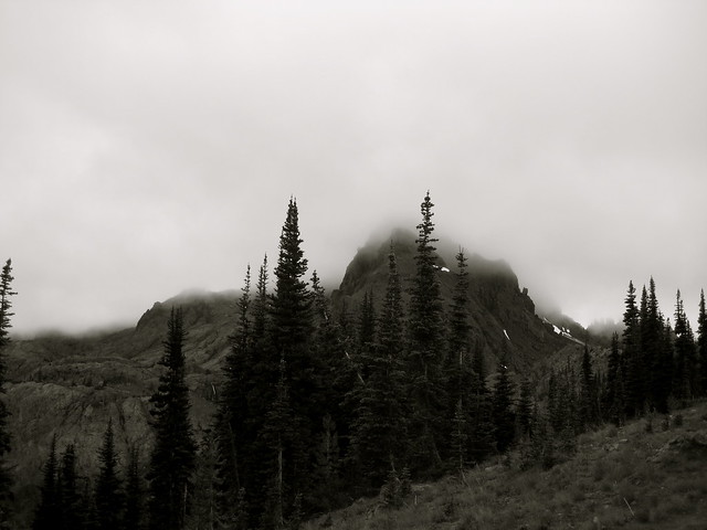
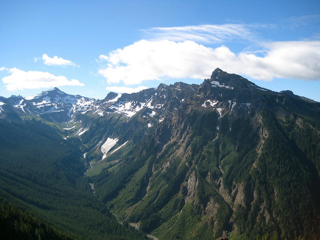
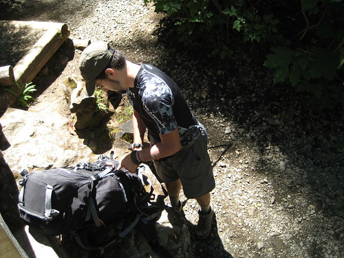
Arriving at Rialto Beach just past 1:00 PM, I took a few minutes to stuff my food into the bear can I had borrowed from the Ranger Station on my way out. The cans are required to keep food secure not from bears, but from marauding raccoons. This was to be the third year I had hiked the Olympic Coast in Winter and, outside of the Sierra Nevada, these have been the only times I’ve carried a bear can. Still, thanks to the warmer temperatures along the coast, even with the can my pack feels light compared to what I must carry this time of year when high in the mountains.
High tide had been at 11:30 AM. It is still high enough to make beach-walking difficult. I opt to make my way through the thick trees and marsh instead of braving the beach. There are no cars in the parking lot when I leave, but I surprise two people panning for gold along a small creek. Neither are talkative. When I ask if they had found anything, the one only replies “a little”. I don’t know if that is the truth, or if he was just anxious to get me gone.
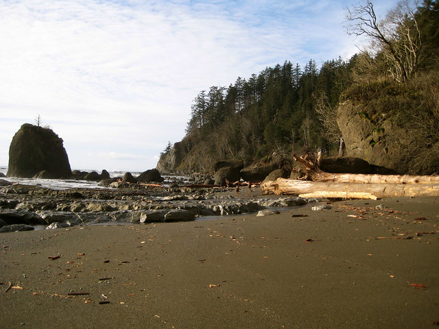
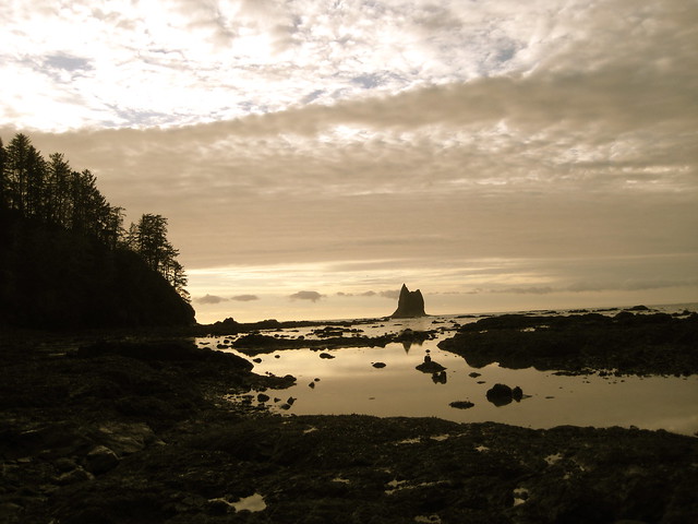
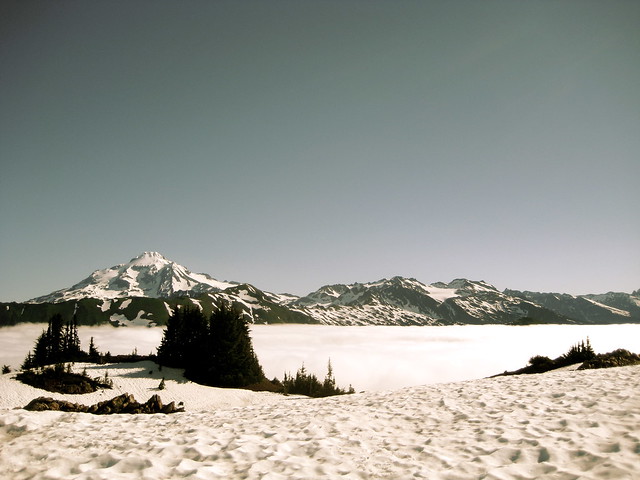
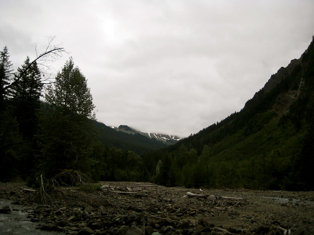
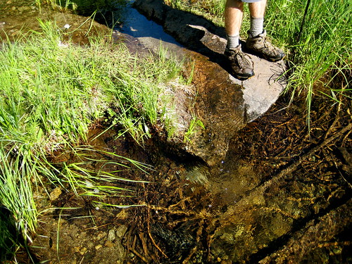
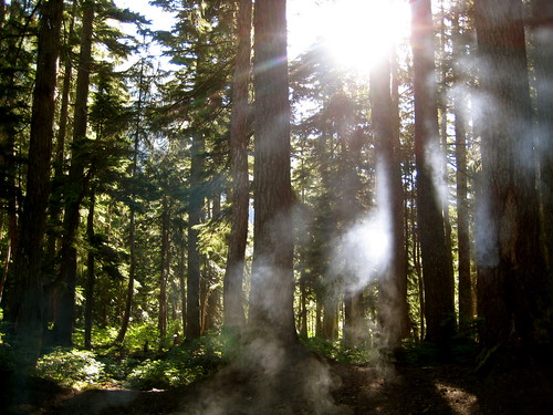
I spend an hour in the woods. The tide is low enough now that I can make my way down to the beach, exchanging thick trees for wet sand. Occasionally I have to run up the beach and jump on top of driftwood to escape from the occasional wave, but for the most part the way is easy going between Rialto and Hole-in-the-Wall.
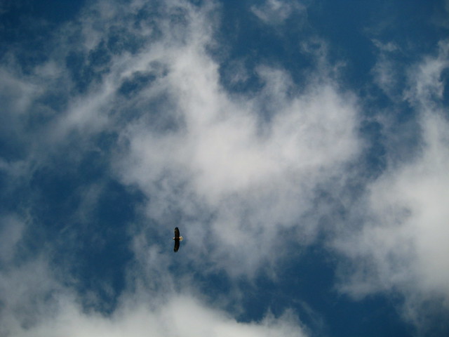
The area is thick with Bald Eagles. Every 15 minutes or so I spot one in a tree, or landing on a sea stack, or one flying over the ocean. At one point I see two eagles eating on a large fish head that had washed up on the beach. (I don’t know what kind of fish, but the head was close to the size of a football.) The two are eating just on the other side of a large boulder. We don’t notice each other until I come around the rock, at which point they jump and fly off. At a distance of about 10 feet, that’s the closest I have ever been to an eagle.
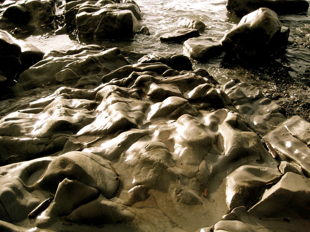
At Hole-in-the-Wall, the sandy beach comes to an end for a good while. Now begins the obstacle course that defines a walk along the wild coast. Piles of driftwood, tide pools, slippery rocks, and tall headlands all present a much different challenge from the steady plodding that characterizes walking in the mountains. The various balancing tricks, pull ups and push ups that are required make one thankful for a well packed backpack.
After rounding one headland I come upon two deer, out looking for whatever seafood it is that deer fancy. They don’t seem too concerned about me, but eventually bound up the steep cliff as I close in.
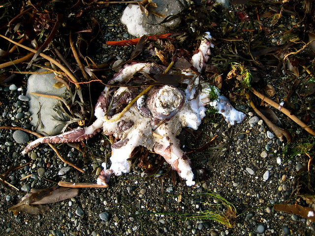
Around the next headland there’s an octopus lying in the sand. It has been partially eaten by something.
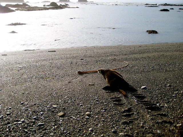
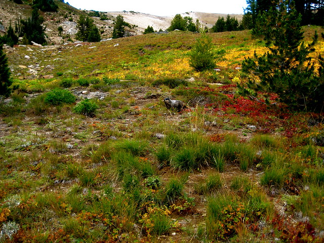
The tide is out now. I walk blissfully along a rare sandy stretch of beach that doesn’t require much attention, and find myself surprised by a dark brown spot ahead of me. My first thought is Marmot, but they belong in the mountains, not the coast. Then I think Badger, but the tail is wrong and they also had no business on the coast. An Otter! I couldn’t identify it at first, as I had no experience to link it to. This was the first time I had seen an Otter – leastwise, on land and in the wild.
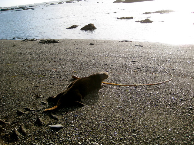
The Otter is slowly flopping down the beach, throwing his front arms forward and then pulling along the rest of his body. His legs wiggle a bit but are clearly useless on land. I approach slowly. He turns his head and looks at me, slows and then finally stops as I approach. I don’t know if he isn’t concerned by my presence, or if he is tired from inefficient land movement. Perhaps he thinks the best course of action is to play (sorta) dead.
I’m able to get within four feet of the Otter, where I stop to admire his fur and watch his whiskers twitch as he sniffs me. It would be easy to approach close enough to touch him – a tempting thought – but I don’t think he’ll appreciate that. Instead I try to make conversation. “Hey, you’re a mammal. I’m a mammal. We both have nipples.” At this the Otter’s concern seems to grow, so I leave him and continue around the next headland. I don’t want him to have to cut short his time on the beach on my account.
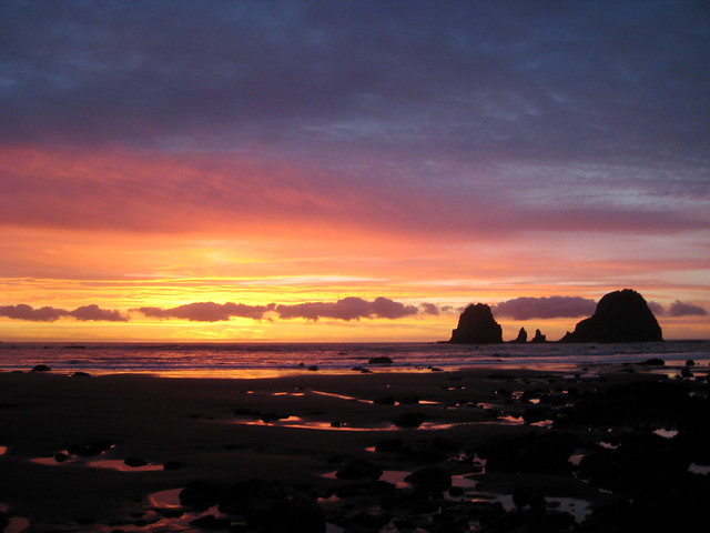
My tide chart has sunset scheduled for 5:00 PM, which is drawing near. I’m still in an area with the ocean on my left and sharp cliffs on my right. The map shows that it is a long way to the next suitable camp spot. I resign myself to hiking for a short while in the dark. At least the tide won’t be coming in till 7:00 PM.
I walk along, and watch the sun set over the edge of the world.
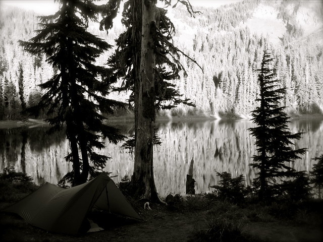
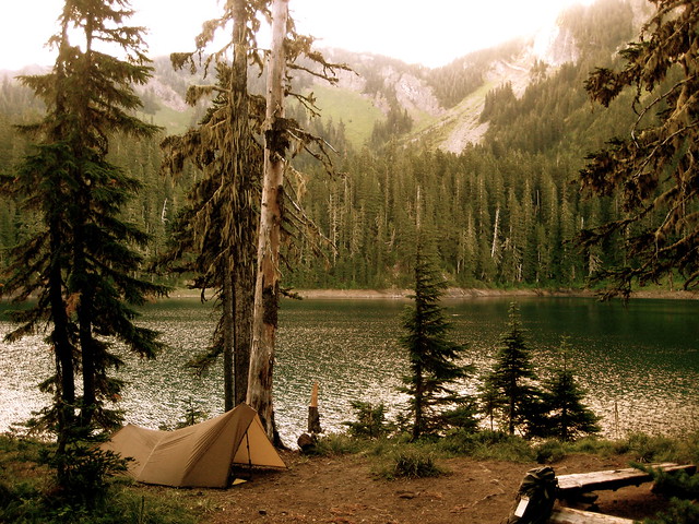
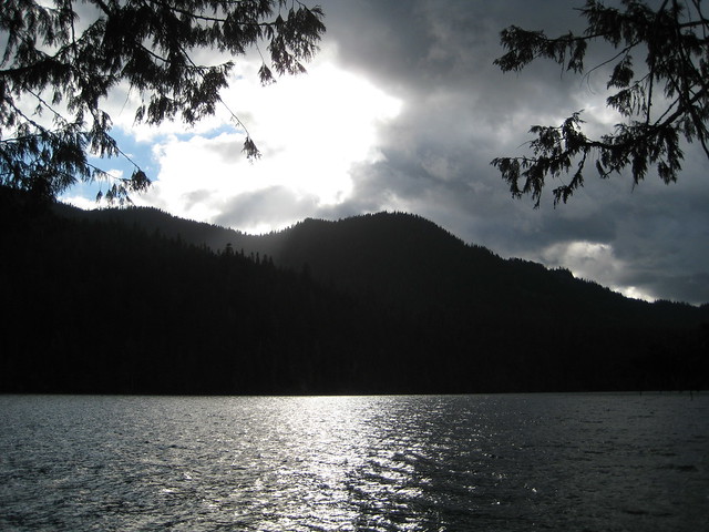
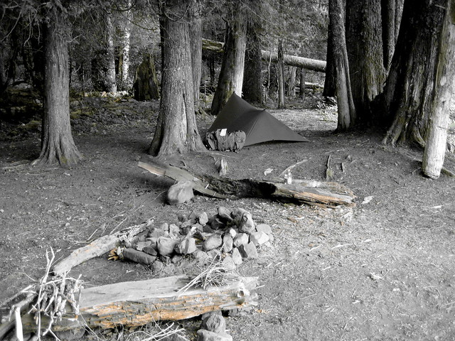
At 6:00 PM I come to an area where the cliffs on my right give way to a clump of trees. I make my way inside and find a spot to pitch the tarp. After dinner in the dark, I crawl into my bag and go to sleep. The roaring of the tide wakes me once around midnight, but, unlike the last time I spent the night out here, my camp tonight is well above the high tide mark.
The tide gives me trouble the next day. It is about an hour later than the day before, with high tide hitting at 12:30 PM. I was hoping to wake up early and log a few miles at low tide around 6:30 AM, but I end up not waking till 9 AM. At that point the tide is high enough that I could barely get anywhere before high tide, at which point I would be able to go nowhere at all. I decide not to make any move until after high tide, though that means a later start than yesterday, and so a longer hike into the night.
It is a gray morning. Rain steadily falls from the sky, coupling with the ocean mist to give all a good soaking. I lie about, enjoy a slow breakfast, read some and write some. By 1:00 PM my patience is gone and I decide to see if any progress can be made. After breaking camp I find that I can scale partway up the cliff that starts on the north edge of my clump of trees, and traverse along that a way. From there I’m able to hop along a few large boulders that stick up out of the ocean, but I can’t get far. Eventually I have to stop and sit out the tide atop a group of rocks. It always goes out slower when you’re waiting for it.
An hour passes and the tide has gone down far enough that there are occasional stretches of bare sand between waves. This allows me some progress. I watch the waves go up and down for a minute, try to get a feel for the timing, and dash along the briefly-bare beach, clambering up the next pile of driftwood or large boulder before the waves come. Sometimes I make it, sometimes the waves catch me. More than once I make it to the top of a rock, but the wave hits with enough force that the water bounces up and splashes me. I’m wet already from the rain, so in the end it makes little difference.
The gray morning turns into a gray afternoon, which passes without difference. I don’t notice it getting dark until only a few minutes before sunset. I’m no more than halfway to where I want to be, but why pack a headlamp if you’re not going to use it? The next two hours are spent along the usual obstacle course of driftwood, headlands, and barnacle covered rocks, made even more interesting due to the dark. But after I pass them, the last hour and a half is along another rare stretch of sandy beach. I make up for lost time by running stretches. With a pack on my back and soft sand underfoot, running is a challenge, but it keeps me warm. Still, I don’t arrive into camp till 8:30 PM.
The rain continues into the next morning. I breakfast on the westernmost point in the contiguous US, turn south, and retrace my steps for a couple days back to Rialto Beach.
"In the static mode an observer may unify the pieces of a puzzle, but only as a blueprint -- kinetics adds the third dimension of depth, and the fourth of history. The motion, however, must be on the human scale, which happens also to be that of birds, waves, and clouds. Were a bullet to be made sentient, it still would see or hear or smell or feel nothing in land or water or air except its target. So, too, with a passenger in any machine that goes faster than a Model A. As speed increases, reality thing and becomes at the pace of a jet airplane no more substantial than a computer readout."
- Harvey Manning, Walking the Beach to Bellingham
I can’t think of a better way to spend the winter solstice than breaking trail in fresh powder.
Days and months are the travelers of eternity. So are the years that pass by... I myself have been tempted for a long time by the cloud-moving wind -- filled with a strong desire to wander... I walked through mists and clouds, breathing the thin air of high altitudes and stepping on slippery ice and snow, till at last through a gateway of clouds, as it seemed, to the very paths of the sun and moon, I reached the summit, completely our of breath and nearly frozen to death. Presently the sun went down and the moon rose glistening in the sky.
- Basho
As the light increased, I discovered around me an ocean of mist, which by chance reached up exactly to the base of the tower, and shut out every vestige of the earth, while I was left floating on this fragment of the wreck of a world, on my carved plank, in cloudland...
All around beneath me was spread for a hundred miles on every side, as far as the eye could reach, an undulating country of clouds, answering in the varied swell of its surface to the terrestrial world it veiled. It was such a country as we might see in dreams, with all the delights of paradise.
- Henry David Thoreau, A Week on the Concord and Merrimack Rivers
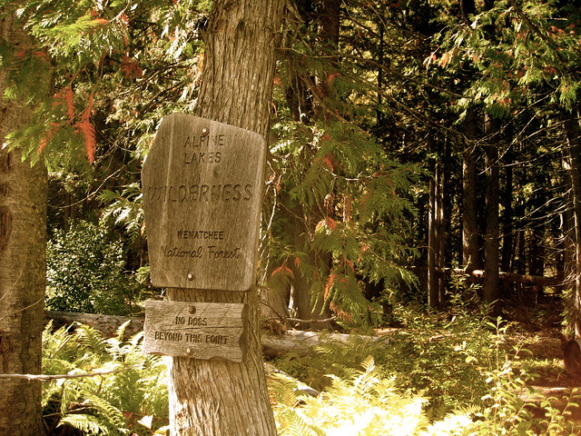
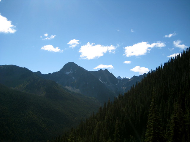
The Alpine Lakes Wilderness is located east of the Cascade crest, over by the town of Leavenworth. A small section of the area, called The Enchantments, became a popular tourist destination a few decades ago, resulting in much overuse. To address the damage the Forest Service instituted a restrictive permit system. To access a normal wilderness area, you generally just fill out a free permit at the trailhead. For the Enchantments, similar free permits are available at trailheads for day use only. To sleep there, you must apply for a permit the previous winter, send in a little cash to grease the wheels, and then hope for the best. Permits are rewarded on a lottery system.
I’m not a big fan of permits. 1 With a system as restrictive as this – and requiring as much forethought as this – it goes without saying that I haven’t spent much time in the Enchantments. But last week I planned a trip in the Alpine Lakes that would begin in the restricted zone.
I arrived at the trailhead near noon, where I met my first setback. The plan was to start out on the Enchantment-area trail to Eightmile lake, take the junction west to Lake Caroline, and head on over Windy Pass, which forms the boundary between the Enchantments and the normal Alpine Lakes Wilderness. I would be in the restricted area for about 6 miles. As I had assumed, day use permits for the Enchantments were available at the trailhead. But normal permits for the Alpine Lakes Wilderness? Of course not! I was slightly perturbed. It wasn’t as if I was planning a cross country trip. I was going in on a trail that started here, at this very trailhead, and continued straight through the Enchantments into the Alpine Lakes Wilderness. Why would they not have permits for the Alpine Lakes here? Is the Forest Service operating under the assumption that nobody is going to walk over Windy Pass on the trail that the Forest Service maintains for that very purpose? Must be. No matter. I wouldn’t feel right about letting a little thing like legality get in the way of my rambling. I took a day use permit and filled it out for the Enchantment part of the trip. On the back I began to write a note telling them of the plan for my trip, the impracticality of trying to control people moving by foot, and the inanity of this system in particular. I ran out of room, so I tore out a few pieces of paper from my journal and attached them. With my public service done for the day, I hit the trail.
I had gotten to the trailhead later than planned, and the permit fiasco set me back a bit further. Since I couldn’t legally sleep till I gained Windy Pass, I set a quick pace and was unable to enjoy much of the Enchantments.
I slowed as I neared the pass. The trail climbing up takes a meandering route through the beautiful basin. Most flowers were gone on this, the last full day of summer, but the bright reds and oranges made up for the lack of scented petals.
Just before gaining the pass, I spotted a very busy (and very fat) marmot. He was scampering all over the basin, yanking out grass with his mouth. A sure sign of the changing seasons. He was no doubt gathering material for his winter shelter.
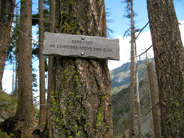
I paused at the top of the pass. I was now safely out of the Enchantments and could once again safely sleep wherever I wished. 2 It is a comfort.
The trail on the west side of Windy Pass is starkly different from the east. It takes a much narrower and steeper path, heading directly down. Starting in alpine meadows, it quickly enters into forests that continue for the remainder of the descent. It had been sunny and dry the whole day, but the thick bush was still covered in dew, wetting my pants. I was grateful for my gaiters.
Initially I had thought to aim for Trout Lake and make my camp there. But at 7PM I was still north of it. The sun was due to set in another half hour. I decided to camp in a clearing and visit the lake for breakfast the following morning.
I woke once during the night. The thermometer read 25°F.
It seemed like a good morning to sleep in, so I did. I crawled out of the bag at 9:00 AM and left camp a half hour later.
It turns out I was only a mile north of Trout Lake. When I arrived the sun was just climbing over the ridge in the east, melting the frost off the lake’s surrounding meadow, filling the air with mist. A fine start to the equinox.
I attempted to make a breakfast of oatmeal with chia seeds, but accidentally dumped in most of the bag of chia seeds. Breakfast became chia seeds with oatmeal.
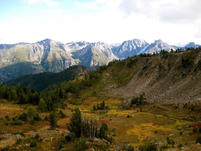
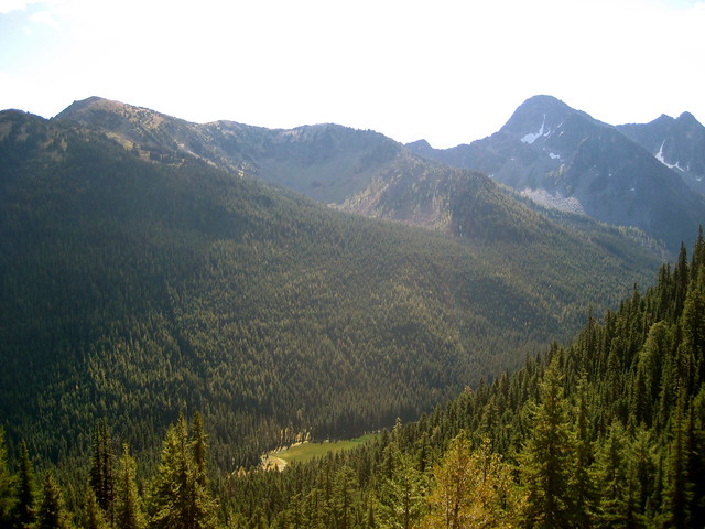
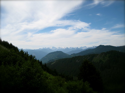
With the meal finished and the sun climbing high, it was time for me to continue west. The climb to the top of Jack Ridge offered splendid views of the Trout Creek valley, back towards Windy Pass, and the many peaks of the Alpine Lakes Wilderness.
At the top of the ridge the obvious tread continued south. Had I looked at my map I would have seen that the real trail turns sharply north before beginning its descent down the opposite side – but why take out a map when there is fine tread below my feet?
I lost the trail shortly and decided that it must have been only a game trail. Turning back to scout out the proper path was the obvious solution, but backtracking always seems depressing. Besides, I only needed to descend into the valley on the opposite side of the ridge till I reached Jack Creek and the obvious trail that parallels it. I would make my own way.
At first I was able to find other game trails that seemed to be heading down. But the trouble with deer is that they don’t organize themselves into trail crews to maintain their highways. The paths always petered out. I soon gave up on them in favor of a more direct descent. It was steep, and lacking a trail, I have the tendency to always aim for a direct descent (or ascent, as the case may be), making nary a switchback.
The areas thick with trees slowed progress further. I was glad when I reached a small open meadow. Until I was stung by a bee. At that point my gladness evaporated. I retreated back to the trees. Having been stung before and never experiencing a reaction, I wasn’t much concerned, but the venom still hurt.
The descent continued. I soon noticed that when I clenched my left hand there was some tightness on the outside, near where I had been stung. It was not yet visible, but the area was clearly swelling. There was nothing to do but continue the descent.
The last stage was the steepest. I often fell and slid down on my rear. Two hours after I had left the top of the ridge I spotted a man with a rifle and orange hat. He yelled a hello. I return the greeting and commented that he must be on the trail. The hunter replied with a thumbs up.
It was good to be back on trail. We chatted while I recovered my breath and sucked down a bit of water. Apparently it was high buck season. The hunter lamented that his ruck was much too heavy for this trip. I observed that he still had to pack out the meat – or, at least, hopefully he would. Luckily he had two friends further ahead of him that could help with that job.
Now on the Jack Creek trail, I turned south and resumed my walk. At the junction with Meadow Creek I stopped for lunch and water. My hand was now visibly swollen, but I experienced no other symptoms. The swelling did not appear to be traveling up my arm. To be safe I switched my watch and paracord bracelet to the other wrist. Gazing at the contrast between my two hands, I thought it funny, like I was slowly (or perhaps quickly) becoming fat. Anyway, the hand still worked fine, doing everything that a hand is supposed to do, so I wasn’t worried.
That afternoon I only traveled a few miles further, a bit past the junction with Van Epps Creek. It didn’t make much mileage for the day, but I was tired from the journey down the ridge, and unsure if there would be any decent spots to camp till the opposite side of the upcoming pass.
Off to one side of the trail was a burned area where I was able to find a decently flat spot for the tarp. I enjoyed dinner while watching the sun set in the west, taking with it the last few moments of this year’s summer. It had been well spent, I thought. I brought to mind waking up in the Glacier Peak Wilderness, with the valleys below me filled with clouds and only the snow-capped peaks visible above. Or throwing my bedroll in the dust in the high country of Oregon’s Cascades, spending the whole night watching the Perseid meteor shower, tossing oohs and aahs back and forth across camp. Or yelling at bears down by the Tucannon.
Camp was at a lower elevation that night, and I slept warmer. But the dry spell was broke by a light morning rain. It didn’t matter: Jack Creek was running a hundred feet from my camp and had to be forded first thing, so I was getting wet anyway.
On the other side I exchanged sandals for boots (tying my shoe laces with one still swollen hand). The rain had stopped, but the forest was still damp. I kept my rain gear on.
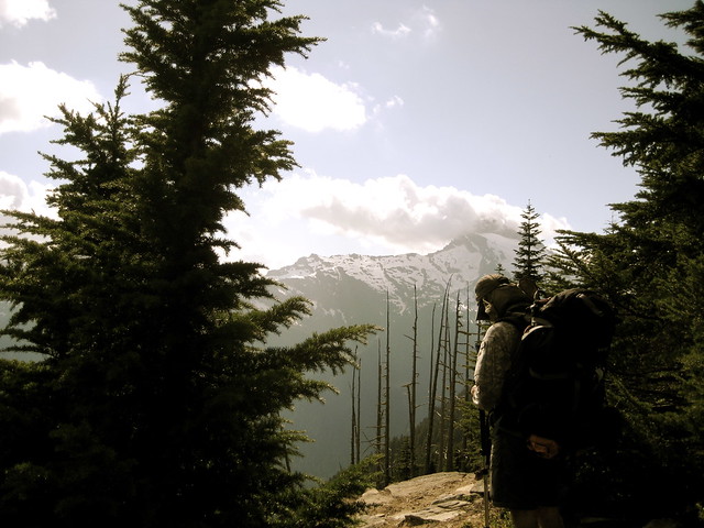
The trail crossed back to the other side of the creek, then started heading up, aiming for Stuart Pass. It was forested, providing few views of the destination, until a sudden break provided a stunning view of Mount Stuart. “Well, shit,” I thought. I’ve seen a lot of mountains, but Stuart is an awesome sight. One of the largest pieces of exposed granite in the States, carved by multiple ice ages, the only way to describe it is rugged. I had a strong temptation to abandon the trail for the mountain, but time – or, rather, my food supply – was against me. I continued on up to the pass.
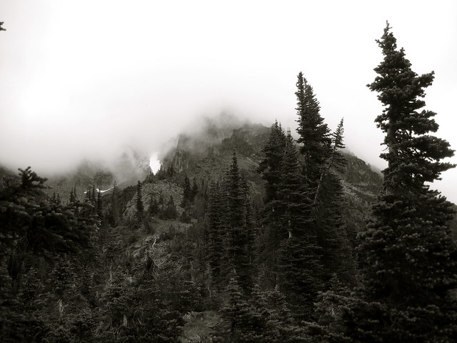
Stuart pass connects Mount Stuart to neighboring Ingalls Peak, but by the time I reached the top, clouds had rolled in and obscured both mountains. Snow began to fall. I sat down for a congratulatory lunch.
I was nearly out of the wilderness now, with nothing left to do but descend the pass and walk through the 20 mile valley of Ingalls Creek. I thought I would do only a few more miles today, and save the bulk for tomorrow. But after I left the pass the flatness of the terrain deceived me. At 4:00 PM I was only 5 miles from the end. Not wanting to end the trip that early, I stopped at the next likely spot and made camp, settling in for another warm night.
The sun wakened the valley in the morning, a welcome change from yesterday’s clouds and rain. I set out a few things to dry while the oats boiled and decided to enjoy a bit more of my book before breaking camp.
The last few miles of trail went quickly. I arrived at the trailhead at noon, but the trip wasn’t over: this wasn’t the trailhead where I had parked. The trip was a one way hike, not a loop. So I walked out the small road to where it met US 97 in one mile, stuck out my thumb, and began the second stage of the journey.
Hitchhiking is a completely different experience from wilderness rambling. I’m at ease with solo travel in the middle of nowhere, depending only on myself. I know what I can do, what I can’t do, and I’m comfortable betting my life on it. But thumbing my way down the highway is the opposite. I barely factor into the equation. Instead I’m completely dependent on everybody else.
Before reaching the highway I had put away my trekking pole and taken off the rain gear that I had been forced to wear down the wet trail. This, I hoped, would make me look a bit more normal. Perhaps it worked. I only had my thumb out for 10 minutes before a middle aged couple pulled over and asked me where I was headed. I told them Leavenworth, which is about 8 miles north on US 97 and then 10 or 12 miles west on US 2. They were going to head east on US 2, but offered to take me up to the junction.
They were Seattleites, heading to the east side to escape the rain for a few days. Both were interested in my travels, so I told them a few tales. When we reached US 2 the driver said he’d head into Leavenworth and drop me off wherever I wanted. Great! That was the bulk of the trip over with. Initially I hadn’t been sure how long it would take me to get back into Leavenworth. I planned for an extra day or two in case I needed to stealth camp along the highway, but now it looked like I would reach my own car that same day.
I was dropped off at the western edge of town. Now I had to get 8 miles down Icicle Creek Road. The first mile or two consisted of suburbs, but after that it was only a small country road. I somewhat doubted my chances of getting a ride all the way.
The second ride took longer. This time a whole 15 minutes before a pickup truck stopped. The driver was an old man, probably in his eighties, blasting music from a country music station. After I hopped in I discovered that the seat belt on the passenger side was broken. Whoops.
I had to strain to make out anything he said. He offered me a bottle of whiskey, saying it would keep me warm, but I told him it wasn’t that cold yet. Then he said something about getting me a woman, ogling at a jogger on the side of the road.
Eventually I made out that he lived just a couple miles down the road. He’d just gone into town for the whiskey and was on his way back. But he too decided to go out of his way to drop me off 8 miles down the road. I decided I must be a pretty ok guy.
I had first stuck my thumb out on US 97 two hours ago and was almost at my destination. This last bit was a small, dirt Forest Service road. I doubted if I’d see any cars going in the right direction, but it was only 3 miles and a few thousand feet to the car. I didn’t mind the walk.
A little over halfway I passed a group of guys chopping wood at the side of the road. “That looks like a lot of work,” I said. “I think I’ll just keep on walking.” One of them joked that he’d give me a ride back down if I wanted to help, but I told him my car was at the top of the hill. “I need a ride in the other direction!” The man replied that they were almost done with the wood and he’d give me a ride up there anyway, but I only had another mile to go and was enjoying the walk. I declined.
Three hours and about 30 miles after leaving the wilderness I was back at the car.
Notes
↵ Regardless of the benefits of permits, or the political ideas behind them, I find them to be completely impractical for wilderness areas. Controlling people in cars is easy, since, for the most part, they're limited to roads. But controlling people on foot? Not so much. (Hence why I equate mobility with freedom.) You can place a permit station at the trailheads closest to the area you want to control. That covers people driving to it. And how about those of us who walk in? Now you need permit stations on every trail leading into the area. But wait! Why assume that foot travelers are limited to trail? To effectively control access, you either need to have permit stations dotted across the entire border every quarter mile or so, or you need to surround the area with a large, unscalable wall or fence with only a select few entrances. Impractical, you say? I agree. (Incidentally, the same thing goes for national borders. They seem to operate on the premise that everybody trying to cross will do so on the roads that you ask them to cross on. As if people are sealed in their tin cans and can't, you know, walk.
↵ Of course there were no signs up here, warning travelers heading in the other direction that they were now entering an area were they were not allowed to lay their head. Once again: the impracticality of wilderness permits.
"Anyhow, let's get down to it, Hig," Mack went on. "I don't understand. What is it that really tempts you? What's the trouble with there?"
"There? Well, I figure this way. There is there all right, until a man gets to it. Then it ain't there. It's here, and here is what you wanted to get away from in the first place."
Mack shook his head. "The only way out that I can see for you is for you to shoot yourself."
"Not as long as there's trails I never took. Not while there be yonders and yonders."
- A.B. Guthrie, Jr., Fair Land, Fair Land
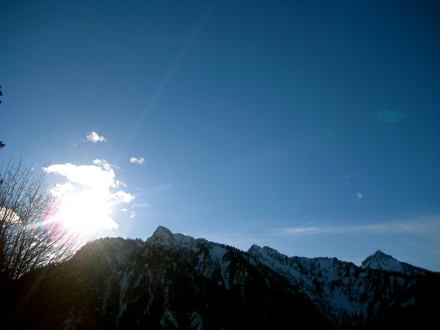
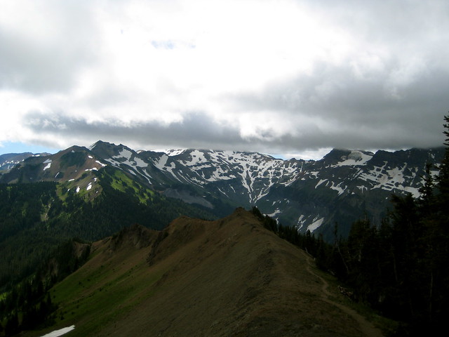
The Goat Rocks are an alpine wonderland situated between Mount Adams and Mount Rainier. The result of volcanic explosions and glacial carving, the area is high and rugged; the way mountains are supposed to be.
My entry into the area was via the Packwood Lake Trailhead. It’s a popular trailhead, leading to the equally popular day-hiking destination of Packwood Lake. The hike is about 4.5 miles to the lake along flat and well maintained trail.
At over 1.5 miles long, the lake itself is fairly large. Near the head of the lake are three different structures: a guard station (guarding what from what, I wonder?), an old ranger station, and, down the drainage a way, a dam for generating electricity. The lake itself is not in the wilderness area, but surrounded by it.
I stopped at Packwood Lake to munch on a bit of trail mix, then donned my pack and began the climb along the northern ridge. My destination for the day was Lost Lake, another 3.5 miles from Packwood. It’s a steep walk, gaining about 2,000 feet in 2 miles. Near the top the trail breaks out of the trees into a pleasant meadow.
I hadn’t eaten much yet during the day, so I stopped in the meadow for a late lunch.
I arrived at Lost Lake near 7 PM. There was one small group with horses near the eastern end of the lake. At the northwest shore I found a nice and secluded spot. I could still hear the horses whinnying occasionally, so I figured that they would act as my bear detection system for the night.
After pitching the tarp I gathered a bit of wood for the fire, cooked dinner, and settled in to watch the sunset.
It was a full moon and another clear night. My headlamp wasn’t necessary to find the bushes when I got up around 2 AM to make water. Before going back to bed, I wandered around a bit, playing in the moon shadows and watching the reflections on the lake.
There was no rush the following morning. I took my time enjoying the oats and watching the sunrise. When I decided to go, it took only a few minutes to break camp.
The plan for the day was to walk along Coyote Ridge to Packwood Saddle, then up to Elk Pass where I would get onto the PCT and head south aways. The trail along Coyote Ridge went through trees, and sometimes across steep, narrow and rocky ridges. Good mountain trail.
It occasionally offered views to the north, south and west.
The day had dawned clear, but clouds were slowly rolling in. By the time I got to the exposed ridge at the southern end of Coyote Ridge, the sky had filled up and strong winds were blowing in from the west. I’d debated packing it beforehand, but now I was glad to have a wind shirt with me.
From this part of the trail I could look further south to Egg Butte, Old Snowy Mountain, and Johnson Peak. This is where the trail would lead me after climbing up to Elk Pass. But the tops were all in clouds. I could tell there would be no visibility up there. Near Old Snowy Mountain I would have to traverse the tops of two glaciers, and the trail often went along steep ledges. I would have preferred the ability to see where I was going.
At Packwood Saddle I stopped for a lunch break and to ponder the situation. I waited for near an hour, but the clouds were only getting thicker. The decision was made that it wouldn’t be safe for me to continue to get higher. Instead, I would cut over to the Upper Lake Creek Trail and head back down to Packwood Lake.
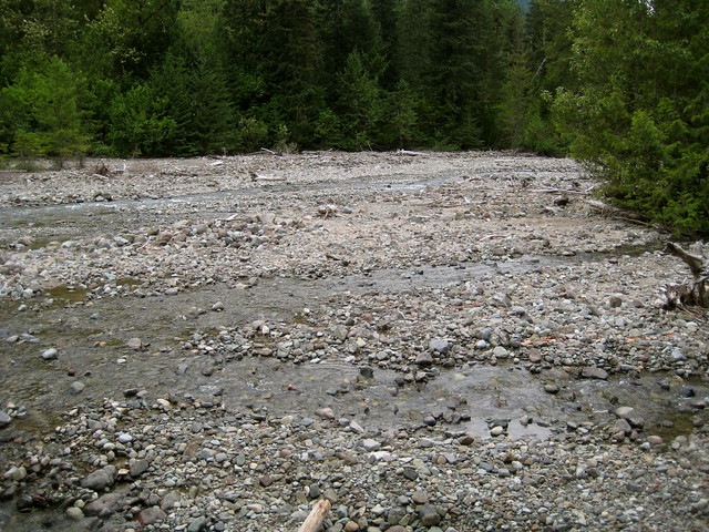
From the saddle the trail descends steeply along a forested ridge before reaching the Upper Lake Creek at the bottom. The creek itself is a small, meandering affair that drains glaciers in the high country. I can’t imagine that it ever gets enough water to fill the entire gravel bar – if it did, it would be quite the torrent. I think it’s more likely that the wide area was caused largely by avalanches.
The trail washed out about halfway down the creek, forcing me to balance over a few thin, slippery logs to the gravel on the other side of the water. From the gravel I turned around to look back up the drainage. The clouds had indeed come in lower and thicker. I could no longer see even the saddle I had descended from an hour earlier.
It was near 5 PM when I arrived at the southeast head of Packwood Lake. There was a spot along the shore that looked like a good camp, so I dropped my pack and gathered wood for a fire.
The wind had followed me down. It blew strong gusts across the water, causing white caps and blowing my fire all over the place. I kept it small and low so as to not start any unwanted blazes. Once or twice the sun peaked out, but clouds dominated the sky.
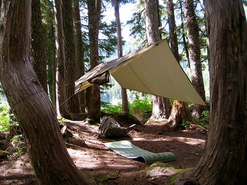
Sitting around in the wind for a few hours takes a mental toll. I was glad to retreat to the shelter of the tarp just after the sun went down. When pitched properly, I sometimes think it would take a hurricane to blow that thing away.
The wind blew the rest of the night, but didn’t bother me. I was woken once before dawn by an owl who saw fit to hoot away in a tree above my camp.
The wind abated in the morning. The clouds remained. I breakfasted, began to pack, then thought better of it and instead warmed up water for hot chocolate. Finally I broke camp and got back on the trail at 10:30 AM.
I had thought there was no one else at the lake, but as I walked along the shore I spotted a tarp pitched on a point along the northeastern edge. For some reason, tarp campers seem rare in these mountains, so I thought to stop by and congratulate the owner on not having a tent.
The occupant was one solitary man, cooking chili over the fire in a blackened old pot. We exchanged greetings and the necessary remarks about where we had been and where we were going. It turns out he had been out for a bit.
He was an older guy, in his early fifties. He’d spent a few years in the Marines, and camped at a state park now and again (“that’s not real camping,” he admitted), but had never been in real wilderness or backpacked before. In June he decided to load up a rucksack and head out into the desert around Yakima for a week long trip. That was too hot, so he walked into the mountains. He’s now finishing up his third month.
We chatted, about wilderness, long term mountain living, and the silly world below. Over the course of the summer he’s been all over the Cascades in the southern half of the state. His routine was to walk into a town, quickly load up on as much food as he could carry, and then retreat back into the mountains. He doesn’t like to spend more than a couple nights in the same spot, and never likes to walk the same trail twice. Since he had no experience backpacking before this summer, all of his gear was spartan – things found at campsites, military surplus, and a few items from general camping stores. He didn’t like to carry anything that ran out or could become dead weight: no stove, because he didn’t want to mess with fuel. Other than the clothes on his back, he had one tarp to sleep under, one to sleep on, an old sleeping bag, some rain gear, one pot, one pan, a grill, knife, a pocket fishing kit (he wished he had a pole), a pair of sandals, ripped out pages of the DeLorme Atlas for Washington, a couple Klean Kanteens and a scavenged plastic water bottle. (He used to have a cell phone, but lost that when he fell into a river near the beginning of his trip. Figured the battery was almost dead anyway. It was just useless weight.) His gear took up less than a quarter of the volume of his large pack, leaving the rest to store food in.
When I first asked him how much longer he thought he might stay out, he said another month or so. But after we talked for a while, he looked at me, smiled, and said “Actually, I was thinking of trying to spend a year.” He’d had enough close encounters with deer and elk that he figured with a rifle he could easily take care of the food problem. I showed him on his maps where I knew there were old cabins that could serve as a shelter. The cabin at Eagle Lake, with its wood stove, appealed to him.
We talked for a few hours. I think he was glad to find an eager listener. Most of the hikers he ran into thought he was crazy and wouldn’t stick around him. He’d been on the PCT some, but couldn’t talk to thru-hikers because they wouldn’t slow down and “didn’t carry nothing.” Resupplying every 5 days wasn’t his style. He liked to get a couple weeks worth of food in his pack and wander aimlessly. If he found a good view, he’d stop and sit for a while. He wasn’t walking to get anywhere.
"Summers didn't guess his heart was as troubled as some. There wasn't any bur under his tail. He was a mountain man, or he had been, and traveled with hunters who never gave thought to soil and timber and tricks to pile up money but went along day by day taking what came, each morning being good in itself, and tomorrow was time enough to think about tomorrow. That was how Summers felt yet, but the movers were different. They traveled to get some place, as they lived life. Chances were they couldn't enjoy a woman and a bed for thinking what they had to do next... They were family men, settled with their women and easy with their children, the hard edges worn smooth, the wildness in them broke to harness. They looked ahead to farms and schools and government, to an ordered round of living."
- A.B. Guthrie, Jr., The Way West
I recommended a few authors that I thought would be up his alley (Abbey and Proenneke, especially). He had been trying to learn a few wild plants that could be useful foods and medicines. I pointed out a couple more to him.
It was near 2:30 PM when I left him. His plan is to head north and check out the country up this way, so we’ll probably run into each other again.
As for myself, I had another 5 miles back to the trailhead and the world below.
Dick Summers thought lazily that these were different from mountain men. These couldn't enjoy life as it rolled by; they wanted to make something out of it, as if they could take it and shape it to their way if only they worked and figured hard enough. They didn't talk beaver and whiskey and squaws or let themselves soak in the weather; they talked crops and water power and business and maybe didn't even notice the sun or the pale green of new leaves except as something along the way to whatever it was they wanted to be and to have. Later they might look back, some of them might, and wonder how it happened that things had slid by them. They would remember, maybe, a morning and the camp smoke rising and the sun rolling up in the early mist and the air sharp and heady as a drink, and they would hanker back for the day and wish they had got the good out of it. But, hell, a man looking back felt the same, regardless. There wasn't any way to whip time.
- A.B. Guthrie, Jr., The Way West
Having been back from the Glacier Peak Wilderness for near a week, I felt a need to return to the mountains. The maps suggested a few possibilities, but one didn’t commend itself to me over the others. I thought to contact Avagdu, who was still in Washington, to see if he had time for another walk before returning to California. He did, so I gave him the options I had come up with and asked what he would prefer.
We settled on heading into the Wild Sky Wilderness. I would lead him back to Eagle Lake, where we would spend the first night. The next day we would climb the ridge of Townsend Mountain, descend down the opposite side, and make our way to Sunset Lake for our second night. From there, we would hike out on the third day.
When we arrived at the trailhead in the early afternoon it was hot – somewhere in the upper 80 degrees Fahrenheit. Too hot for hauling around a pack, but luckily the short, flat hike to the first destination of Barclay Lake was mostly in the shade. From there we would head up, and I hoped the higher elevations would be cooler.
I’ve traveled to Eagle Lake via Barclay Lake a half dozen or so times, but the sight of the steep north face of Mount Baring jutting up from the lake basin never fails to impress. On the drive over I had told Avagdu that only yesterday a base-jumper had died leaping off Baring when her parachute failed to open. The death is tragic, but still, I felt, like Ed, the need to congratulate her taste.
Looking out on this panorama of light, space, rock and silence I am inclined to congratulate the dead man on his choice of jumping-off place; he had good taste. He had good luck -- I envy him the manner of his going: to die alone, on rock under sun at the brink of the unknown, like a wolf, like a great bird, seems to me very good fortune indeed. To die in the open, under the sky, far from the insolent interference of leech and priest, before this desert vastness opening like a window onto the eternity -- that surely was an overwhelming stroke of rare good luck.
- Edward Abbey, Desert Solitaire
At Barclay Lake, the official trail ends. We turned north and headed up the steep slope to Stone Lake, which sits in a small saddle at the top of the ridge. The first half of the route is through forest. It’s a popular route, so a trail made by the many feet of travelers is vaguely visible. The way is also marked by occasional flagging, which I always have a difficult time spotting on the way up. (On the way down, sticking to the route is easy.)
After breaking out of the trees we entered the boulder field. Here the route is marked by cairns, but at this point the way is obvious enough that the markers aren’t really needed – at least, the way is obvious enough to me after having ascended and descended the field a few times before!
At Stone Lake we stopped for a breather. We had gained enough elevation that the temperature was no longer uncomfortably hot, but still pleasant. While waiting for Avagdu to reach the lake, I ate an apple that I had been carrying.
From Stone Lake it was only a short 15 minute walk through Paradise Meadow to our day’s destination of Eagle Lake. I warned Avagdu that the meadow would be extremely muddy, but in fact it was surprisingly dry. I had been in the area earlier in the year and later in the year, but never had I visited in late July, so clearly my predictions were off.
I enjoyed the pleasant walk through green grass, trying to avoid the occasional mud patch, and jumping over the creek as it meandered through the meadow. We spotted a few frogs jumping around, and one or two small trout in the creek.
As we approached Eagle Lake I saw a tent in the clearing on the edge of the lake at the south side of the creek. There was no one there, so we ventured over to the cabin to see if anyone was about. At the cabin was a family of three fishing the lake. They had spent the previous night at the lake and were planning on one more at the same site before heading out in the morrow. There had been no luck fishing, which surprised me as you usually can barely throw a rock into the lake without hitting a trout. We talked about Townsend and what lay on the other side before I suggested Avagdu take a look inside the cabin.
It’s a neat place. I don’t enjoy spending the night inside: it’s small and dark and smelly and the mice always want to share the bed – much better to spend the night under the stars – but I enjoy visiting. The cabin looked to be in good repair and was cleaner than the last time I visited (in early February of this year). One new addition that caught my eye was a small inner tube tucked away in the corner. I had visions of floating about the lake, followed by visions of being extremely cold. But the latter was not enough to deter me. I knew that I could not echo the timeless lament of Shaquille O’Neal (particularly since I had used that quote as my email signature for the better part of a year and even had the piece of zen wisdom inscribed on a bright yellow pin).
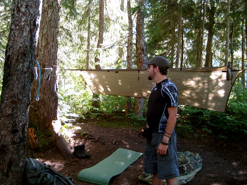
We left the cabin to go make camp. My preferred site was on the opposite side of the creek that drains the lake. There was one clear, flat spot that I usually used for my tarp, but no other spot that was ideal for Avagdu. Since I intended to pitch the tarp in an elevated manner, we decided that there would be plenty of room for both of us to sleep below it. The chance of rain that night was slight, anyways.
Having made camp and filled up on water, I returned to the cabin to grab the inner tube. It was about 5 PM. I figured that I had enough time to kick around the lake for a bit and then dry off before the sun was lost behind Merchant Peak.
The tube, it turned out, was a little small. It floated, but after putting my weight on it, it sunk in about halfway. With my butt hanging down the middle, I was submerged up to my navel. Still, the water was actually pleasant after getting over the initial shock – much warmer than some of the icy cold rivers and alpine lakes I’ve jumped into in the past. I kicked around for a bit and thought to use the opportunity to try out a small pocket fishing kit I had put together a few months ago, but I was unable to efficiently cast with it. After seeing that I hadn’t died of shock from the water, Avagdu decided to join me. He slowly made his way in until the water was up to his neck. I suggested that, since my small kit had failed, he could swim down the shore to the cabin and pick up the spinning rod that was hung on one of the rafters. He had had the same thought.
As Avagdu swam, I slowly attempted to follow, but it was difficult to propel the tube in the direction I wanted to go. After he got the rod, Avagdu walked back down along some of the logs that cluttered the shore and we managed to meet about halfway. I had him hold out the tip of the rod to me as I tied on a rooster tail lure that I had spotted in the water near where I had gotten on the tube. “Okay, you’re fishing!” I announced.
We figured out how the spin-cast reel worked and, after only a couple tips, Avagdu was casting out to the lake. I gave it a couple shots as well, but neither of us had any bites.
Soon the sun fell beneath the peak of Merchant. Though there were still many hours till dark, neither of us wished to be standing around wet without the direct warmth of the sun. We walked back to camp.
I had gotten in the lake in my underwear and pants. Dry underwear and merino long johns awaited me in my pack, so I wasn’t concerned about that. The pants were quick drying, but in the meantime I didn’t want to put them on and wet out my dry underwear. So I was walking around camp in my long johns, which I was concerned about: being made of a lightweight merino wool, they are somewhat delicate. I didn’t want to sit down directly on the ground or on a log without some other layer of protection, out of fear of snagging them. Before leaving for the trip I had taken my normal rain pants out of the pack to save weight, but had tossed in a garbage bag rain skirt on the off-chance that rain did occur. So, as a bit of protection until my pants dried, I donned the stylish garbage bag skirt.
We both wanted a fire to dry our things. Easy to gather wood was scarce in the area, but soon enough we had a merry blaze.
As the sun set the bugs came out in force. They bothered me a bit, but were bearable. Avagdu, however, they loved. He couldn’t go more than a minute without waving his hands around and slapping himself. I had packed along a bottle of a natural insect repellent that I was skeptical of, but wished to test further. After trying it out, Avagdu concurred with my conclusion that the repellent worked great for ten or fifteen minutes, but then failed. Still, we had the smoke of the fire to protect us.
The following day we rose around 7 AM, breakfasted, and broke camp. Shouldering our packs, we headed for the ridge of Townsend Mountain that lay along the north side of the lake.
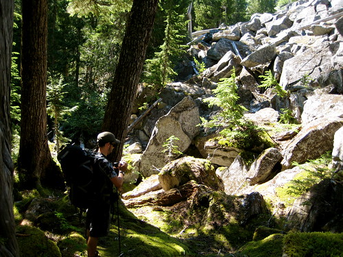
The first part of the route was through thick bush, but this quickly led to an easy climb up a small talus field. As with the previous day’s walk, there was no official trail, but people did sometimes come this way and cairns occasionally suggested a route.
After the talus it was back into the bush. I enjoy off-trail travel, but the trouble is that when making my own way, I have a tendency to always go straight up and make nary a switchback. A defect in my character, perhaps. No matter. Switchbacks are luxuries, not necessities.
Breaking through the bush we entered an open area of rock. This was a little over halfway up the mountain. We stopped for a breather and to enjoy the view.
Observing the face of the mountain from below I had pointed out this large face of rock to Avagdu, saying “See that rock? We don’t want to go up it, so we’ll just hug the edge and make our way around. We’ll come above it and then have only a short skip to the top.” A good plan. But near the rock on which we sat I spotted a cairn, and another beyond it. This seemed to suggest that there was a safe route across the field. Okay, I said to myself. I had never been up here before, so thought to trust to the judgment of my predecessors on the mountain. We donned our packs, and I led Avagdu off in the direction of the markers.
The route started out easy, but progressively got steeper. I couldn’t spot any more cairns, so I observed the rock and picked my own route. We moved from scrambling to what was basically rock climbing – but with full packs, boots, and no ropes or other safety equipment. This was my idea of fun. I was quite enjoying myself. Avagdu was making his way, but struggling a bit and falling behind. As I was waiting on a small ledge for him, he called out that he would need some help. I stashed my pack in a crack and, after making sure that it was secure, went back down to him. It was his pack that was slowing him down, so I threw it on my back, climbed back up, and stashed it with my own. Then I guided him to the ledge where I waited.
Directly above us the way looked more technical. We would have had more difficulty climbing that with our packs. But off to one side I spotted another cairn on an angle of the slope. Studying the rock, I saw what would make a decent enough path for us to use to traverse over to the cairn. Due to the angle I couldn’t see what lay on the other side, but I assumed that since there was a marker it would lead us back onto a more manageable route. I pointed out the cairn to Avagdu and the path that I meant to follow. He wisely queried how we would get from where we were to the ledge that started the path. I replied “I don’t know. Just follow me.” I was making this up as I went!
Getting to the path wouldn’t have been much trouble, but for the water. Most of the rock between it and where we were was wet from a trickle that came down from the top of the mountain (from snow melt I thought, since the map showed no other water source up there). It made the rock slick and extremely difficult to get any purchase on. I managed to traverse a few feet laterally from where Avagdu stood till I got myself jammed in a crack. I hoped to be able to make my way down the crack to where the path started below. But there was water in there as well and I couldn’t get enough holds. About halfway down I decided that this wasn’t going to work. There was a slope to the crack and I had been making my way down it facing out. With my pack on again, I couldn’t turn around and face into the mountain to climb back up. I tried inching my way back up while still facing out, but that didn’t work either: I had no holds for my feet and I couldn’t spot where I should be placing my hands. There was no going anywhere with the pack on.
I pushed out on either side of the crack with both my legs so that I could temporarily take my hands off the rock and slip out of my pack straps. Then I slowly moved my body forward and down to see if the pack was jammed in enough to stay where it was. I had to move only a couple inches before realizing that the pack was coming too. That wouldn’t work. I yelled back up to where Avagdu was watching and asked if he had any paracord. He did, so I told him to throw me one end and keep the other. He got it out and untangled it as I thought to myself “Does he have to take forever with this?” I’m sure it was only 15 seconds or so, but my feet had slipped, and I was holding up both my body and my pack with only my locked out arms.
Eventually he tossed the end to me and I was able to get enough purchase with my feet again to temporarily remove my hands and tie the cord in a quick knot around one of the shoulder straps of my pack. Having done this, I instructed Avagdu to slowly start to pull in the cord until it was taut. “Okay,” I said. “You have my pack.” I moved forward away from the pack, but found that even without the extra weight on my back, I wasn’t going to be able to make it along this route to where the path started. I was able to get out of the crack and onto the rock face on the opposite side from Avagdu and scrambled back up till I was level with him. I asked him to hold onto the cord for a bit longer until I could figure out what to do, and then went scrambling around, trying to find a route. There wasn’t much of promise. I scrambled up a little higher along a slick face till I couldn’t go up anymore, and then found that I couldn’t get back down. “Whoops,” I thought to myself and announced out loud that I was stuck (which probably didn’t do much good for Avagdu’s morale). But I found that by laying down on the rock so that my whole body was in contact I was able to generate enough friction to slowly slide and inchworm my way back down to a more secure area.
Avagdu suggested that we turn around. The way showed no signs of easing up and since I was having such difficulty I knew that Avagdu would probably not enjoy this next bit, even if he could do it. So I agreed. I was disappointed that we wouldn’t make the top and see what was on the other side, but it was my fault for trying to go up along these rocks rather than trusting my original plan of hugging the edge and going around them.
But there was still that cairn that I had spotted over in the distance. The way we took up was certainly not the intended trail and would be no easier going down. If that cairn marked the trail, it would probably offer a better path back down to the lake. I stilled wanted to reach it.
I thought to try the crack again. I made my way back down till I was above the pack and, making sure that Avagdu still had a good hold on the cord, gave it a slight kick till it swung out of the way. With the crack cleared, I eventually made it down to the path that I had been aiming for. I walked along it a ways toward the cairn, but I didn’t like what I saw between us and it. And I didn’t like what I couldn’t see, on the other side of the angle. I decided to take the known challenge offered by the route that we had come up, rather than risk the unknown.
Back at the bottom of the crack I had come down on, I found that I couldn’t make it back up to where Avagdu sat. I spotted what looked like a doable route below me and announced to Avagdu that I would make my way down a bit, traverse to the other side, and then climb back up to where he was. He assented, though I’m sure he was tired of holding up my pack by a single piece of paracord at this point. He probably was thinking that I would fall off and die and there would be no one to get him off the mountain.
I have thought briefly about getting caught in rock slides or falling from a rock face. If that happened, I would probably perish on the mountain in much the same way many of the big animals do. I would be long gone before anyone found me. My only wish would be that folks wouldn't spend a lot of time searching. When the time comes for man to look his Maker in the eye, where better could the meeting be held than in the wilderness?
- Richard Proenneke, One Man's Wilderness
Getting down and over was easy. The way back up proved more challenging. There were handholds, but with my boots on, I couldn’t get my toes into anyplace where they needed to be. So I basically pulled myself back up the mountain with just my arms.
I had almost reached Avagdu, but then found that, on this side, I could actually get to where my pack was hanging and take that off his hands. So I headed over there, got a hold on it, and had him drop the cord. Then I traversed off in the other direction a bit till I found a spot where I could securely stash the pack. I untied the paracord from it, wrapped it around my hand, and went back to the spot where the pack had previously been dangling, right below Avagdu. Tossing one end of the cord back up, I instructed him to tie it onto his pack. He did so, and I said that he should then slowly lower the pack down to where I was. I would hold onto the end of the cord and he would lower from above, acting as a sort of pulley in the three-point system. He lowered it down till I could grab it. I put it on my back and had him drop the cord, then traversed back over to my pack and stashed his next to it.
Avagdu came over till he was directly above me and I guided him down to where I was. He wasn’t comfortable moving down the mountain with his pack on, so I donned my own and climbed down 30 feet or so till I found another spot where I could take it off and stash it. Then I had him slowly lower his own pack to me via the paracord. When I could grab it, he would drop the cord and I would stash his pack with mine and wait for him to make his way down.
We repeated this procedure a couple times till the slope of the rock eased up again and the going was simpler. I figured he could make it down easily enough with the pack on. I made my own way down to a sort of mini-cirque where I could stand comfortably and wait for him.
Avagdu made his way down, dragging his pack along side him. Above where I was standing he announced that he was going to drop his pack. I assumed he meant that he would hold on to one end of the cord that was still tied to the pack. I got out of the way and saw him toss down the pack without holding onto the cord. Turning around, I watched the pack tumble off the cliff behind me and vanish from sight.
Luckily Avagdu could watch it fall down the mountain from his higher vantage point. He saw it land in a finger of greenery that shot up into the rocks from the treeline below. It was a bit off from the path that I had intended to follow back down.
We went down a ways before I dropped my pack and said that I would go down into the bushes and retrieve his. I knew he was physically tired at this point and the fact that he had just thrown his pack off a mountain suggested that he was somewhat mentally exhausted. I didn’t think he needed to climb down, beat around the bushes for a bit, and then climb back up till where we could continue our planned descent.
The bushes were thick. I poked around a bit and, not finding anything, climbed back up till where I could see Avagdu. I yelled up to him, asking exactly where he saw the pack come in. He replied that he couldn’t be sure from the spot where he was. I silently thought to myself “Well you need to be fucking sure! I can’t scour this whole mountain for the pack that you threw off it.” But rather than voicing my thoughts, I turned around and dived into another spot in the bushes and small trees. Pushing my way through, I stumbled upon the pack. I looked it over briefly and nothing appeared to be broken, so I threw it on my back and began the hard climb back up to where Avagdu waited. “Don’t do that again,” I suggested as I returned his pack.
I knew that my internal frustration toward Avagdu was unjustified. I was supposed to be the experienced one who was leading this little venture. I could only blame myself for anything that occurred. It pointed at my own mental exhaustion. We both needed to sit down, hydrate, and eat something. In the distance below us I could spot the rock that we rested on as soon as we had broken out of the tree line on the way up. I took off for that.
From there it was only an hour’s easy climb back down to the lake, so I didn’t have any problem draining my last liter of water. After drinking, I threw down a Clif Bar. Feeling much better after that, I yelled out a bit of guidance to Avagdu, who was a little ways behind me but doing a good job of making his way down. As he approached, he teased me, saying my problem was that I confused backpacking with mountaineering. I smiled, but replied honestly that in my book they were the same thing. I couldn’t spot a difference. Later, I reminded him that before heading out I had told him that this would be an easy, mellow trip. “I’m a man of my word,” I said.
After Avagdu had drank and eaten something, I led the way back down. I broke off from the marked route after a few hundred feet, favoring what looked like a more direct path. It went through a bit thicker bush, but I still think it ended up being a quicker descent.
Since the family of three had gone, we decided to make camp in the larger clearing opposite the creek from where we had camped the previous night. I quickly threw up my tarp, filled up my water containers, gathered some firewood, and cooked an early dinner while Avagdu was still pitching his own tarp. It was about 5 PM. We were both glad to be back at the lake, and I had my mind set on that inner tube and fishing rod again. After Avagdu pitched his tarp, he helped to gather a bit more wood before filtering water for himself. I had finished my rice before he started to cook his own meal, but I waited around for a bit to get a little digestion happening before getting into the lake.
When I jumped on the tube, the cold water was invigorating and refreshing. I kicked around the lake a little bit while Avagdu ate his meal. Eventually I tired of that and thought I would see what I could do about getting some line wet.
On the second or third cast I noticed a small trout investigating my scavenged lure, but he wouldn’t bite. I tried to get the next cast in that general area and, by luck, succeeded. As soon as it hit, I felt the bite and started to reel it in. But the line snapped and the little guy made off with my hook. I have no idea what type of line was in the reel or what its age or condition was, but it also might have been the fault of my knot. I tried casting a few more times with a couple of the different hooks and lures that I had in my pocket kit, but had no luck. All the fish were jumping for the bugs on top of the water, but none but the one who had taken my lure seemed interested in anything under the surface. A fly rod would probably have been the weapon of choice.
Avagdu and I hung out on the logs on the shore of the lake until the sun dipped below Merchant Peak once more. As the sun left, the mosquitoes appeared. We decided to return to the camp and light up the fire to smoke all the bugs out.
On the way down the mountain, Avagdu had ripped out the stitching on one of the bottom compression straps on his pack. It was his first field repair, so I loaned him the kit from my hat to sew it up. I advised an X-ed box stitch. After preparing my second dinner, I looked back to his sewing and saw his creative interpretation of a box stitch. We both laughed as I pointed out what I had meant by a box stitch. His stitching looked plenty strong for the job, so it didn’t much matter. Embolden by his sewing success, Avagdu decided to use the Reflectix material I had given him to make his first pot cozy.
The rest of the evening was spent talking around the fire. There had been a few thick logs stacked next to the fire ring. After our fire had got good and hot I was able to arrange three of the thick logs into a tripod and had them burning strongly in a manner that probably would have heated us all night, had we wanted it. Around 11 PM we retired to our bags for sleep.
I awoke once at 2 AM to get up and pee. The fire was still burning brightly.
Next morning I slept in, awakening at 8 AM to find Avagdu already tending the fire and cooking breakfast. We had a slow morning, eating, talking, and packing. Late in the morning we left Eagle Lake and returned through Paradise Meadow to Stone Lake. Then, it was an easy hike back down to Barclay Lake.
It was the hottest day of the trip. When we reached Barclay Lake I took off my shirt and jumped in (much to the the chagrin of some of the family day hikers who were there, I think). I swam for about a minute before getting out and eating a little beef jerky followed by granola while drying off. After Avagdu had eaten something we hit the trail again for the final stretch back to the trailhead.
Avagdu had a bus to catch late that afternoon, so I set a 4 mph pace. We reached the trailhead in good time and, after refreshing ourselves, traded the safety of mountains for the hazards of urbanity.
We are vagabonds of a peculiar type. Our chief pleasure is in roving about the mountains. Each of us has a month's wages -- forty-five dollars -- and consequently we feel wealthy. Our lives are free from care, therefore we have but to enjoy ourselves.
- Pat Quayle, quoted in Gary Ferguson's Walking Down the Wild