Lawrence had a talent for employing the Great War’s new technologies: semi-automatic pistols, airplanes, electric detonators, machine guns and motorcars. The equipment used by T.E. Lawrence and his colleagues against the Turks was innovative, as was his untraditional approach to the employment of intelligence, aerial reconnaissance and mobile gun platforms. His methodologies were game-changers and would heavily influence what would later be known as special operations in the British military, not to mention guerrilla leaders such as Mao Zedong and Võ Nguyên Giáp.
A metaphor can help understand the role of sleep and why alarm clocks are bad. We can compare the brain and its NREM-REM sleep cycles to an ordinary PC. During the day, while learning and experiencing new things, you store your new data in RAM memory. During the night, while first in NREM, you write the data down to the hard disk. During REM, which follows NREM in the night, you do the disk defragmentation, i.e. you organize data, sort them, build new connections, etc. Overnight, you repeat the write-and-defragment cycle until all RAM data is neatly written to the disk (for long-term use), and your RAM is clear and ready for a new day of learning. Upon waking up, you reboot the computer. If you reboot early with the use of an alarm clock, you often leave your disk fragmented. Your data access is slow, and your thinking is confused. Even worse, some of the data may not even get written to the disk. It is as if you have never stored it in RAM in the first place. In conclusion, if you use an alarm clock, you endanger your data.
With climate change, humans are beginning to appreciate that cities are not separate from the environment. They are environments. We should also recognize that the rural is, at least in part, man-made. Cities approaching the changes already in motion with a sense of the Earth as a biological network, rather than adopting psychological siege positions, will be essential for survival. Technology and engineering will need to be deployed in what is currently regarded as wilderness. In turn, what seems rural will have to be deployed in cities: rooftop and vertical gardens, wetland buffer zones, greenery as a sponge for rising waters, and towers that channel polluted air into greenhouses…
I few months ago I read Marie Kondo’s The Life-Changing Magic of Tidying Up. It’s not the sort of book that usually finds its way into my library, but it had been recommended periodically by a handful of different people over a year or two. I found the book to be disappointing. Many of the pages struck me as fluff – clutter, you might say, which is ironic given its subject. Edited down to a pamphlet of a dozen pages, or perhaps a short series of blog posts, it could be enjoyable, but there isn’t enough content for a book.
The one thing I did take away from the book is folding. Kondo recommends folding things such that they stand on edge in the drawer rather then being stacked on top of each other. This way all the contents of the drawer are visible at once, instead of only the things on the top of a stack.
The goal should be to organize the contents so that you can see where every item is at a glance, just as you can see the spines of the books on your bookshelves. The key is to store things standing up rather than laid flat… The number of folds should be adjusted so that the folded clothing when standing on edge fits the height of the drawer. This is the basic principle that will ultimately allow your clothes to be stacked on edge, side by side, so that when you pull open your drawer you can see the edge of every item inside.
This made sense to me. Unfortunately, the combination of having a walk-in closet in my apartment and not owning much in the way of furniture means I don’t actually fold many of my clothes. Most things end up being hanged (a Kondo no-no). I fold some less-seasonally appropriate clothing for storage in Transport Cubes (another Kondo no-no) and I fold larger things like sheets and towels for storage in underbed boxes, but neither of those really lend themselves to this method of folding.
One of the few pieces of furniture I do find useful enough to own is a filing cabinet. I keep socks in the large bottom drawer and underwear in the middle drawer. The top drawer holds an assortment of bandannas, hand wraps, and some seasonally appropriate head and neck wear. After reading the book, I dumped out all the socks and underwear and folded them to Kondo’s specifications.
It is definitely an improvement. Previously I rolled socks together, which is not very efficient in terms of volume (and disrespectful to the sock, according to Kondo). The drawer was overfilling. A pair or two would frequently fall behind the back of the drawer, where I would forget about it until I happened to notice that the drawer was no longer closing all the way.
Folded this way, everything fits. Immediately upon opening the drawer I can take stock. As with all clothing categories, I have different types of socks and different types of underwear, each more or less appropriate for different applications. A quick glance in the drawer lets me know what I have available, and when it may be time to address the laundry pile.
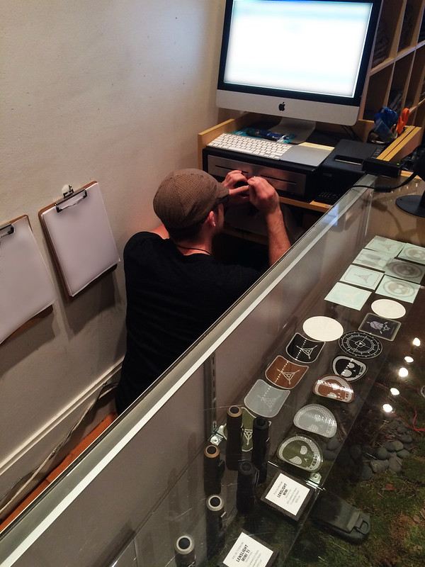
Triple Aught Design is a small business. All of us wear multiple hats to make things go. Sometimes I end up wearing hats that may be considered odd in other businesses.
Today I got a call from our retail store manager. The key for the cash drawer at our Hayes Valley Outpost had been accidentally locked inside the drawer. As the guy generally responsible for security-related things, and the lockpicker in the office, the retail team thought I could help.
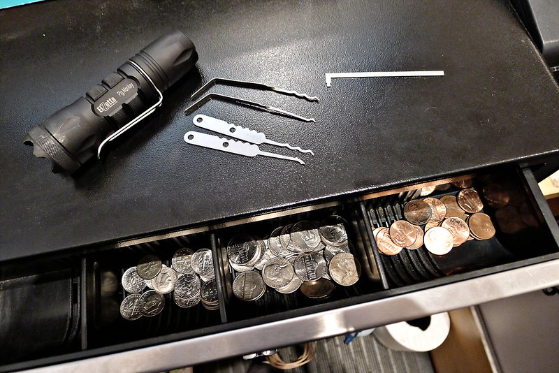
I’ve carried a set of Bogota picks in my wallet every day for a number of years. The popularity of the Bogota picks is well-deserved, but I found that this particular lock was too small for me to insert both the pick and the tension wrench. Fortunately I just picked up a pair of Kelly Alwood‘s ALS Mini Flats a couple weeks ago, and happened to have those in my pack. I don’t like the picks as much, but the tension wrench has a nice small tip that left me just enough room to insert the single hook Bogota pick. Between the ALS wrench and the Bogota pick I had the drawer opened shortly, and recovered the key.
Unfortunately I did not get to keep what was inside.
On the wall of the Outpost we have the well-known Heinlein quote, which is something of a driving force for what we do at Triple Aught Design, and struck me as appropriate today.
A human being should be able to change a diaper, plan an invasion, butcher a hog, conn a ship, design a building, write a sonnet, balance accounts, build a wall, set a bone, comfort the dying, take orders, give orders, cooperate, act alone, solve equations, analyze a new problem, pitch manure, program a computer, cook a tasty meal, fight efficiently, die gallantly. Specialization is for insects.
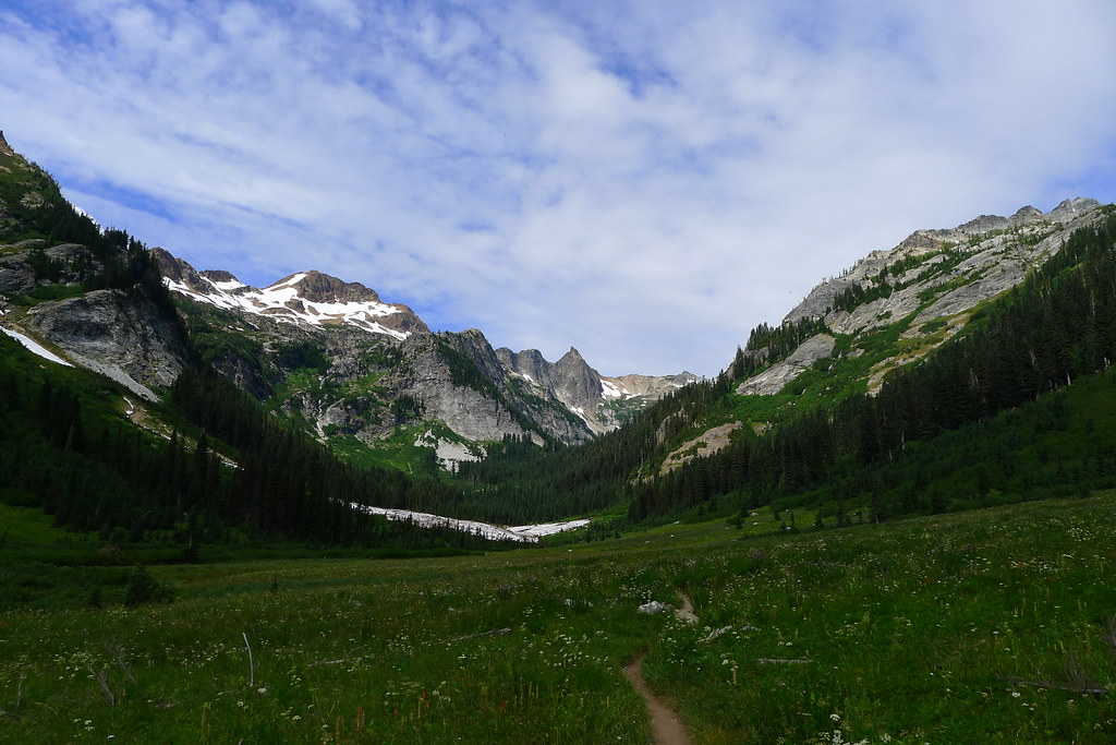
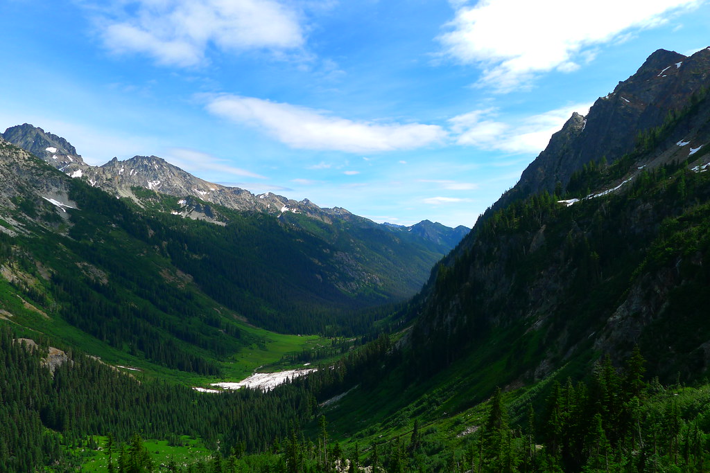
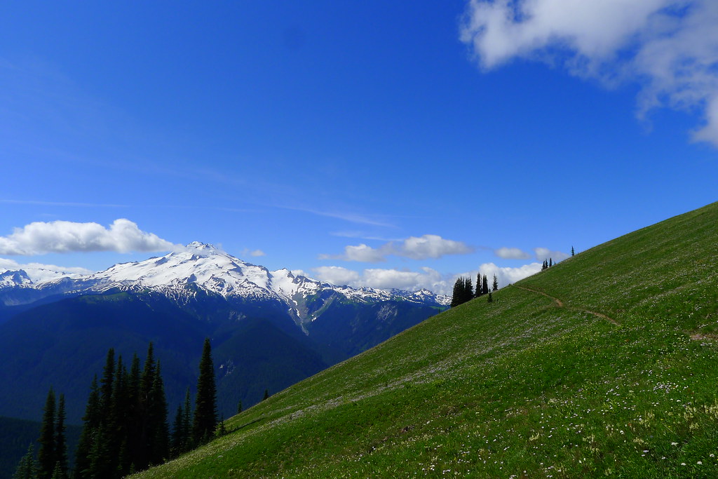
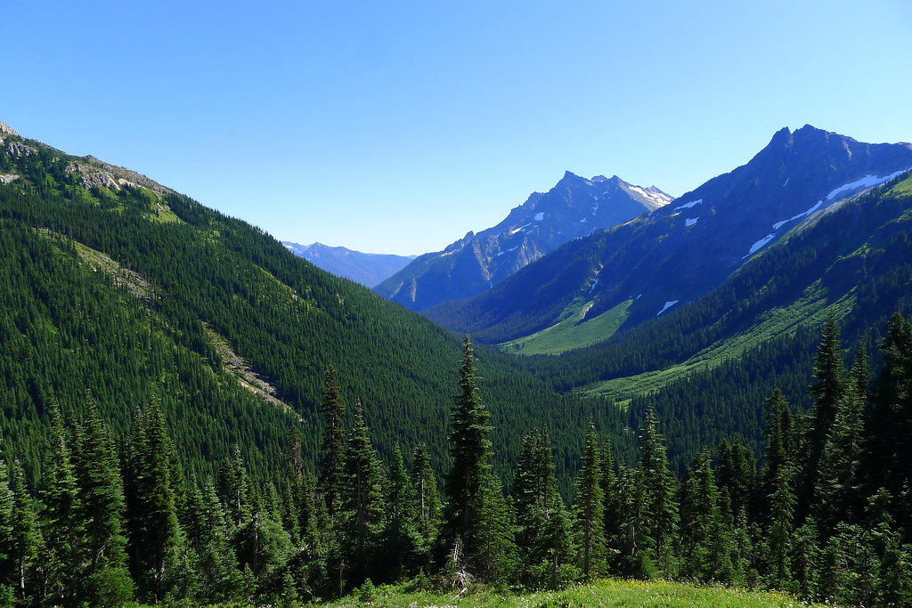
The Spider Gap – Buck Creek loop is one of the most popular trips in the north Cascades. For 40 miles the trail winds through the Glacier Peak Wilderness. It takes the traveler through low, emerald valleys and atop high alpine ridges.
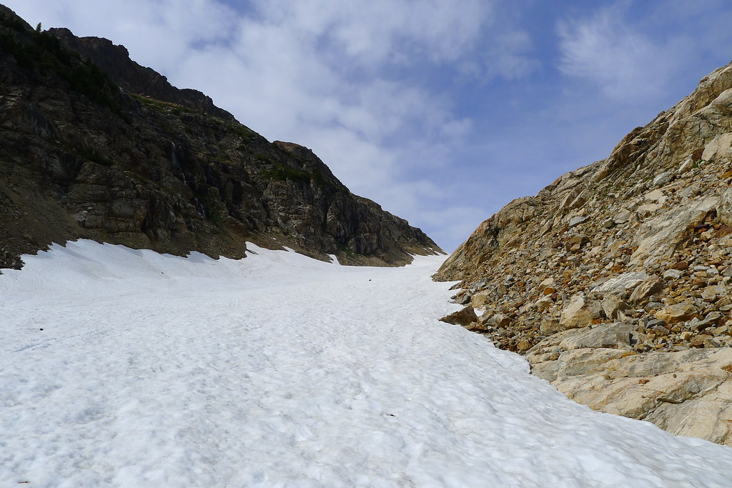
Spider Gap
The trail along Phelps Creek is well used by hikers and hunters. It is a wide horse road, leading through thick woods. When I arrive in the middle of the week there are three different groups heading out, but no one else going in. It looks as if I have hit a lull in the summer crowds.
At the head of the valley the forest thins, giving way to wide meadows, good camps, and the remnants of avalanche slides. Two grouse hunters were tramping through the meadows, and one person hunting the opening of archery season for deer. None of them had so far had any luck.
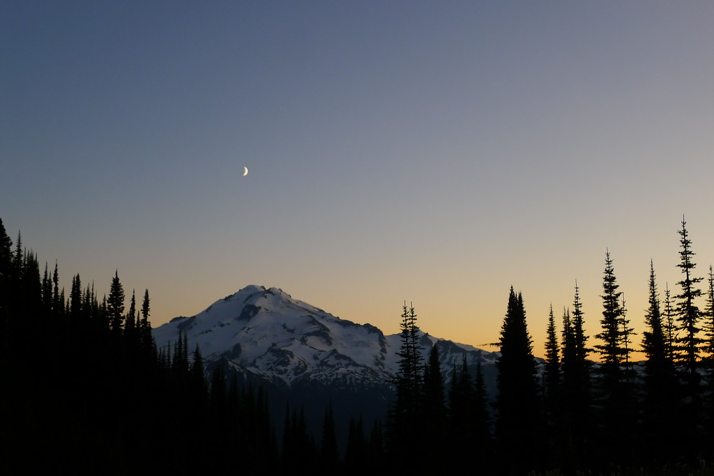
From Spider Meadows my route climbs up the first of many ridges. I was aiming for Spider Gap, a small pass between towering rock, carved by the small but powerful Spider Glacier. The trail is steep. The noontime sun strikes it hard. Trees are soon left behind in the valley bottom, and any shade left with them. An occasional cooling breeze gives reason to stop and gaze back down to the valley of Phelps Creek below.
Soon I hit talus. Soon after, the source. Spider Glacier: narrow but long, and uphill to the Gap. I put my trekking pole into the pack, trading it for an ice axe. The year’s heavy snow and late melt-off means that the glacier is still covered with a coat of snow. I progress slowly, but the snow allows for a relatively easy walk up without the traction devices that would be necessary had I been walking on the ice itself. All the way up, I think to myself that I should have done the loop in reverse, so that I could glissade down the glacier rather than walk up it. (Later, I shared my observations with others I encountered on the trail. None seemed to agree. “You have a different idea of fun that I do,” said one.)
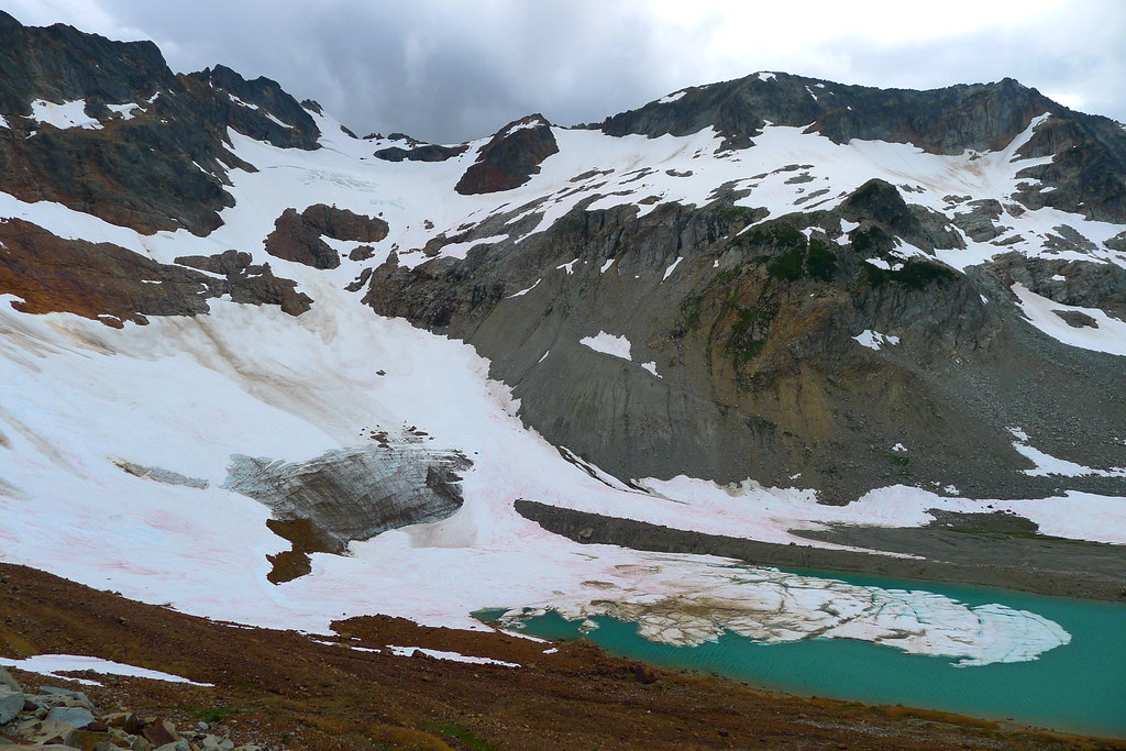
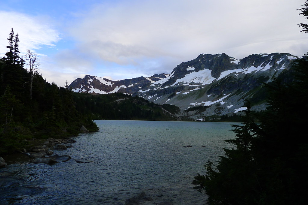
At the head of the glacier and the top of the gap I drop pack to hydrate and take in the views. This is surely mountain goat country – bare, carved rock and spiring peaks abound. Peering down the other side I spot the ever diminishing Lyman Glacier and the relatively young Upper Lyman Lakes. My goal for the day is the lower Lyman Lake, hidden in the trees beyond.
Snow fields occasionally cover the rocky north facing slopes on the other side of the Gap, but I can see faint outlines of a trail where the snow has melted, traversing the western slope of Dumbell Mountain. Ice axe still in hand, I make my way in that direction.
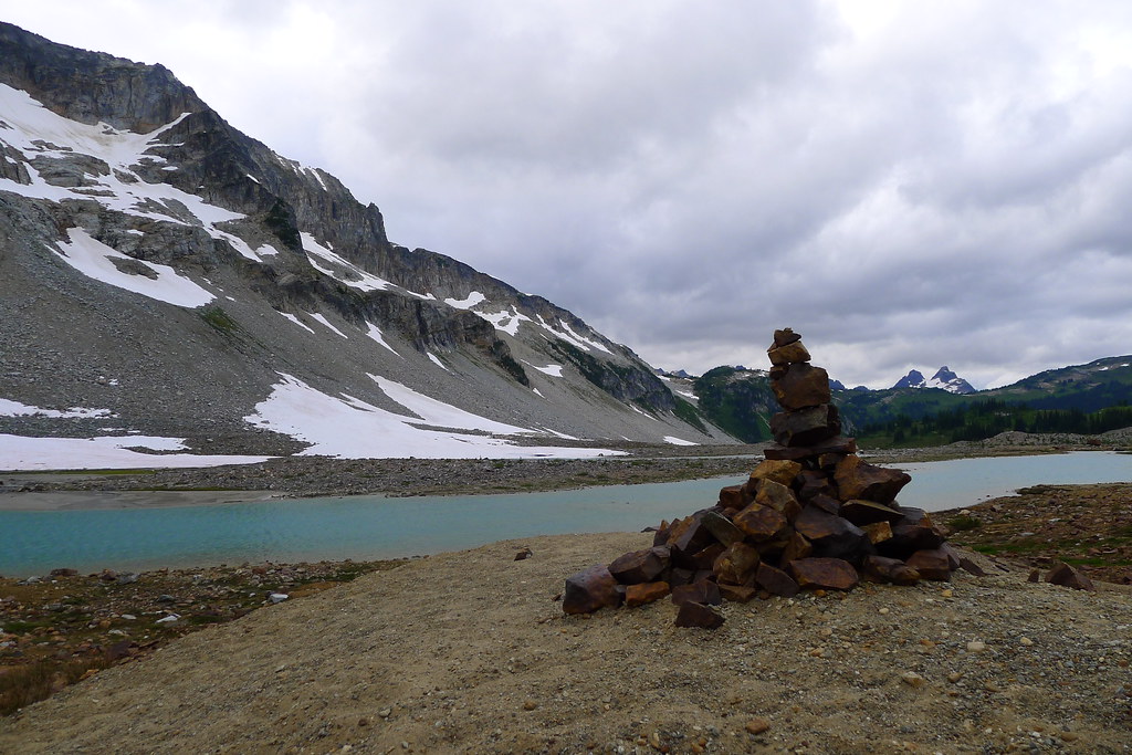
As I reach the opposite side of a field of snow, I find myself among scree and boulders. No longer can I make out the previously spotted trail. I peer ahead, but I cannot see its relief anywhere along the slope. I’m not sure what the trail was making for, anyways. When I did see it, it looked to keep the slope of the mountain, heading off perhaps to Rubin Creek on the other side. It is definitely not the obvious route given the topography. A few hundred feet below me I can see Upper Lyman Lakes, and the bare fields surrounding. It looks easy enough to just walk along the edge of the lakes, following the drainage down to lower Lyman Lake itself. Simpler than fooling around on the side of the mountain.
So I begin the descent, lowering myself down large boulders, occasionally loosing my footing as I kick loose small rocks that go tumbling down. After some time I reach another snow field, steep and perhaps forty or fifty feet down to the other side. I could go around it, but it has been slow going, making my way among the rocks. “Ballsy,” I think, but what’s the point of packing an ice axe if you aren’t going to really use it? I carefully step onto the snow, sit down, and push off.
The late season snow is hard packed and crusty, more like ice, which makes for a faster acceleration than I had planned. I cannot dig in with my heels or the spike of the axe enough to slow the descent. Nearing the bottom, I’m forced to roll over and arrest with the pick of the axe to avoid flying into the talus below. That done, and feeling quite pleased with myself, I merrily make my way down the remaining hundred feet to the lakes below. Reaching the bottom, I spot good tread, and even a few cairns here and there. I don’t know what route the path took down from the Gap – it certainly wasn’t the same as mine – but there it is.
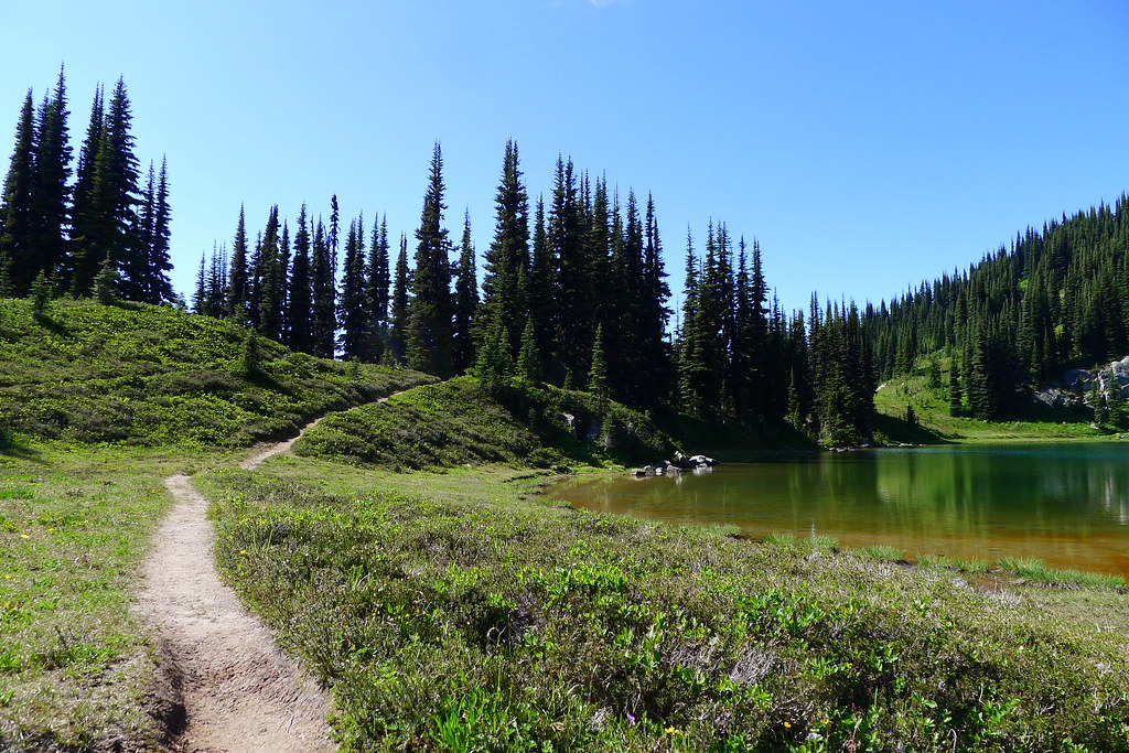
The tread soon turns to trail. Clouds begin to move in and, as I make my way to the lower lake, I feel drops of rain on my face. The trail descends into trees, reaching Lyman Lake itself soon thereafter.
At the lake there are a few other people already camped. I find a likely looking spot and pitch the tarp before the rain increases. It does not last long, soon diminishing to only occasional sprinkles. That and the accompanying breeze are enough to keep down any bugs.
A downed Hemlock tree next to my camp provides plenty of slightly-damp wood. I break off a few branches and after three minutes of processing have enough to fire up the Inferno. After dinner I have plenty of fuel left over, so I boil some water for hot chocolate. The fire is still going as I finish the drink, allowing me to heat a bit of water for cleaning and then dry the pot before putting it away. Then to bed.
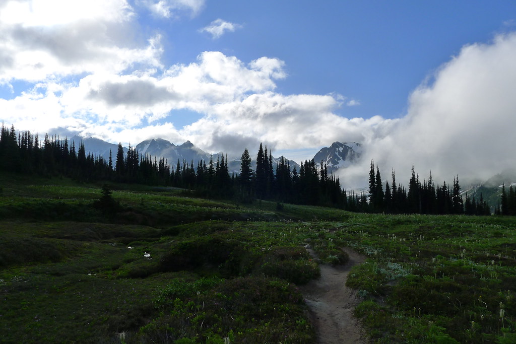
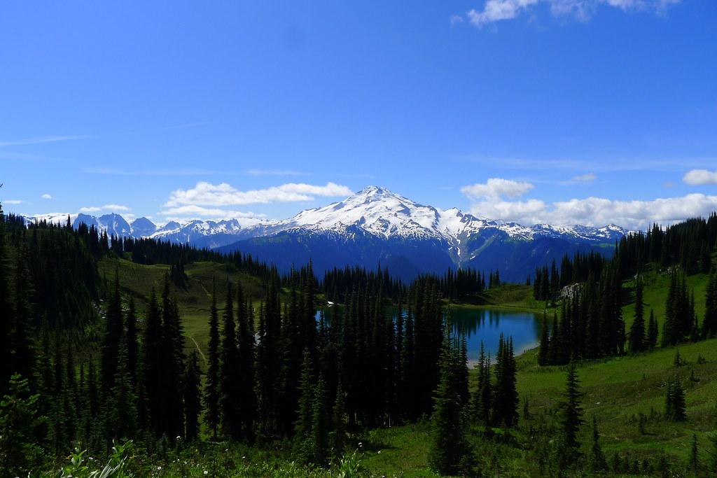
Image Lake
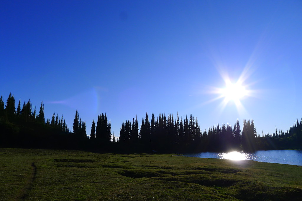
I rise early, break camp, and walk a couple hundred feet through the woods to the shore of the lake. Breakfast, and water, and then I’m gone. I want to get on the trail ahead of the others, whom I assume are doing the same loop as I. The trail winds along the shore of the lake for a short while before breaking off to head north and west. It climbs out of forest, into the meadow below Cloudy Pass. Here I spook deer and marmot, the latter collecting grass for their winter holes. (Already, the temperature dropped to freezing last night.) I spotted blue sky as I woke, but now Cloudy Pass is living up to its name. Looking back, I see clouds moving in to veil Lyman Lakes and the Gap.
Low clouds obscure the country by the time I reach Cloudy Pass. Descending to the other side I catch tantalizing glimpses of massive walls of rock all around me. I rather enjoy this hiking, walking through the mists in country that is new to me. It is fitting for the second day of September, being in stark contrast to the sweaty hikes under strong sun that defined much of August.
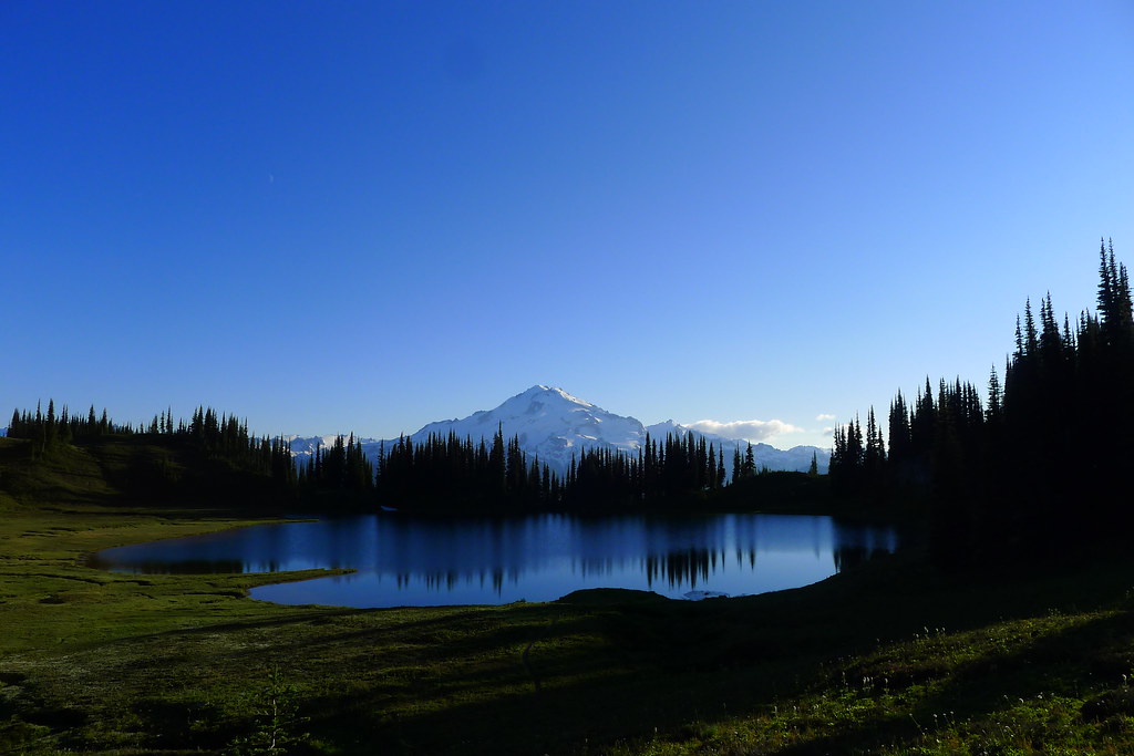
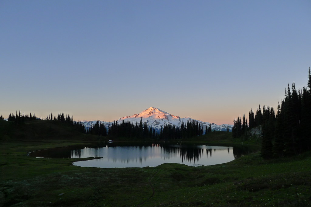
After Cloudy Pass, I avoid the descent all the way into the valley bottom just to rise again by taking a shortcut along the side of a steep ridge to Suiattle Pass. At the top of the pass I look forward and can see mammoth slopes of snow obscured by trees and clouds. Glacier Peak is in front of me, but still only allowing glimpses of its noble flanks. I step onto the Pacific Crest Trail and descend lower into thick trees, reaching the junction with the trail to Miners Ridge. Here the classic loop continues south along the PCT, but I intend to make the detour to Miners Ridge and spend a night at the famed Image Lake. There, the summit of Glacier towers over the lake and is reflected in the still waters, giving the lake its name.
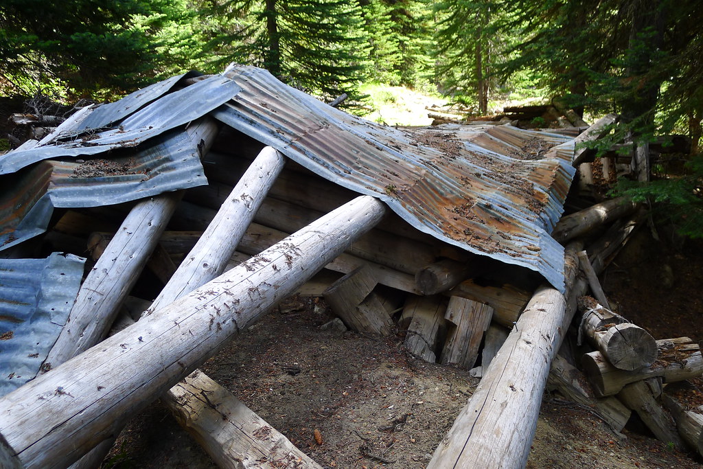
It is late morning now. The sun has begun to burn off the clouds as I start the climb to the top of the ridge. Mining artifacts from the sixties liter the trail, making for interesting archaeological pauses. (The ridge was largely saved from being destroyed by copper mining thanks to William O. Douglas.)
As the trail climbs, the day warms, and the trees are once again left behind, revealing meadows which carpet the upper slopes of the ridge. The clouds are all but gone now. Under a blue sky, green fields roll out before me and, to the south, Glacier Peak, the Wilderness Sentinel, stands in all its glory, surrounded by its court of lesser peaks.
The trail leads along the southern face of the ridge and descends to the small basin that holds Image Lake. There are good camps just south of the lake, where I drop my pack. It is just shortly after noon now, but I plan to spend the night here so that I may catch the sunrise over the lake the following morn. The rest of the day is spent exploring the basin and taking in the views.
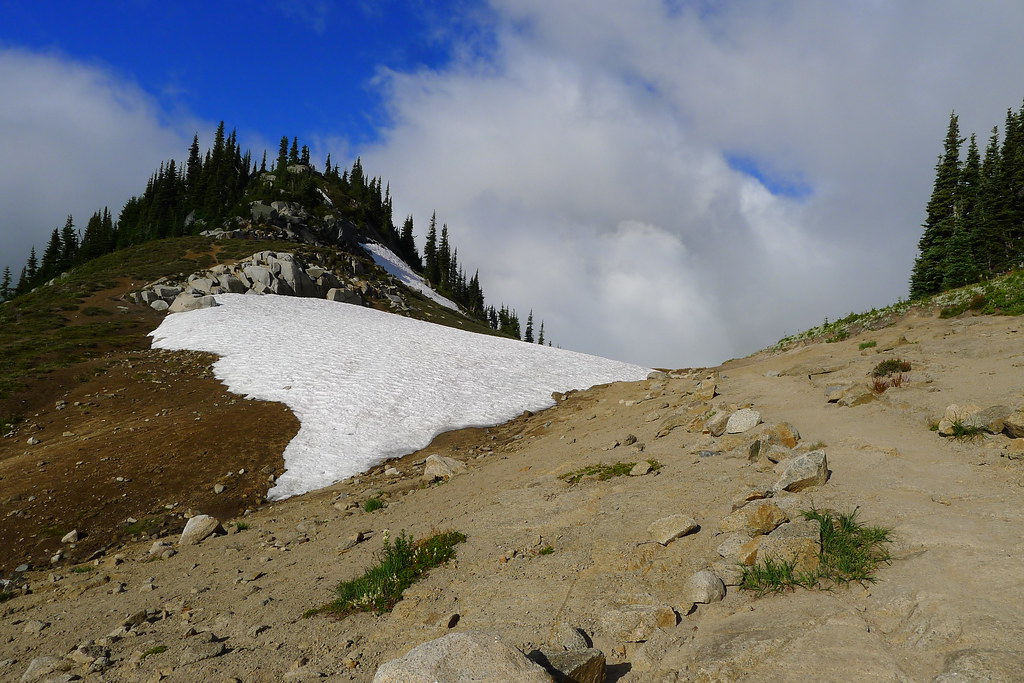
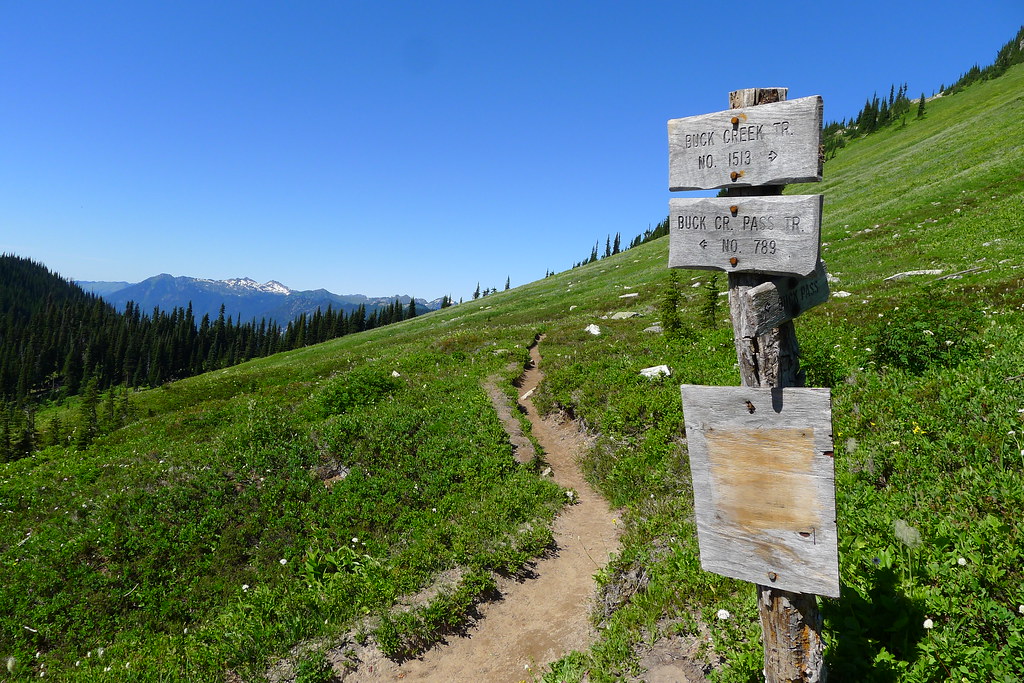
Buck Creek Pass
I rise at half past five to a clear dawn. Down comes the tarp, and I throw my things into the pack and walk slightly up the ridge on the north shore of the lake. As the sun rises, it sets fire to the summit and upper glaciers of the peak. I eat breakfast as the show progresses, and soon the whole of Glacier is red with the dawn. That’s my cue to leave. I pack up again, and retrace my steps east along the southern slope of Miners Ridge. There are plenty of deer out browsing, or perhaps they are just watching the sun rise.
At the bottom of the ridge I come to the end of my detour and once again gain the Pacific Crest Trail. There, the trail descends further to Miners Creek, re-entering thick old growth where the morning light has barely yet penetrated. After the creek is crossed, I leave the PCT and head south, aiming for Middle Ridge and Buck Creek Pass.
I spend the rest of the morning in the old growth forest. The trail begins to climb, soon opening up to expose the avalanche-scoured slopes of Middle Ridge. The shady trees are left behind just as the sun reaches its peak. Views of the aptly named Fortress Mountain dominate the route.
I stop for lunch at the top of Middle Ridge. The bugs, which have hitherto not been bothersome on this trip, encourage me to cut the break short. I descend once more, this time steeply into the valley of (not so) Small Creek. There is shade down here in the forest. I drop my pack again, this time for a more relaxing break.
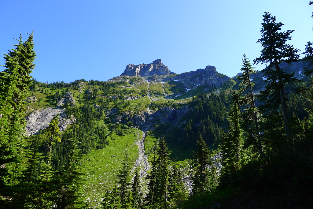
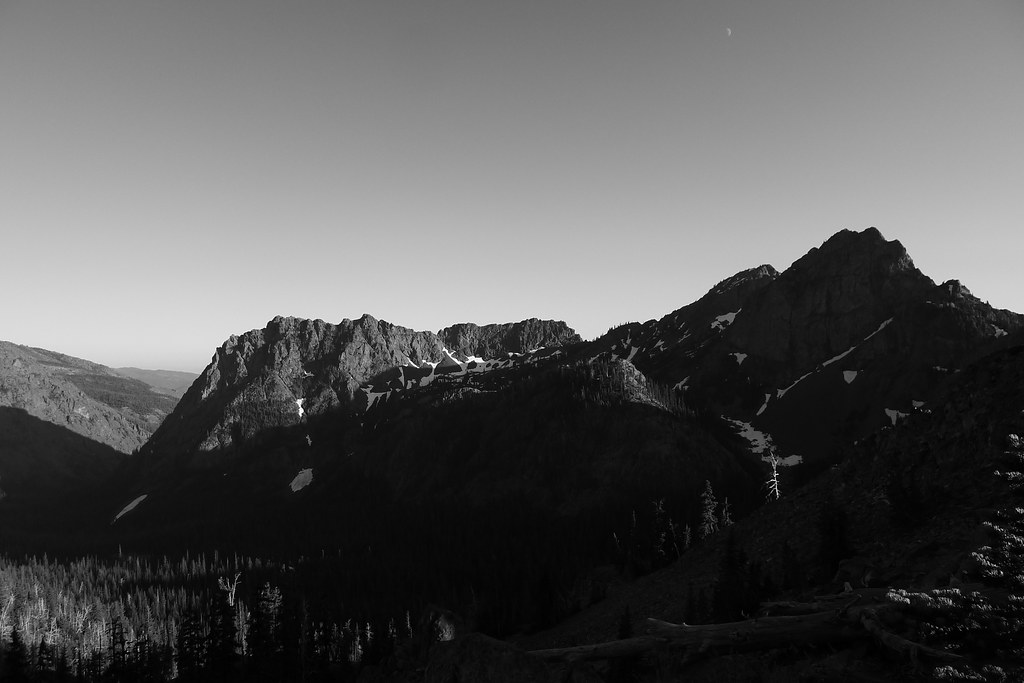
There is one more climb ahead of me: up steep, dusty slopes to Buck Creek Pass, the last high point of the loop. It’s a slog to get up there under the early afternoon sun, but, once gained, the pass offers close-up views of the eastern slopes of Glacier, rising steeply up from the deep Suaittle valley. Flower Dome, Helmet Butte and Liberty Cap surround the meadows here at the pass.
I see two groups camped at the pass, but it is early yet, and after yesterday’s short day I want a longer hike today. The trail leads down to Buck Creek. I follow, into the last valley.
The trail chooses a long and gradual way down to the valley bottom. It is the weekend now. I pass many people on the way up, likely looking to sleep at the pass. I think that it will get a bit crowded up there tonight, and I’m glad that I chose to come down to the cool and largely empty valley.
It’s late afternoon and I figure that I’ve come seventeen miles or so from Image Lake. Another four or five miles and I’ll be at the Buck Creek trailhead, which I don’t want to reach until tomorrow. Branching off the trail, I head close to Buck Creek and soon find a clearing large enough for my tarp. I decide on an early dinner, followed down with the last of the trail mix. Afterwards I entertain myself with a fire built up around the stove.
Trinity
The night is not as cold down in the valley as it was in the high country around Lyman and Image lakes, but it still gets down close to freezing. I wake early, shivering. The sun won’t reach down here for a few hours yet. Quickly, I complete the morning routine and regain the trail, looking to generate some heat with movement.
I’ve only been a couple hours on the trail when I reach the trailhead outside of the small town of Trinity (which looks to consist of three buildings). I’m not yet done with the loop – three miles remain, on dirt road, until I reach the Phelps Creek trailhead. I shed a few layers at the Buck Creek trailhead, which the sun has begun to warm, and meet a man preparing to take a mule train up to the pass. Then, it is the dusty road. An hour later I am back where I entered the Wilderness, satisfied in my experience of these mountains.
The secret of the mountains is that the mountains simply exist, as I do myself: the mountains exist simply, which I do not. The mountains have no “meaning,” they are meaning; the mountains are. The sun is round. I ring with life, and the mountains ring, and when I can hear it, there is a ringing that we share. I understand all this, not in my mind but in my heart, knowing how meaningless it is to try to capture what cannot be expressed, knowing that mere words will remain when I read it all again, another day.
These here is God’s finest scupturings! And there ain’t no laws for the brave ones! And there ain’t no asylums for the crazy ones! And there ain’t no churches, except for this right here! And there ain’t no priests excepting the birds. By God, I are a mountain man, and I’ll live ‘til an arrow or a bullet finds me. And then I’ll leave my bones on this great map of the magnificent…