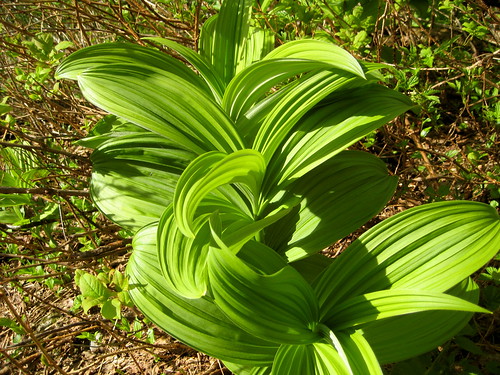
Indian hellebore is one of the most violently poisonous plants on the Northwest Coat, a fact recognized by all indigenous groups. This plant was, and still is, highly respected, for even to eat a small portion of it would result in loss of consciousness, followed by death. It is sometimes known as 'skookum' root, the Chinook jargon for 'strong, powerful.' This plant was an important and respected medicine, used by most northwest coast groups. The Tlingit used an Indian-hellebore medicine for colds. The Nisga'a used small quantities of the root for toothache. There is one report of a Haisla who was cured of tuberculosis by placing a lozenge of dried Indian-hellebore root under his tongue for a day. It is said that his face went numb, but he recovered. The Haida made a poultice for sprains, bruises, and rashes, and a medicine for colds. It was believed almost any disease could be cured with Indian hellebore. The Haida also treated kidney and bladder troubles and acute fevers with this plant. The Nuxalk made preparations for chronic coughs, gonorrhea, constipation, stomach pains, chest pains, heart trouble and for toothache or rotting teeth. The Kwakwak'wakw made medicinal preparations for constipation, internal back and chest pains, colds and to abort pregnancy. The Nuu-chah-nulth rubbed the mashed root on sores or rheumatic areas to stop pain, and as a general liniment. Among the Coast Salish this plant was utilized by the Quinalt, Squamish, Sechelt, Mainland Comox, Southern Vancouver Island Salish and other groups for similar cures.
Some species of this genus are powdered to form the garden insecticide 'hellebore.' People who drink water in which hellebore is growing have reported stomach cramps. Other symptoms of hellebore poisoning include frothing at the mouth, blurred vision, 'lockjaw,' vomiting and diarrhea.
- Jim Pojar, Plants of the Pacific Northwest Coast
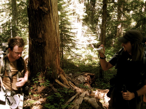
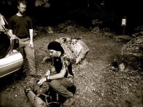
This past week, Kevin arrived in Seattle for the last leg of his America trip. I couldn’t let him come all the way from Scotland without seeing a few mountains, so we had planned a four day trip into the Glacier Peak Wilderness. Avagdu‘s schedule had recently opened up, allowing him to come up from California to join us. I had planned a loop of about 47 miles around the ridges just southwest of Glacier Peak.
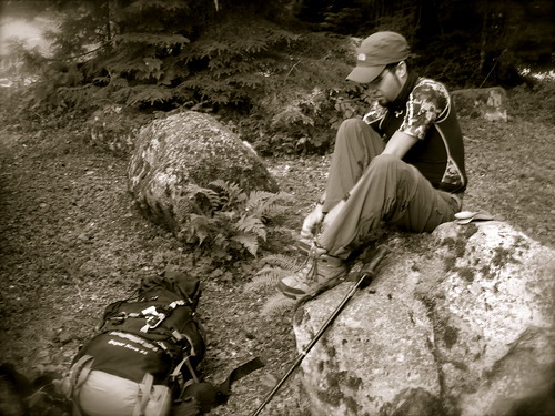
We arrived at the North Fork Sauk River trailhead late in the morning and, after quickly adjusting gear, hit the trail at 11:30 AM.
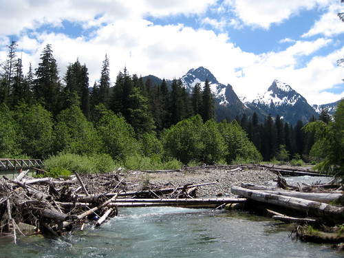
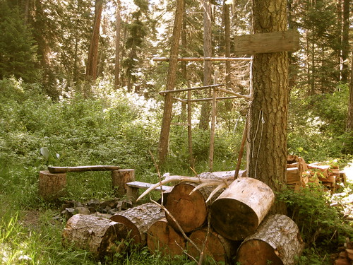
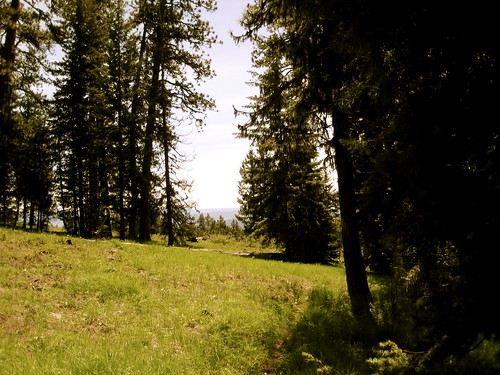
The trail paralleled the north fork of the Sauk and led into forests of old-growth cedar, with forest floor covered in Skunk Cabbage and Devil’s Club.
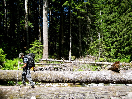
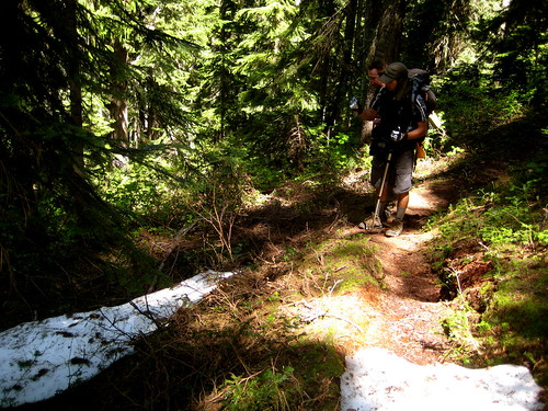
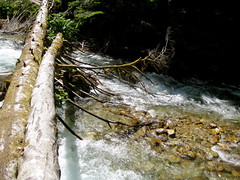
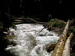
We quickly reached the junction with the Pilot Ridge trail, which heads south, cuts over the river, and begins to climb the ridge. Originally I had thought we would have to ford the river at this point, but there were a few logs laying across that allowed us to easily avoid getting wet.
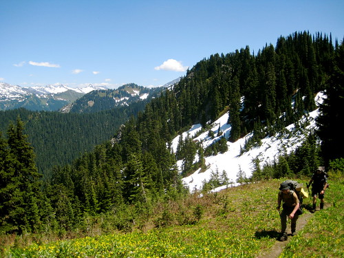
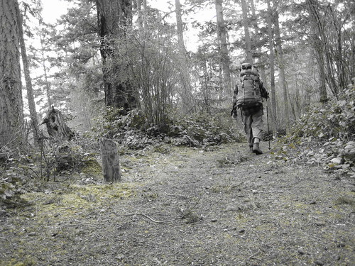
The trail up to Pilot Ridge gains about 3,000 feet in 2 miles. That qualifies as steep by most definitions. It’s times like that when all the physical training (particularly on Mailbox Peak) really pays off. I find that the easiest way to tackle a steep climb like that is to set a slow pace and keep on climbing with a minimal amount of rest stops – stopping and starting sucks a lot of energy. Kevin was able to keep up a pretty good pace for most of the steep part of the climb. Avagdu lagged behind a bit, but did much better than the last time we went on a hike. I wanted to keep both of them in sight, which meant extra work for me. I would walk with Kevin, then stop and stand around for a few minutes, waiting for Avagdu to catch up. After walking with Avagdu for a bit, I would cruise on ahead, catch up with Kevin, and walk with him for a time before stopping and waiting for Avagdu again.
Luckily the steepest section of switchbacks quickly led to a more gradual climb, so I didn’t have to maintain my inefficient pacing for too long. As the trail leveled off a bit, I would walk ahead and find the path so that the other two didn’t have to worry about navigating.
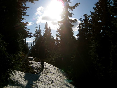
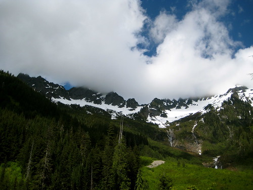
We hit our first small patches of snow at around 4,200 feet. Near 4,500 feet the patches became larger and began to obscure the trail. The snow slowed the pace of the others a little bit, which provided time for me to go ahead and find where the trail came out on the other side of the snow.
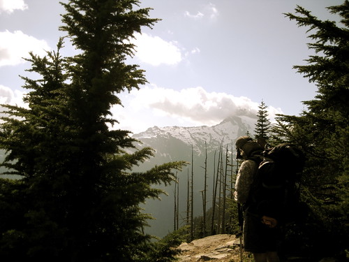
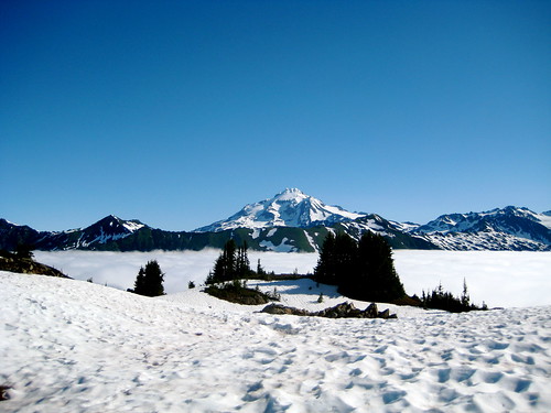
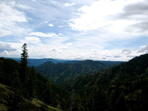
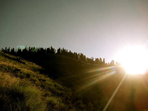
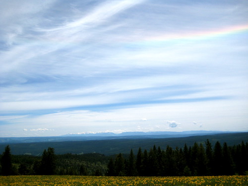
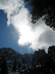
We came out of the trees at 5,100 feet and were greeted by views of Glacier Peak in the east, Sloan Peak in the west, and Mt. Rainer far away to the south. I could just make out the top of Mt. Baker sticking above the clouds in the north.
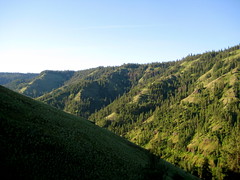
The snow fields became more constant at this point, so we donned gaiters before continuing further. When we did move on, the trail dropped a couple hundred feet down into the trees again for a short time before regaining the elevation and opening up to a beautiful alpine traverse of the ridge. At this point we were walking the wilderness boundary, with one foot in the Henry M. Jackson Wilderness and the other in the Glacier Peak Wilderness.
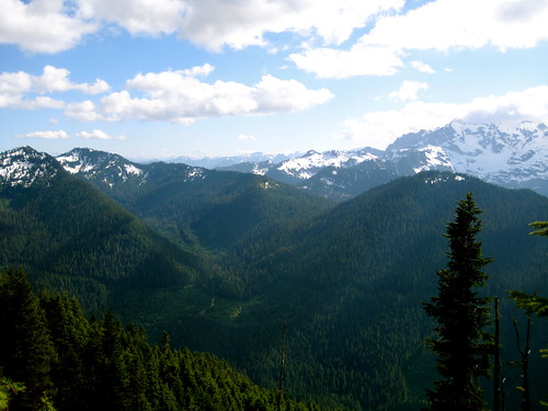
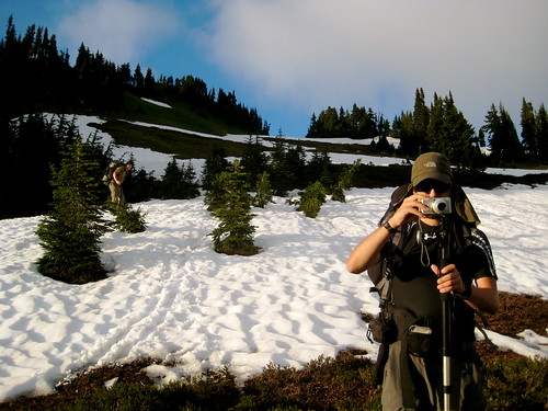
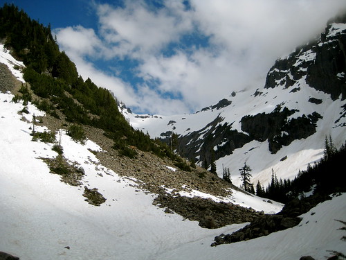
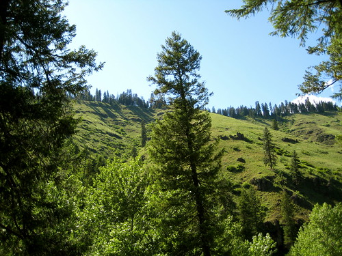
What was supposed to be open meadows filled with wildflowers atop the ridge turned out to still have significant snow fields on it. Many of these were too steep for us to safely walk directly across, so we would have to either go above or below them. Either way it was steep going.
When we would reach a large snow field, Kevin and Avagdu would wait on the trail while I went ahead and cruised above, below, or across it (or all three), searching for where the trail came out and the best route to the other side. It was nerve racking when we were unable to avoid the snow fields, as neither Kevin or Avagdu had much experience in that kind of mountain travel. I would go first and kick steps as they continued behind. I think it’s safe to say that they both now have more snow experience than the average recreational backpacker. They’re both well on their way to becoming certified mountain goats!
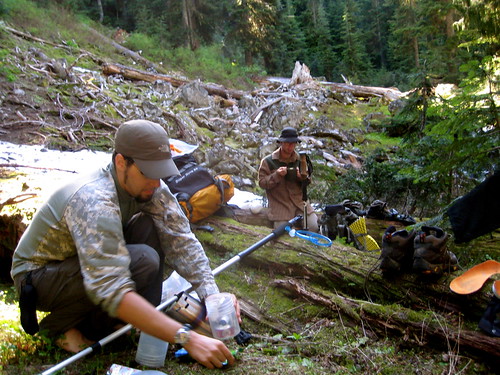
Our intended destination for the first day was Blue Lake. We had gotten a later start than I had planned and the steep climb mixed with snow had slowed our pace some. At 8:30 PM we were still about a mile and a half from the lake. There had been no running water since climbing the ridge, so all three of us were thirsty. As I climbed to the top of one snow field to scout out the route I noticed a few dry and flat spots at the top of the ridge. After glissading back down I put it to the others that we could continue to the lake, which at our pace and given the snow we wouldn’t reach till probably a little after dark, or we could spend a night on top the ridge. Water would be the issue on the ridge – it would take us some time and work to gather enough of the sparsely available wood to build a good fire and melt enough snow. They elected to spend the night on the ridge, which I thought was a good choice.
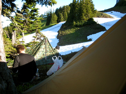
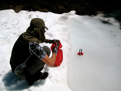
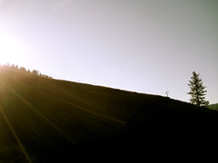
I had climbed back up and was waiting for the others when I heard a yell from behind. Turning around I saw a solitary fellow standing a couple hundred feet away. It was a surprise to see anyone else out here in this remote area – particularly since we were off the trail at this point – so I walked over to say hello. It turns out he was a local hunter who was up there to glass the slopes. He had his tent setup in a bare spot behind a clump of trees. When I told him our predicament he invited us to camp there with him. Kevin and Avagdu had made it up at this point, so we all introduced ourselves and prepared to make camp. When I mentioned that we were hoping to melt snow for water, the hunter said that just over on the other side of the ridge were a few small puddles of snow melt that he had used to fill his bottles. I left to go pump water for the three of us. With Avagdu’s Dromlite and my Platypus we had 8 liters, which was enough for that evening and the following morn.
When I returned Kevin and Avagdu had their tarps up and the hunter had a small fire going. I threw on a couple warmer layers of clothing and pitched my own shelter. Kevin quickly cooked a bit of dinner on his stove and went straight to bed. Avagdu and I stayed up a bit later eating dinner and chatting with the hunter. He knew the area pretty well and showed me on the map where I could find a few unmarked hunting trails. We also talked a bit about Kifaru packs and tarps, both of which he wanted for himself. He crawled into his tent to sleep and Avagdu and I retreated to our tarps soon thereafter.
I slept in a bit, waking around 7 AM to find Kevin and Avagdu both already awake and starting on breakfast. The hunter had been up early with his binoculars. He hadn’t seen much and was breaking his camp, preparing to head back down to the trailhead.
Temperatures that night probably dropped to a few degrees below freezing. I slept well in my cozy 20°F bag, but the others didn’t have so restful a night. Both had been cold, and the ground that Avagdu had pitched on turned out to have a slight angle so that he was slowly sliding off the mountain all night.
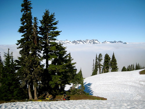
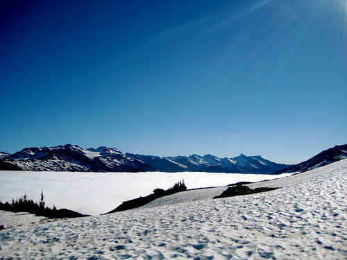
That morning there were clouds filling the valley on either side of the ridge. We were cut off from the world below, isolated in the mountains.
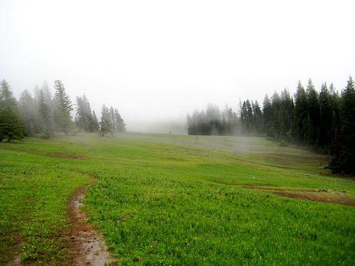
After breakfast we went down the slope to where we had left the trail the previous evening. As we did so the clouds moved in from the valley below, covering us in fog. I went ahead to scout out the route, but couldn’t see more than a hundred feet in any direction. We were in a white out. It wasn’t safe to travel, so we stopped where we were and had a sit, waiting for the clouds to burn off.
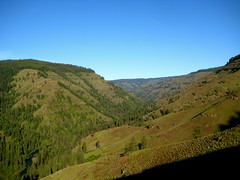
The clouds did burn off in about an hour and we once again had blue, sunny skies. We continued on much as the last day, doing our best to avoid dangerous snow fields, which inevitably meant steep going, both up and down.
We were coming to the end of the ridge. As I scouted ahead I was able to see a good deal of our future route. It looked like we would be able to get to the lake without much trouble, but past that the snow got worse. I would have continued on if I was by myself, but I felt responsible for the others and didn’t feel comfortable leading them on into even more difficult terrain. When I returned to where they were resting I told them that the original plan was out. I proposed that we could continue to the lake and spend a night there before turning around, or spend another night at the camp from last night, or head back down to the north fork of the Sauk and spend a night or two down there. They decided to turn around and head back to the river.
Since we knew that the next stretch would be dry, we first stopped by last night’s camp and filled up our water containers with the snow melt.
After snacking a bit, we headed out once more to retrace our route from yesterday. It was now near noon.
Heading back across the ridge was easier going than the previous day. I knew the land now and could lead them across a more efficient route. Plus, we were rested, and, going down hill, there were lots of opportunities for quick and fun glissading. Soon we were back in the trees.
We stopped for lunch at about 4 PM before heading onto the steep switchbacks that lead down to the bottom of the valley.
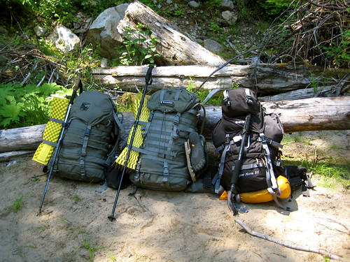
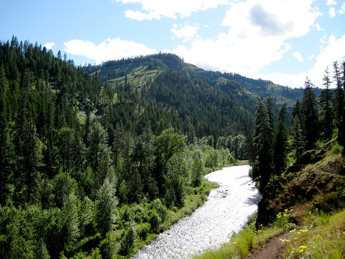
We reached the river around 7PM. Both Avagdu and Kevin had wet feet from traversing the snow, so I had collected a bunch of firewood on the way down and strapped it to my pack. After crossing the river we pitched our tarps and I went to go pump another 8 liters of water for us. We all processed the wood I had brought down and quickly had a bright fire burning. That night we all went to bed an hour or so after dark.
The next morning I woke around 6 AM and peeked out of my tarp to see if anybody had the fire going. No one was up. I continued to sleep a bit and look out every 30 minutes, until 8 AM rolled around and finally I decided that I better get up. There weren’t enough hot coals left in the fire to blow it back to life, so I started it again with a cotton ball. The others came over soon after I had thrown a few pieces of wood on the blaze.
That day we didn’t have any plans. Late in the morning I jumped in the river to rinse off the previous two days worth of sweat and sunblock. I couldn’t convince Kevin to get in, but Avagdu braved the water for a few seconds before declaring it too cold.
I collected a bunch more wood for the evening’s fire. Avagdu and I spent a while splitting it all down till we had a nice pile.
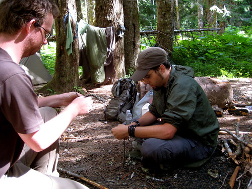
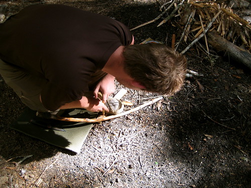
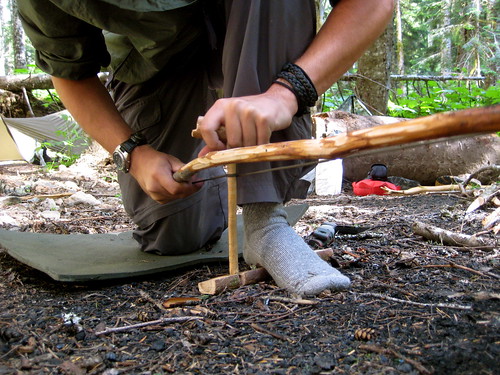
That afternoon Kevin taught Avagdu how to weave a paracord bracelet while I used some of the nearby cedar to throw together a quick bow drill for the other guys to play with.
Kevin got close to getting a coal a couple times.
Avagdu struggled a bit more.
Another night, another fire. Kevin went to bed a bit after dark. Avagdu and I stayed up another half hour or so, till the fire was burned down to glowing coals.
We left camp the next morning and made it back to the trailhead at 10 AM. I was refreshed and ready to brave the cities for a few more days.
Needs? I guess that is what bothers so many folks. They keep expanding their needs until they are dependent on too many things and too many other people. I don't understand economics, and I suppose the country would be in a real mess if people suddenly cut out a lot of things they don't need. I wonder how many things in the average American home could be eliminated if the question were asked, "Must I really have this?" I guess most of the extras are chalked up to comfort or saving time.
Funny thing about comfort -- one man's comfort is another man's misery. Most people don't work hard enough physically anymore, and comfort is not easy to find. It is surprising how comfortable a hard bunk can be after you come down off a mountain.
- Richard Proenneke, One Man's Wilderness
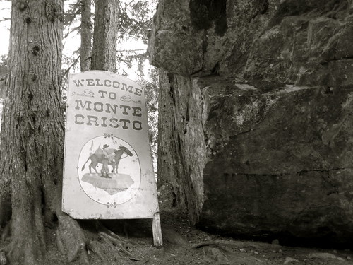
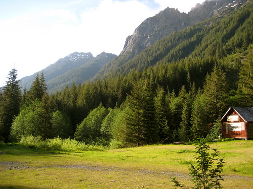
Yesterday I headed out to Monte Cristo for a quick night out. I was in this area last fall when I visited Gothic Basin, but had not continued all the way down the main trail to the town site.
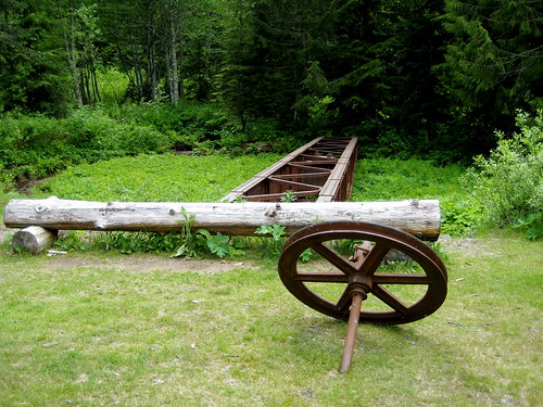
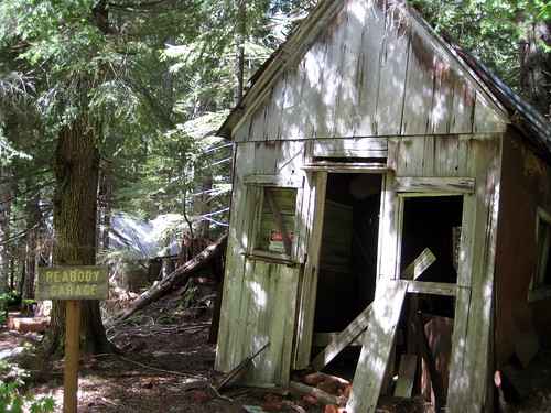
Monte Cristo is an old mining town that was founded in the 1890s and lasted until 1907. It’s now a ghost town, maintained by the Monte Cristo Preservation Association. The trail into town is an easy hike along the old railroad grade. Most of the buildings in the town itself have burned down or were long ago dismantled, leaving only a few remnants. More interesting than the buildings are the metal artifacts strewn about the site.
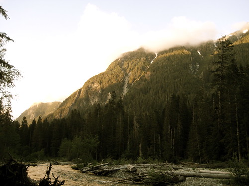
From Monte Cristo, my plan was to head up to Glacier Basin in the Henry M. Jackson Wilderness (just the other side of Cadet Peak from Goat Lake) and see what the snow was doing. The hike up to the basin goes uphill alongside a waterfall that carries away the melting snow, as well as melt from Columbia Glacier.
The whole drainage, including the trail, had been hit by at least one major avalanche somewhat recently, leaving lots of debris and snapped trees for me to climb over. The hike was hot, but enjoyable. I encountered no snow until just before the basin at 4,500 feet. Before venturing further, I stopped to put on my gaiters, take out my other trekking pole and put the snow baskets on both. I almost always forget to pack the snow baskets for my poles, so I was excited to have remembered them this time around. Heading on into the snow, my pace slowed. It was now late afternoon – just about the worst time to attempt to traverse a snow field on an inclined slope. The sun had been beating down on the snow all day, making it soft and prone to slipping. I managed not to fall off any mountains, but, due to my lack of snowshoes, did posthole up to my crotch two different times. Soon enough I made it to a scree field just inside the basin.
My original plan had been to spend the night up here, but it didn’t look very promising. I dropped my pack in order to be a little lighter on my feet and took off to survey the basin. Most of it was still covered in the same deep, wet snow that I struggled through at the entrance. I didn’t fancy sleeping on this. The areas that were melted were rocky and devoid of any flat spaces. I imagine it will be mostly cleared up in another couple weeks, but for now I decided to turn around and spend the night at a lower elevation.
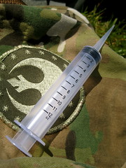
I managed not to sink or slip on the snow field on the way out. Retracing my steps, I made my way back down along the waterfall. The avalanche had exposed a lot of smooth rock that, wet with snow melt, made for slippery going. Near the bottom I slipped and slid down about ten feet on my side, slicing open my left knee. It was a 3” long incision across the front of the patella, but not very deep. I continued on the trail for a bit, letting it bleed. As long as it’s not a gusher, letting wounds ooze a little blood helps to clean them out.
Five minutes further down I found a nice rock sit on. I dropped my pack, grabbed the first aid kit, and pulled out my syringe. It took just under a liter of water to fully clean the cut. I had noticed a patch of yarrow further up the trail, but there didn’t seem to be any around my rock. Instead, there was a large hemlock tree that must have been knocked down by the recent avalanche. It still looked green and alive. When I punctured it with my knife, it oozed sap. I used this to cover the cut. The sap is antiseptic and forms a barrier to keep dirt or anything else from the wound. Plus, it smells good! After the sap had dried, I bandaged it and carried on down the trail, arriving back at Monte Cristo at 7PM. I had dinner in the town and took advantage of the long summer evening to scout out an agreeable place to sleep in the surrounding forest.
The following morning I breakfasted and started to head back to the trailhead. On the way out I decided to make a short detour up to Gothic Basin. As with neighboring Glacier Basin the climb was mostly clear, but I hit deep snow just at the entrance. After looking around a bit I climbed back down and finished the walk back to the road, arriving at the trailhead late that morning.
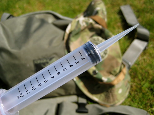
If I could only carry one first aid specific item in the wilderness, it would be an irrigation syringe.
There’s a lot that can be done with bandannas, duct tape, and paracord. A multitool, spare clothing, sleeping pad, tarp, poles – pretty much everything in a pack, including the pack itself, can be fashioned into some kind of medical implement with a little ingenuity. But cleaning a wound will always remain difficult. It also remains extremely important. Infection is both very common and very inconvenient in the wilderness, where you’re well away from definitive care.
Clean water should always available and irrigation is a simple and effective method of cleaning a wound. But water just poured over a wound won’t do much good. Pressure is needed. Occasionally you might hear people claim that you can fill up a ziploc bag with water, cut or poke a hole in one corner, and squeeze the bag to force out a stream of water. That’s certainly better than nothing, but in my experience the pressure from that is not comparable to the pressure from a syringe. With an irrigation syringe, you can take the cleanest water available (usually your drinking water) and shoot it into the wound. Pressure washing the wound like this allows you to easily clean out all the grit and dirt. There’s no need to go poking around in there with unsanitary tools, probably causing more harm than good. A 12cc syringe like the one I carry costs $1, weighs 8 grams (0.28 oz), and takes up very little room. I can’t think of a reason not to have one in your pack!
Remember: a clean wound is a happy wound. You can put all the effort you want into the perfect bandage, but if the wound isn’t clean, you’re going to have some problems down the line.
I arrived at the Panjab trailhead in the Tucannon canyon at around 3PM on Saturday. The plan for the day was to take a short walk and spend the night at Dunlap Spring, a distance of about 6 miles. The Panjab trail proved uneventful, with no interesting sightings. I reached the meadow above the spring at 6PM and was happy to see it free of snow. The meadow sits at 5,700 feet (around 2,500 feet higher than the trailhead) which was not the highest elevation I would be reaching during the loop, but close. It seemed a safe bet that I wouldn’t be post holing the whole trip, which is always good news.
As I walked down the meadow toward the spring, I ran into my first local. A black bear with a nice brown coat was having his supper about a hundred feet away. He had his butt toward me and his head down. I yelled a greeting. He didn’t budge. Not exactly the response I was hoping for. I yelled a bit more and he looked around but was either blind or uninterested in the biped waving frantically at him. After a minute, though, the wind shifted direction and brought my scent to him. He turned his head to look right at me, then ran off into the trees. Thanking him, I went on my way.
I found the spring without any trouble and filled up my water bladder. After pitching my tarp in a nice spot in the trees a little ways away, I started to think about dinner. The sky was clear that evening and there was a spot up on the meadow that would provide a nice seat to watch the sun as it set into the West. I grabbed my food, stove, and water and headed on up. Along the way I grabbed a few small sticks and twigs to fuel the stove. After dinner and the show I headed back down into the trees and climbed into bed at 9:30PM.
Sunday morning I awoke to a light sprinkle. No matter. I thought it’d be good to get a few miles under my belt before breakfast. I got out of bed and topped off my water at the spring. Just as I was about to start breaking down my small camp, the rain really started coming down. Maybe breakfast later on down the trail wasn’t such a good idea. It seemed like a better option to crawl back under the tarp and do a little breakfast from bed.
That proved a good choice. Just as I was finishing my noodles the rain stopped. I took advantage of the lull to quickly break camp and get on my way. Most of the day’s walk was along high meadows that should have provided good views to either side, but everything was covered in cloud and I was unable to see more than a hundred feet or so in any direction for all the mist.
Occasional small breaks in the cloud provided a hint of the country I was traveling through and I did manage to spot a herd of seven elk having breakfast further down the meadow.
The trail was gaining elevation and started to enter a few trees. Snow covered the ground. It was only a few inches deep and pretty crusty so I didn’t sink in, but it obscured the trail. I was looking around trying to decide where the trail might have gone when I spotted a pair of really big bear tracks. “Aha,” I thought. “Those are heading in the right direction. I’ll follow them.” The tracks led on through the trees and I followed (hoping not to meet the fellow who left the tracks). Eventually the tracks led out of the trees and deposited me on the trail at exactly where I wanted to be: the aptly named Bear Wallow Spring.
From then on whenever I lost the trail in the snow I would just follow the tracks of bear or elk. They always seem to know where they’re going and tend to take the most efficient route to get there.
The trail continued east along the ridge, with a steep drop-off on the south side. At its highest point it got to around 6,200 feet, but there still was no more than a few inches of snow. The trail passed Squaw Spring, which was a disgusting mess of a hunter’s camp, and Sheephead Spring before finally reaching the high point at Diamond Spring. From that point my route turned south as I began a long, slow descent down into the canyon toward Oregon. I had been in fog all day and just as I started to descend the canyon I heard thunder off in the west. Whoops! That high open ridge was about the last place I wanted to be. I picked up the pace a bit and started to loose elevation. Safely back in the trees I spooked another elk, grazing all by his lonesome.
As I slowly (very slowly) lost elevation I began to get underneath the clouds and started to see a bit more of the country. Lots of canyons all around, and somewhere down there to the south the Wenaha River. Oregon Trail country. (Briefly, I relived childhood fears of dying of dysentery.)
At one point I misplaced my foot and starting to slide down the slope to my right. Throwing out my left hand I was able to stop myself but scraped up the palm of my hand in the process. Right where I fell was a patch of yarrow, which I grabbed and put on my palm as a poultice. After walking for another half hour or so I found a good spot to stop and properly clean and bandage the wound.
Continuing on, the trail finally finished its descent into the canyon and met up with Melton Creek. At 7PM I stopped to cook up dinner. The local ants were apparently of the mind that my meal was lacking in protein: a few of them crawled into the pot and ended up in my tummy. As I was eating dinner I spotted movement on the opposite side of the canyon. At first I thought it was an elk, but it turned out to be another black bear, this time with a light brown coat of fur around the body and dark fur around the neck and head. Just like an elk! Neat.
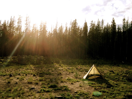
Another few miles down the trail and I finally arrived at the confluence of Melton Creek and Crooked Creek, where I intended to camp. After filling up my water supply and cleaning the pot from dinner, I pitched my tarp and crawled right in. It was a little after 9PM. I had walked around 17 miles that day.
Monday morning it was raining. It was to be a short day – I had only about 7 miles to go – so I decided I would wait it out. The rain fell for a good while as I killed time in the tarp.
Finally it stopped and I got out of bed, hitting the trail near 11AM. Just a few steps down the trail I had my first water crossing of the trip. I had to get to the other side of Melton Creek just north of where it joins with Crooked Creek. The water was cold, but only about knee deep. Another mile down the trail was another crossing, so I just left my sandals on and my shoes hanging around my neck.
When I got to it, First Creek proved to be a bit deeper and very fast moving. Had I slipped and fallen in Melton Creek I would have been cold and wet and might have come out with a bruised bum or stubbed toe, but it looked like if I was to fall here in First Creek I could actually get swept down it a ways.
The creek was waist deep. I made it across with no more trouble than frozen privates – which was trouble enough – but the creek also proved to be the boundary between winter and summer. Just as I got to the other side the sun popped out and the temperatures were soon in the mid-70F degrees. A bit downstream from the crossing was an old cabin and horse corral. I headed over there to cook up a brunch and dry out in the sun.
Back on the trail, the bush got really thick as I headed south down the side of Crooked Creek. I might as well have been bushwhacking, but the sun was out and there wasn’t a cloud in the sky so it didn’t much matter. A mile or so down the “trail” I ran into a mule train. They had just packed in an SCA crew down at the Oregon border who would be spending the summer working on this trail. Good luck! In a couple weeks it’ll be getting way to hot for me down in that canyon, but I’m glad that somebody will be working the trail. The guy at the head of the mule train seemed impressed when I told him my route – more so because I was solo. “That’s quite a walk!” he said. Before I had gotten on the trail, I was in the town of Pomeroy where I ran into a couple locals. They described the Wilderness as “bumfuck nowhere” and tried to discourage me from going in by myself. Apparently people who live in the region don’t venture into the Wenaha-Tucannon very often. Seems strange to me.
Soon after passing the mules I reached the Oregon border. Just off in the trees I found the trail crew having lunch. I headed over to say hello and swap stories about the SCA. Since this was their very first day, they were all still looking pretty neat and clean. One of the girls even had makeup on! I imagine they’ll look a bit different come August. Anyway, I wished them good luck and continued on my way, soon reaching the point where Melton Creek drains into the Wenaha River. Here, my route turned west and headed upstream along the river.
The Wenaha River and its canyon really are beautiful. It’s not the sort of area I associate with the Northwest, instead seeming like it belongs somewhere in Montana. At this point the day had warmed up till it was somewhere around 80F which seemed to please the two rattlesnakes I found hanging out in the middle of the trail.
I reached Fairview Bar just after 5PM and, after dropping my pack, stripped down and jumped in the river. It wasn’t any warmer than the ball-freezing First Creek, but was refreshing after the hot hike. After getting out of the Wenaha I threw up the tarp and collected water while drying off in the sun. I dressed as the sun began to sink below the canyon wall. Then, laying my pad out on the ground, I had a good sit. It lasted about 3 hours. During that time I cooked up dinner and paid a little attention to my feet, which were hurting due to the new footwear I was trying out.
While I was digging in my food bag for dinner I came across the chocolate bar I packed. I always like to pack a bar of chocolate in the cooler months when it won’t melt. Emergency Chocolate, I call it. Not only is it tasty and mentally comforting, but it provides a great energy boost and can be helpful in warding off hypothermia. When I pulled it out of the bag it was still firm, but I said to myself “Self, look at this here chocolate bar. With warm temperatures like today, it’s going to melt in no time! We better eat it before that happens.” To which I replied “I like the way you think, Self” and proceeded to eat the whole thing.
The next day I woke determined not to lounge around in bed that morning, but to get an early start on the day. I had a long and steep climb north out of the canyon ahead of me and wanted to get most of it done before the sun started beating down. Quickly breaking camp, I threw on my pack and started heading uphill just past 6AM. Sunrise in the Wenaha is a wonderful time. Undoubtedly, that leg of the trip had the best scenery.
Around 7:30AM I reached the trees and stopped to cook breakfast at the base of an old pine. I spotted two ospreys flying over head.
After that, my hike was through forest. Soon I was back in Washington. I lost the trail a couple times and stumbled upon another hunting camp, but found my way up out of the trees without much trouble.
There are some great grassy ridges up there around Moore Flat and Smooth Ridge that demand one to at least have a sit on them, if not take a nap. I did a bit of both.
Soon I reached the top of Weller Butte and the highest point of elevation for the day. Lodgepole Spring, where I planned to spend the night, was just another few miles north of that.
Lodgepole Spring was a bit disappointing when I got there. It was fairly muddy and finding a good spot to put the tarp was difficult. Despite the day’s perfect weather, some clouds had started to move in and it was looking like rain. Eventually I found a spot a bit above the spring that was sort of flat and had a few trees around it to help protect from any wind. Most of an Elk skeleton lay beside it.
The wind did pick up and got pretty strong that night. I was cozy inside my tarp, but I had pitched the front left side a little sloppily which meant that it was making a lot of noise as the slack got blown back and forth in the wind. It woke me a couple times, but I was too comfy inside my bag to get up and do anything about it.
The next morning was rainy and windy. Still, I didn’t want to hang out in the tarp all morning. I broke camp, filled up on water at the spring, and headed on my way. Around 10AM the sky cleared up and the sun came out for another fine summer day.
As I headed north, I was gaining elevation. I went along the narrow ridge along Danger Point and a bit further on reached Oregon Butte – at 6387 feet, the highest point in the Wilderness area. Just north of Oregon Butte I reentered the snow and lost the trail. There was a confusing intersection with three or four trails heading off in different directions at that point and I wanted to make sure I got on the right one. I spent 20 minutes looking around for the correct trail – or even an area where the trail might be likely to go – but couldn’t find anything. Finally I gave up and just started heading cross country via map and compass along the route that the trail should have gone. About a mile further I had lost enough elevation for the snow to disappear and I found the trail again. I was only off by about 10 feet in my route calculations.
Just after noon the sky started to fill up with clouds again and darken. “More rain!” I thought. Then I heard a rumble. And another. And another. The storm was just northwest of me and heading in my direction. Once again I was up on top of an exposed ridge, the highest thing all around. I dropped off the trail and heading down to the tree line. Picking up my pace a bit, I paralleled the trail and kept my eyes open to see what would happen. I hadn’t seen any lightning yet, but the thunder was getting nasty.
Originally my plan had been to spend the night at Dunlap Spring again and then head out back to the trailhead the next morning. If the storm kept up though, I didn’t want to spend the night that high. I reached the meadow above the spring at 3PM. Just as I came out of the trees it started to hail. The thunder sounded like it was right on top of me at this point and I saw a flash or two of lightning. I decided I needed to get down. I started to half walk, half run toward the Panjab Trail that heads down into the trees toward the trailhead. Just before I reached the meadow I encountered another bear. This one was about 50 feet away, oblivious to my presence. I yelled at him. He didn’t budge. I was anxious to get down, but this guy was standing right where I wanted to go. Yelling at him again, he looked up at me and shook his coat, throwing water all over. “Yeah,” I yelled “it sure is wet up here, isn’t it? I bet it would be nice and dry in those trees down there! Wink wink nudge nudge.” Apparently bears don’t understand winks because he didn’t take my hints. He just kept doing what he was doing. More yelling and waving my arms around finally got him to look at me again. He cocked his head as if to express his displeasure at this disruption of his schedule and slowly turned around and waddled off into the trees.
I reached the trees myself soon thereafter. Just as I left the meadow the hail stopped and the storm passed on further east. The clouds hung around and only allowed a few sun breaks the rest of the afternoon, but I was able to dry out. I continued down the trail to just a bit northeast of the trailhead and found a good spot to camp for the night. That evening the sky cleared and I was allowed a view of the awe-some golden sunset in the Tucannon Canyon.
Beyond a critical point within a finite space, freedom diminishes as numbers increase. This is as true of humans in the finite space of a planetary ecosystem as it is of gas molecules in a sealed flask. The human question is now how many can possibly survive within the system, but what kind of existence is possible for those who do survive.
- Frank Herbert, Dune
Sealed in their metallic shells like molluscs on wheels, how can I pry the people free? The auto as tin can, the park ranger as opener. Look here, I want to say, for godsake folks get out of them there machines, take off those fucking sunglasses and unpeel both eyeballs, look around; throw away those god-damned idiotic cameras! For chrissake folks what is this life if full of care we have no time to stand and stare? eh? Take off your shoes for a while, unzip your fly, piss hearty, dig your toes in the hot sand, feel that raw and rugged earth, split a couple of big toenails, draw blood! Why not? Jesus Christ, lady, roll that window down! You can't see the desert if you can't smell it. Dusty? Of course it's dusty -- this is Utah! But it's good dust, good red Utahn dust, rich in iron, rich in irony. Turn that motor off. Get out of that piece of iron and stretch your varicose veins, take off your brassiere and get some hot sun on your old wrinkled dugs! You sir, squinting at the map with your radiator boiling over and your fuel pump vapor-locked, crawl out of that shiny hunk of GM junk and take a walk -- yes, leave the old lady and those squawling brats behind for a while, turn your back on them and take a long quiet walk straight into the canyons, get lost for a while, come back when you damn well fell like it, it'll do you and her and them a world of good. Give the kids a break too, let them out of the car, let them go scrambling over the rocks hunting for rattlesnakes and scorpions and anthills -- yes sir, let them out, turn them loose; how dare you imprison little children in your goddamned upholstered horseless hearse? Yes sir, yes madam, I entreat you, get out of those motorized wheelchairs , get off your foam rubber backsides, stand up straight like men! like women! like human beings! and walk -- walk -- WALK upon our sweet and blessed land!
-Edward Abbey, Desert Solitaire
I was up around Lake Twenty Two yesterday, further exploring the area and testing small changes to my gear load out. I was surprised at the amount of snow I encountered. There was a good foot of it around the lake, whereas at the end of January there was only a dusting. Winter and Spring seem to have gotten themselves confused.