Further Explorations in the Buckhorn Wilderness
Last week I planned a loop through (and around) the Buckhorn Wilderness of Olympic National Forest. My previous visit had only provided a glimpse of the many mountains and valleys, all of which demanded further exploration. The loop was about 30 miles, which I thought I’d split into 3 or 4 leisurely days, allowing time for side trips and naps.
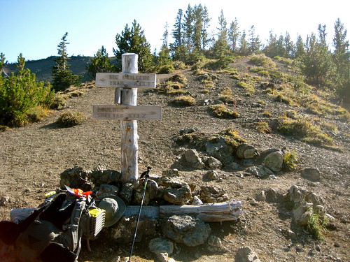
I entered the forest at the same trail head as before and climbed the same trail up to Marmot Pass.
I had arrived at the trail head later than intended, so it was already late-afternoon by the time I had made the climb to the top. My intended camp for the night, Home Lake, was another 5 miles (and 1,000 feet down, then 1,000 feet up) away, which I thought I could still easily make before dusk.
A couple miles down from the pass, I arrived at an area marked on the map as Boulder Camp: an open field with a stream running through it. I thought it would make a fine camp, but I had heard that Home Lake was a popular backcountry destination, and I wanted to see why.
As I continued down the trail, I thought about which of my meals I would fix up for dinner that night, and enjoyed the scenery of the forest. I was startled out of my serenity by a sign on the side of the trail informing me that I was entering Olympic National Park. Oops. Apparently I had not studied my map closely enough while planning the trip. I had no intention of leaving the National Forest, and certainly had not meant to cross the Park boundary. Without a permit from the National Park Service, it would be illegal for me to spend the night at Home Lake. Oh well, I thought. On the off chance that I met anyone official along the trail, I’ll just pull out the “I-used-to-do-backcountry-trail-patrol-for-the-NPS-too!” trick out of my hat and play on their sense of camaraderie.
As it turned out, I encountered no person along the trail that day and arrived at the Lake just as the sun set behind the westerly peaks. With the sky lit up red, I put on my long underwear and jacket and enjoyed a meal to end the fine day. The sky looked clear, with small chance of rain, so I left my tarp in my pack. A sleeping pad and bag in a clearing above the lake would be my home for the night. After hanging my food in a stand of trees beyond the camp, I settled into the bag and fell asleep watching the stars slowly pass by overhead. I was awoken once that night to the sound of rocks falling down the flank of neighboring Mount Constance. Satisfied to have been witness to the changing of the Earth, I slept once more.
Waking with the sun, I quickly broke my small camp and started on the trail back to Boulder Camp, from where I would take another trail that would continue my loop. Halfway back, I stopped at a waterfall for water and a small breakfast. Mid-morning found me back at Boulder Camp.
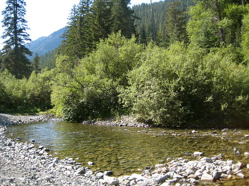
The rest of the morning was consumed by walking along the trail down into the valley carved by the upper reaches of the Dungeness River. Shortly after noon I arrived at a fine spot along the river with a rocky beach and an open field beyond. With no other demands on my time, I cooled my feet in river, fixed a lunch, and napped under the bright sun.
I had no planned campsite that night, intending instead to simply stop wherever I happened to be when the sun set. The rest of the day’s walk was easy going, not gaining or losing much elevation, along a trail and, at the end, a bit of an old Forest Service road. At the end of the dirt road I picked up the trail that would complete the loop. Soon thereafter I came upon a clearing and a shelter on the side of the trail.
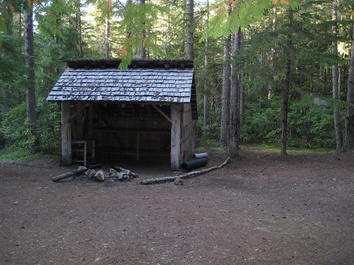
The day was close to its end. I decided to camp near the shelter for the night. As the sun set, the sky slowly filled up with clouds, hinting at the possibility of rain that night. I decided I would place my pad and bag in front of the shelter, so as to enjoy once again what stars shone through the breaks in the clouds, but have a retreat close by in case rain did fall.
Sleep found me quickly once again that night, and I snoozed comfortably until the pleasant pitter-patter of water entered my dreams. Some conscious part of my brain recognized the sound as rain and waged a difficult battle to wake up the rest of my body enough to quickly move my bedroll under the shelter’s roof. Afterward, I slept soundly again until morning. Fog had filled up the valley overnight, blocking the sun’s wakeful rays and encouraging me to sleep well into the morning. Eventually I woke and completed the morning rituals of gathering water, retrieving my food bag, and cooking a breakfast.
On the trail again, I walked through the mist shrouded valley, wondering if the previous day had been the year’s last day of summer weather.
The day’s walk along the last part of the loop should have been a simple affair. It was on a trail, requiring no effort of navigation of my part, and close enough to the area around Buckhorn Mountain that I had scouted last time that I thought I could probably find my way without trail or much use of map or compass if I had to.
Around noon on that third day, I arrived at a fork in the trail. From looking at the map, I had expected a fork, but not for another mile or two. No matter, I thought, I have probably just been walking a bit faster than I thought. I took the right fork, which should have continued along the main trail back to Marmot Pass. The fork went slightly uphill for about a hundred feet and immediately entered a clearing in the trees. Trails, being rather fickle by nature, are often hard to mark when going from dense woods into a wide clearing. This right fork disappeared immediately on the boundary. I walked the perimeter of the clearing, thinking that I would pick up the trail again on the other side. To my surprise, I did not find what looked to be the main trail, but half a dozen smaller trails going off every which way instead. I explored them all and discovered that they had a disturbing habit of petering out into nothing very shortly after leaving the clearing. Deciding then that this right fork of the trail must not be the fork marked on my map, I backtracked to the junction and took the left fork. This trail also disappeared shortly after the junction, compounding my confusion.
I saw the sun poking through the fog and clouds a bit and decided to head back to the clearing down the right fork so as to enjoy the warmth and see if I could discover where I was. Setting my pack down beside a rock, I dug out my GPS, turned it on, and set it aside to acquire a satellite signal. Then I took the map out of my pocket and, judging from my gut feeling of my pace and length of time on the move, reckoned roughly where I thought I should be. Pulling out my compass, I attempted to get a bearing and corroborate the opinion of my location. The compass agreed with me, but, even though I was in a clearing, I was still down in the middle of a deep valley stuffed full of old growth forest and so had a difficult time getting an accurate bearing on any landmark with my compass. Still, at the very least I was comfortable of knowing that I was somewhere in a 100 meter box on the map. The GPS had acquired its signal by this time and was displaying my coordinates. I never put much faith in the device and generally refrain from using it for navigation as it has proved at times to be wildly inaccurate, but the coordinates it displayed agreed with my previous findings. Everything pointed to myself being where I was supposed to be. I was found, but the trail was most definitely lost.
Neither the right nor left fork of the trail had any evidence of continuing after the junction. The right fork had a small creek running along its western side, which matched the map, but the left fork also had a small creek, this one along its eastern edge, that was not supposed to exist. The creek along the right fork looked slightly larger. I reasoned that the left fork’s creek might be a new comer in the area and so not represented on my map. I knew that the trail that I was supposed to be following should follow a creek up to a lake. It seemed likely that this creek along the right fork of the trail was most likely the one that drained the lake. I thought I would try to follow it to the lake, from where the main trail should once again become obvious.
This planned proved well for the first hundred feet or so, but I was soon defeated by the valley. Increasingly dense plant life crowded around the stream, with frequent boulders and massive downed trees blocked my way. Without the large pack on my back, I might have attempted to continue, but, as it was, I did not think that attempting to climb, crawl, and push my way along the creek was a realistic or overly wise notion.
Accepting defeat, I sat down, pulled out the map once more, and considered my options. I knew that I could backtrack the entire loop, retracing my footsteps of the whole trip and come out that way. Another two days to do that, I figured. I had enough food to complete that with no lack of comfort, but the option did not appeal to me.
I also knew that I could make my way back down to the Forest Service road that I had used to make up part of the loop, and make my way out to the highway. But I had no guarantee that there would be anyone at all on this road to give me a lift and I judged that the road took about 45 miles to wind its way out of the forest. A worse option than the previous, this did not appeal to me either.
I was still not entirely convinced that this fork in the trail that was troubling me was not the same fork marked on the map. Looking at the map, I saw that after the split, the right fork made a couple rather wide switchbacks up to the top of the western ridge. Judging from where I thought I was, I reasoned that I could simply walk straight west up the slope and intersect the main trail. It was a steep climb, and proved my plan easier said than done.
A third of the way up, I decided to drop my pack and continue up less encumbered. The thick forest had ended up here, giving way to tall grasses and rocks, which made the going easier, but also completely hid my pack from view after I set it on the ground. I walked up a little higher, turned around, and did my best to make a mental picture of the area, hoping that I could find my way back to my pack on the way down.
Continuing up the slope (much faster than before) I resumed my search, but was discouraged when I failed to find the main trail. I thought I had gone far enough, but decided to travel up just a little bit further to make sure that I did not miss it. Slightly higher, I found a narrow channel cut through the grass. It looked like something made by the local goats. I was sure that it could not be the trail that I was looking for, but it ran in roughly the direction that I wished to go and was surely the path of least resistance. Deciding that I would see where it led, I went back down the slope to get my pack (which I found with little trouble). Then, back up again to the goat trail.
The small path continued to travel in the correct direction and was much easier than walking through the thick valley below. My spirits began to improve, but I was dismayed once more when the path split. Another fork! One path continued on, roughly in the same direction, while the other went up steeply and shortly disappeared from view. I had no idea which to take, but chose to climb the higher one. I would see where that one went, I thought, and, from up there, ought to be able to see where the lower path went as well. The decision proved well. After climbing the higher fork only a short distance, I saw above me what could only be the main trail. Wide, well maintained, and even defined on the edges by an old log here and there. I hurried onto the trail and continued on my way. In all, I had only been misplaced for about 2 hours.
The main trail climbed high to the top of ridges, well above tree line, where the ground was covered only by rocks and the occasional hardy moss and lichens. In this sort of terrain, it’s difficult to mark out a trail, and I ended up losing it now and again. This didn’t worry me. Unlike when I lost the trail down in the valley, up here I was able to see where I was going and easily make my way along my own path.
Giving up on the trail, which became only more and more faint as I went on, I marked what looked to be Marmot Pass and made my way towards it. The distance was not great, but it was steep. For some nonsensical reason, whenever I make my way cross country, I always choose a line as straight as possible, avoiding any switchbacks. It makes for a shorter overall distance, but a much more difficult climb. I did not much mind, as the views of the alpine environment made up for the difficulty of the hike.
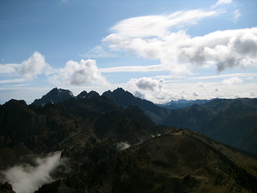
Below me, I could see to one side the fog over the Dungeness River valley that I had walked in the day before. On the other side, I could look back and see clouds over the valley that I had lost my way in.
Climbing ever higher, I finally reached what I had thought would be the pass and my way out. I looked around and muttered to myself that this looked suspiciously like Buckhorn Mountain. In fact, I decided, it was Buckhorn Moutain. I had no intention of coming up here this trip and so had climbed a good thousand feet higher than I needed to. Oops. I looked down to the pass, and, with a sigh, began my descent.
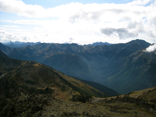
Below me, I could see that the way down to the trail head, along with most the rest of the region, was covered by cloud. I marched on and, despite the day’s misadventures, found the end of the trail just before the sun began to set on the third day.