A Week in the Wenaha-Tucannon Wilderness
The Wenaha-Tucannon Wilderness in the Umatilla National Forest is a remote section of the Blue Mountains located in southeastern Washington and northeastern Oregon. This past week I did a loop of about 60 miles in the Wilderness.
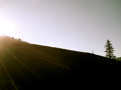
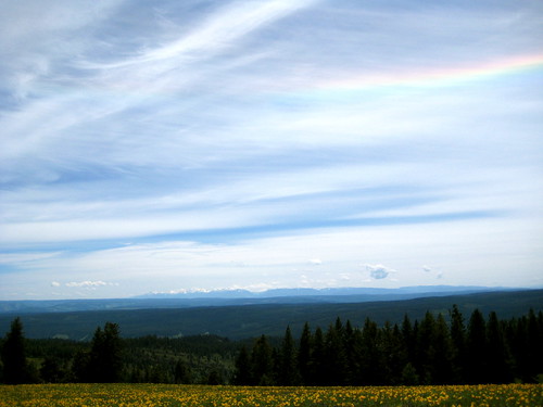
I arrived at the Panjab trailhead in the Tucannon canyon at around 3PM on Saturday. The plan for the day was to take a short walk and spend the night at Dunlap Spring, a distance of about 6 miles. The Panjab trail proved uneventful, with no interesting sightings. I reached the meadow above the spring at 6PM and was happy to see it free of snow. The meadow sits at 5,700 feet (around 2,500 feet higher than the trailhead) which was not the highest elevation I would be reaching during the loop, but close. It seemed a safe bet that I wouldn’t be post holing the whole trip, which is always good news.
As I walked down the meadow toward the spring, I ran into my first local. A black bear with a nice brown coat was having his supper about a hundred feet away. He had his butt toward me and his head down. I yelled a greeting. He didn’t budge. Not exactly the response I was hoping for. I yelled a bit more and he looked around but was either blind or uninterested in the biped waving frantically at him. After a minute, though, the wind shifted direction and brought my scent to him. He turned his head to look right at me, then ran off into the trees. Thanking him, I went on my way.
I found the spring without any trouble and filled up my water bladder. After pitching my tarp in a nice spot in the trees a little ways away, I started to think about dinner. The sky was clear that evening and there was a spot up on the meadow that would provide a nice seat to watch the sun as it set into the West. I grabbed my food, stove, and water and headed on up. Along the way I grabbed a few small sticks and twigs to fuel the stove. After dinner and the show I headed back down into the trees and climbed into bed at 9:30PM.
Sunday morning I awoke to a light sprinkle. No matter. I thought it’d be good to get a few miles under my belt before breakfast. I got out of bed and topped off my water at the spring. Just as I was about to start breaking down my small camp, the rain really started coming down. Maybe breakfast later on down the trail wasn’t such a good idea. It seemed like a better option to crawl back under the tarp and do a little breakfast from bed.
That proved a good choice. Just as I was finishing my noodles the rain stopped. I took advantage of the lull to quickly break camp and get on my way. Most of the day’s walk was along high meadows that should have provided good views to either side, but everything was covered in cloud and I was unable to see more than a hundred feet or so in any direction for all the mist.
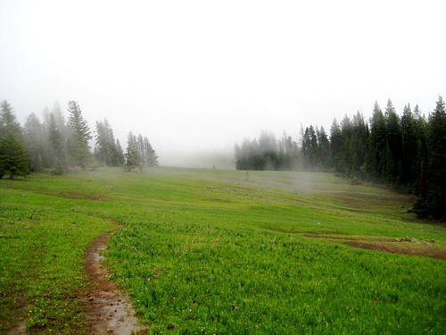
Occasional small breaks in the cloud provided a hint of the country I was traveling through and I did manage to spot a herd of seven elk having breakfast further down the meadow.
The trail was gaining elevation and started to enter a few trees. Snow covered the ground. It was only a few inches deep and pretty crusty so I didn’t sink in, but it obscured the trail. I was looking around trying to decide where the trail might have gone when I spotted a pair of really big bear tracks. “Aha,” I thought. “Those are heading in the right direction. I’ll follow them.” The tracks led on through the trees and I followed (hoping not to meet the fellow who left the tracks). Eventually the tracks led out of the trees and deposited me on the trail at exactly where I wanted to be: the aptly named Bear Wallow Spring.

From then on whenever I lost the trail in the snow I would just follow the tracks of bear or elk. They always seem to know where they’re going and tend to take the most efficient route to get there.
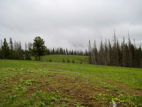
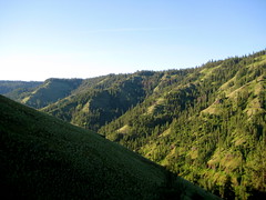
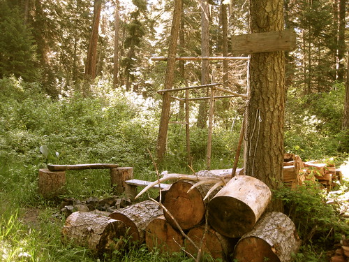
The trail continued east along the ridge, with a steep drop-off on the south side. At its highest point it got to around 6,200 feet, but there still was no more than a few inches of snow. The trail passed Squaw Spring, which was a disgusting mess of a hunter’s camp, and Sheephead Spring before finally reaching the high point at Diamond Spring. From that point my route turned south as I began a long, slow descent down into the canyon toward Oregon. I had been in fog all day and just as I started to descend the canyon I heard thunder off in the west. Whoops! That high open ridge was about the last place I wanted to be. I picked up the pace a bit and started to loose elevation. Safely back in the trees I spooked another elk, grazing all by his lonesome.
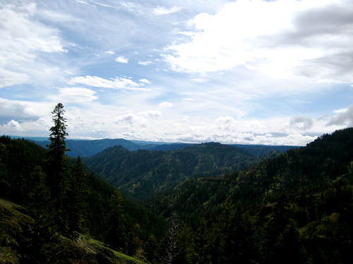
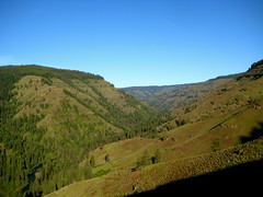
As I slowly (very slowly) lost elevation I began to get underneath the clouds and started to see a bit more of the country. Lots of canyons all around, and somewhere down there to the south the Wenaha River. Oregon Trail country. (Briefly, I relived childhood fears of dying of dysentery.)
At one point I misplaced my foot and starting to slide down the slope to my right. Throwing out my left hand I was able to stop myself but scraped up the palm of my hand in the process. Right where I fell was a patch of yarrow, which I grabbed and put on my palm as a poultice. After walking for another half hour or so I found a good spot to stop and properly clean and bandage the wound.
Continuing on, the trail finally finished its descent into the canyon and met up with Melton Creek. At 7PM I stopped to cook up dinner. The local ants were apparently of the mind that my meal was lacking in protein: a few of them crawled into the pot and ended up in my tummy. As I was eating dinner I spotted movement on the opposite side of the canyon. At first I thought it was an elk, but it turned out to be another black bear, this time with a light brown coat of fur around the body and dark fur around the neck and head. Just like an elk! Neat.
Another few miles down the trail and I finally arrived at the confluence of Melton Creek and Crooked Creek, where I intended to camp. After filling up my water supply and cleaning the pot from dinner, I pitched my tarp and crawled right in. It was a little after 9PM. I had walked around 17 miles that day.

Monday morning it was raining. It was to be a short day – I had only about 7 miles to go – so I decided I would wait it out. The rain fell for a good while as I killed time in the tarp.
Finally it stopped and I got out of bed, hitting the trail near 11AM. Just a few steps down the trail I had my first water crossing of the trip. I had to get to the other side of Melton Creek just north of where it joins with Crooked Creek. The water was cold, but only about knee deep. Another mile down the trail was another crossing, so I just left my sandals on and my shoes hanging around my neck.
When I got to it, First Creek proved to be a bit deeper and very fast moving. Had I slipped and fallen in Melton Creek I would have been cold and wet and might have come out with a bruised bum or stubbed toe, but it looked like if I was to fall here in First Creek I could actually get swept down it a ways.
The creek was waist deep. I made it across with no more trouble than frozen privates – which was trouble enough – but the creek also proved to be the boundary between winter and summer. Just as I got to the other side the sun popped out and the temperatures were soon in the mid-70F degrees. A bit downstream from the crossing was an old cabin and horse corral. I headed over there to cook up a brunch and dry out in the sun.
Back on the trail, the bush got really thick as I headed south down the side of Crooked Creek. I might as well have been bushwhacking, but the sun was out and there wasn’t a cloud in the sky so it didn’t much matter. A mile or so down the “trail” I ran into a mule train. They had just packed in an SCA crew down at the Oregon border who would be spending the summer working on this trail. Good luck! In a couple weeks it’ll be getting way to hot for me down in that canyon, but I’m glad that somebody will be working the trail. The guy at the head of the mule train seemed impressed when I told him my route – more so because I was solo. “That’s quite a walk!” he said. Before I had gotten on the trail, I was in the town of Pomeroy where I ran into a couple locals. They described the Wilderness as “bumfuck nowhere” and tried to discourage me from going in by myself. Apparently people who live in the region don’t venture into the Wenaha-Tucannon very often. Seems strange to me.

Soon after passing the mules I reached the Oregon border. Just off in the trees I found the trail crew having lunch. I headed over to say hello and swap stories about the SCA. Since this was their very first day, they were all still looking pretty neat and clean. One of the girls even had makeup on! I imagine they’ll look a bit different come August. Anyway, I wished them good luck and continued on my way, soon reaching the point where Melton Creek drains into the Wenaha River. Here, my route turned west and headed upstream along the river.
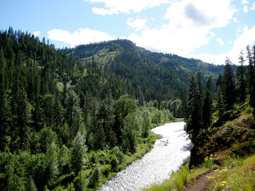
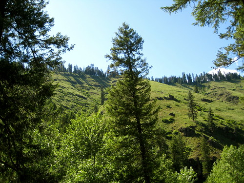
The Wenaha River and its canyon really are beautiful. It’s not the sort of area I associate with the Northwest, instead seeming like it belongs somewhere in Montana. At this point the day had warmed up till it was somewhere around 80F which seemed to please the two rattlesnakes I found hanging out in the middle of the trail.
I reached Fairview Bar just after 5PM and, after dropping my pack, stripped down and jumped in the river. It wasn’t any warmer than the ball-freezing First Creek, but was refreshing after the hot hike. After getting out of the Wenaha I threw up the tarp and collected water while drying off in the sun. I dressed as the sun began to sink below the canyon wall. Then, laying my pad out on the ground, I had a good sit. It lasted about 3 hours. During that time I cooked up dinner and paid a little attention to my feet, which were hurting due to the new footwear I was trying out.
While I was digging in my food bag for dinner I came across the chocolate bar I packed. I always like to pack a bar of chocolate in the cooler months when it won’t melt. Emergency Chocolate, I call it. Not only is it tasty and mentally comforting, but it provides a great energy boost and can be helpful in warding off hypothermia. When I pulled it out of the bag it was still firm, but I said to myself “Self, look at this here chocolate bar. With warm temperatures like today, it’s going to melt in no time! We better eat it before that happens.” To which I replied “I like the way you think, Self” and proceeded to eat the whole thing.
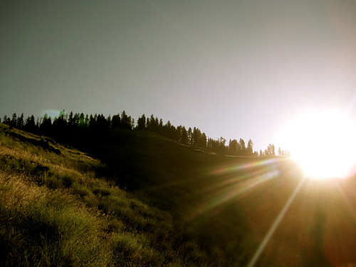
The next day I woke determined not to lounge around in bed that morning, but to get an early start on the day. I had a long and steep climb north out of the canyon ahead of me and wanted to get most of it done before the sun started beating down. Quickly breaking camp, I threw on my pack and started heading uphill just past 6AM. Sunrise in the Wenaha is a wonderful time. Undoubtedly, that leg of the trip had the best scenery.
Around 7:30AM I reached the trees and stopped to cook breakfast at the base of an old pine. I spotted two ospreys flying over head.

After that, my hike was through forest. Soon I was back in Washington. I lost the trail a couple times and stumbled upon another hunting camp, but found my way up out of the trees without much trouble.
There are some great grassy ridges up there around Moore Flat and Smooth Ridge that demand one to at least have a sit on them, if not take a nap. I did a bit of both.

Soon I reached the top of Weller Butte and the highest point of elevation for the day. Lodgepole Spring, where I planned to spend the night, was just another few miles north of that.
Lodgepole Spring was a bit disappointing when I got there. It was fairly muddy and finding a good spot to put the tarp was difficult. Despite the day’s perfect weather, some clouds had started to move in and it was looking like rain. Eventually I found a spot a bit above the spring that was sort of flat and had a few trees around it to help protect from any wind. Most of an Elk skeleton lay beside it.
The wind did pick up and got pretty strong that night. I was cozy inside my tarp, but I had pitched the front left side a little sloppily which meant that it was making a lot of noise as the slack got blown back and forth in the wind. It woke me a couple times, but I was too comfy inside my bag to get up and do anything about it.
The next morning was rainy and windy. Still, I didn’t want to hang out in the tarp all morning. I broke camp, filled up on water at the spring, and headed on my way. Around 10AM the sky cleared up and the sun came out for another fine summer day.
As I headed north, I was gaining elevation. I went along the narrow ridge along Danger Point and a bit further on reached Oregon Butte – at 6387 feet, the highest point in the Wilderness area. Just north of Oregon Butte I reentered the snow and lost the trail. There was a confusing intersection with three or four trails heading off in different directions at that point and I wanted to make sure I got on the right one. I spent 20 minutes looking around for the correct trail – or even an area where the trail might be likely to go – but couldn’t find anything. Finally I gave up and just started heading cross country via map and compass along the route that the trail should have gone. About a mile further I had lost enough elevation for the snow to disappear and I found the trail again. I was only off by about 10 feet in my route calculations.
Just after noon the sky started to fill up with clouds again and darken. “More rain!” I thought. Then I heard a rumble. And another. And another. The storm was just northwest of me and heading in my direction. Once again I was up on top of an exposed ridge, the highest thing all around. I dropped off the trail and heading down to the tree line. Picking up my pace a bit, I paralleled the trail and kept my eyes open to see what would happen. I hadn’t seen any lightning yet, but the thunder was getting nasty.
Originally my plan had been to spend the night at Dunlap Spring again and then head out back to the trailhead the next morning. If the storm kept up though, I didn’t want to spend the night that high. I reached the meadow above the spring at 3PM. Just as I came out of the trees it started to hail. The thunder sounded like it was right on top of me at this point and I saw a flash or two of lightning. I decided I needed to get down. I started to half walk, half run toward the Panjab Trail that heads down into the trees toward the trailhead. Just before I reached the meadow I encountered another bear. This one was about 50 feet away, oblivious to my presence. I yelled at him. He didn’t budge. I was anxious to get down, but this guy was standing right where I wanted to go. Yelling at him again, he looked up at me and shook his coat, throwing water all over. “Yeah,” I yelled “it sure is wet up here, isn’t it? I bet it would be nice and dry in those trees down there! Wink wink nudge nudge.” Apparently bears don’t understand winks because he didn’t take my hints. He just kept doing what he was doing. More yelling and waving my arms around finally got him to look at me again. He cocked his head as if to express his displeasure at this disruption of his schedule and slowly turned around and waddled off into the trees.
I reached the trees myself soon thereafter. Just as I left the meadow the hail stopped and the storm passed on further east. The clouds hung around and only allowed a few sun breaks the rest of the afternoon, but I was able to dry out. I continued down the trail to just a bit northeast of the trailhead and found a good spot to camp for the night. That evening the sky cleared and I was allowed a view of the awe-some golden sunset in the Tucannon Canyon.
Beyond a critical point within a finite space, freedom diminishes as numbers increase. This is as true of humans in the finite space of a planetary ecosystem as it is of gas molecules in a sealed flask. The human question is now how many can possibly survive within the system, but what kind of existence is possible for those who do survive. - Frank Herbert, Dune